“Thou shield of that faith which in Spain we revere
Thou Scourge of each foeman who dares to draw near
Whom the Son of the God whom the elements tames,
Called Child of the Thunder, Immortal Saint James!”
– – – – – – – – – – – – – – – –
~ Pilgrims’ hymn, translated by George Burrows
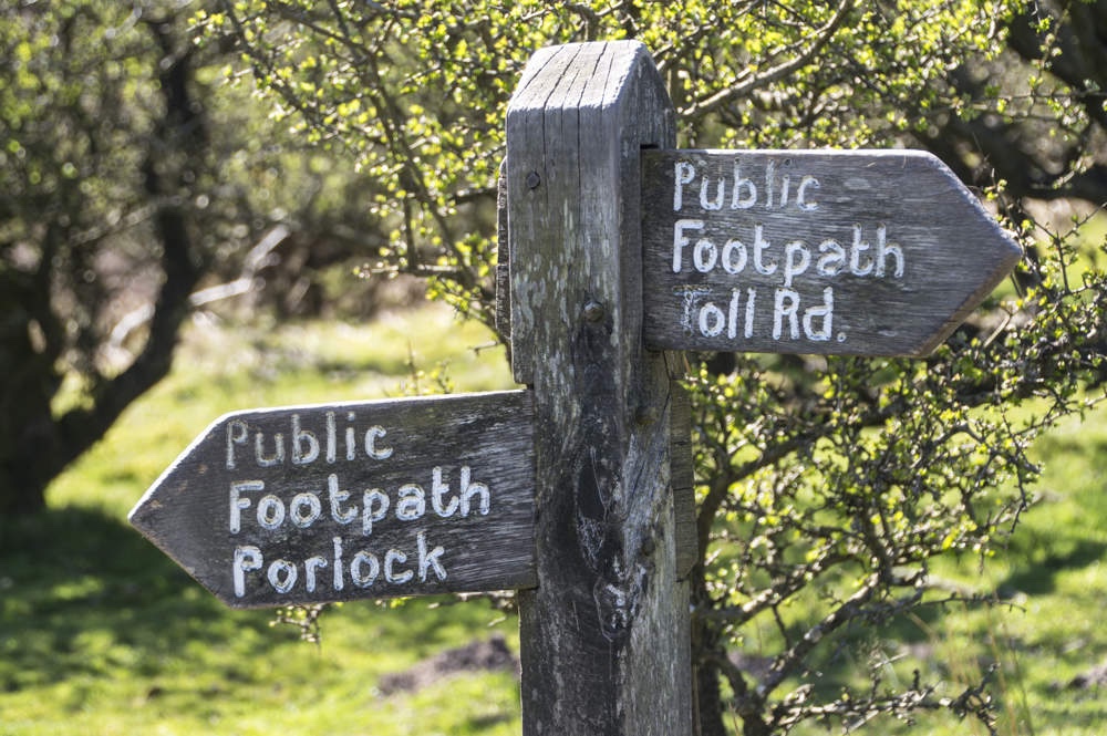
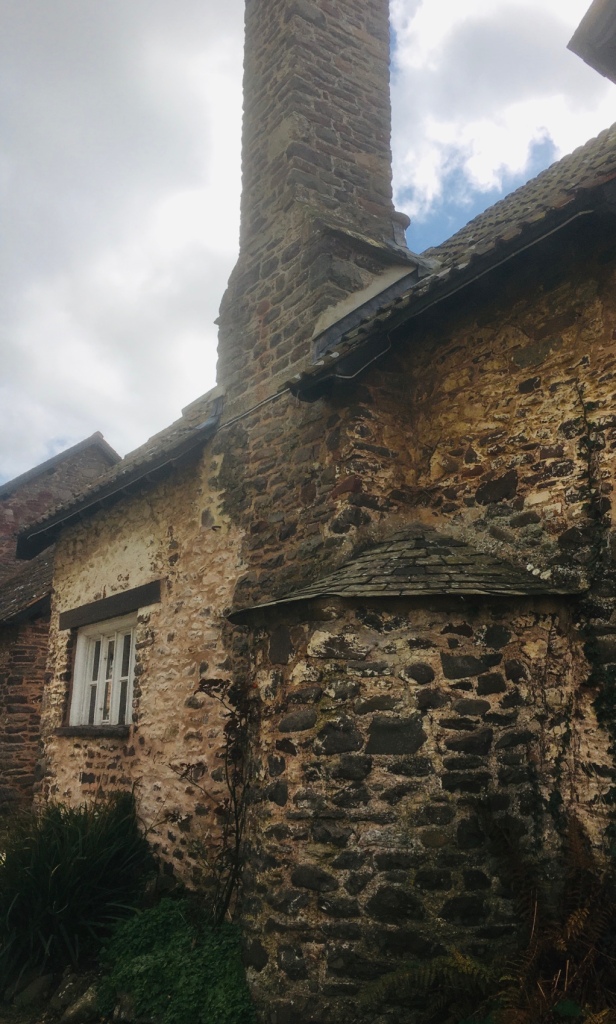
Modern day protectors on the Camino – The Guardia Civil – what a cultural difference from my first encounters with them in the 70s.
NOTE THE SHELLORIGINAL GUARDIA CIVIL MOTIF
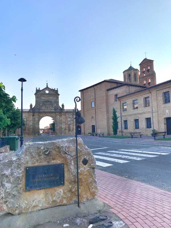
I thought I should preface today ( I’m writing this on Maundy Thursday ) by reminding us of the four principal sources I have used: CAMINO DE SANTIAGO – Sergi Ramos – SR in the text. A WISE PILGRIM GUIDE TO THE CAMINO FRANCES – WP in the text. CAMINO DE SANTIAGO , A PILGRIM’S GUIDE – John Brierley – JB. CAMINO DE SANTIAGO -MOON – Beebe Bahrami – BB in the text .
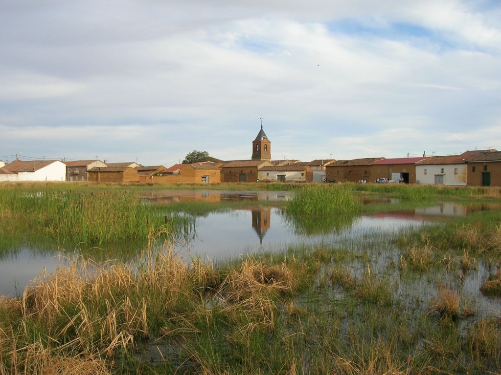
This would appear to be a relatively straightforward saunter and SR interestingly,gives it most attention. “ …it is a testing one …the towns along the stage are far apart,although all of them,with the exception of Villamoros de Mansilla, have at least a bar , restaurant and grocery store. It is necessary , however, to carry sufficient water,above all for the first section.” WELL NOTHING WE WOULDN’T DO ANYWAY !
“Much of the way between here and Puente de Villarente is adjacent to the road. “WP
Just a little further on is the Archaeological site of Lancia – “ a detour to the right …the partially excavated ruins of the Roman settlement of Lancia “BB
After 6 KM or so “ Villarente shaded area down by the river ( The first building( left) was a medieval pilgrim hospital which operated a donkey ambulance service for sick pilgrims to Leon ). There are several cafes to choose from here.
“ The river here once posted a serious threat to pilgrims when waters ran high and as a result it became home to several pilgrim hospices”WP
“ As you are leaving Puente behind you,keep an eye out for arrows pointing you along a trail to your right hand side ,and up a small hill towards Arcahueja. It is fairly well marked but is along a service road that is often lined with parked trucks and the way might be obscured “ WP
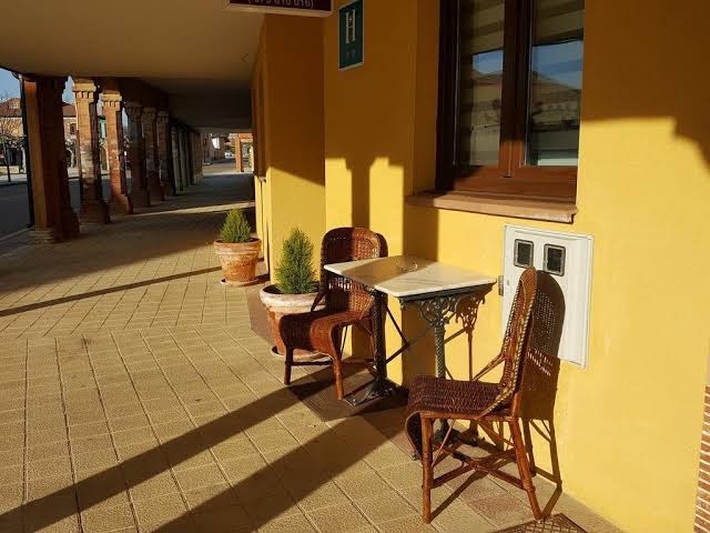
Next up is Arcahueja,” The last chance to take a rest in the relative quiet before we hit the city traffic.150 metres off route,( left) is the welcoming bar La Torre”. JB
It is also an Albergue.As traditional as it gets…Thank goodness
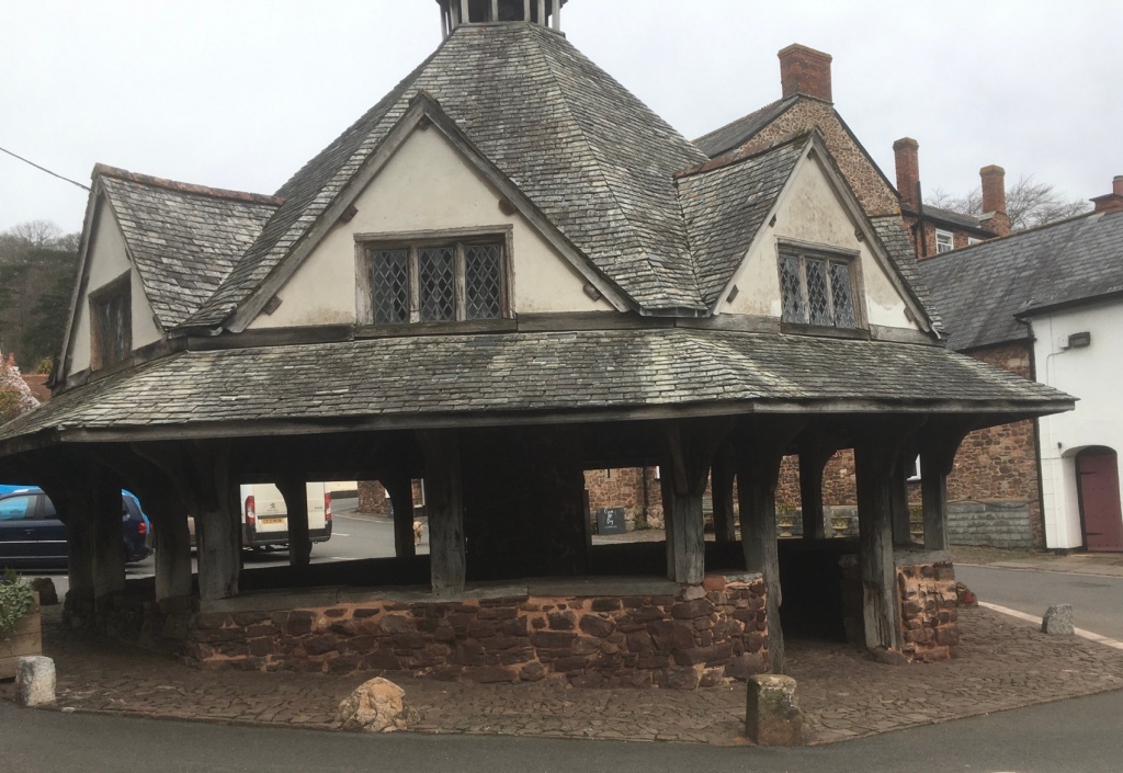
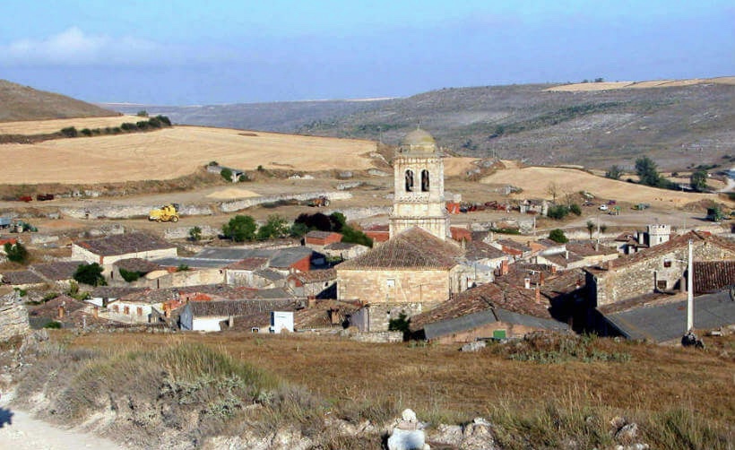
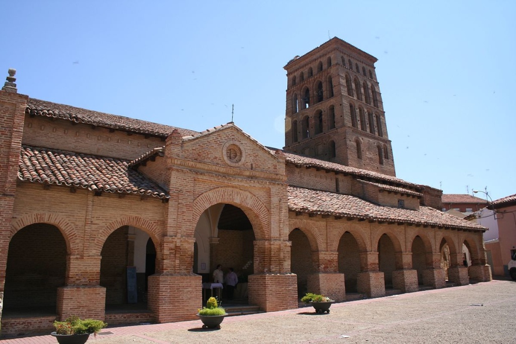
Puente Castro is the last notable place before entering Leon. ( The modern buildings here disguise the fact that this was an influential Jewish district in the XIIth c and site of a former Roman settlement “ JB
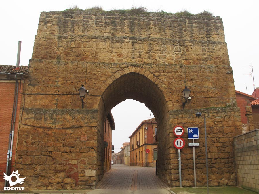
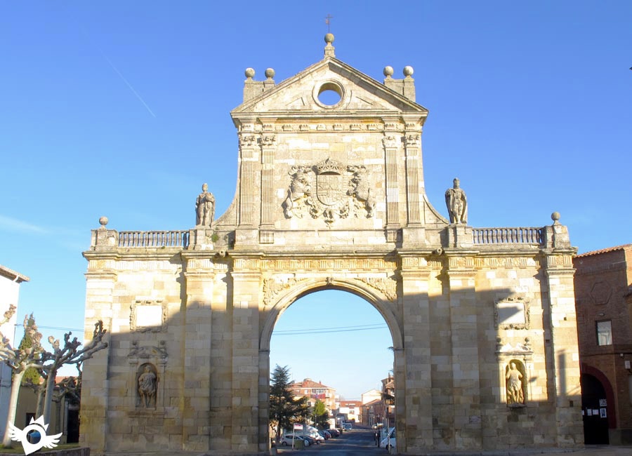
We the shall continue through the “ Leon suburbs up the wide Alcarde Miguel Castano ,eventually arriving at Av. Del Europa and then into Plaza de SantaAna…here we can calm frayed nerves “( speak for yourself ) JB. Then on through Puerta Moneda one of the original gateways to the medieval city ( note the vast city walls as you pass) JBPUERTA MONEDA
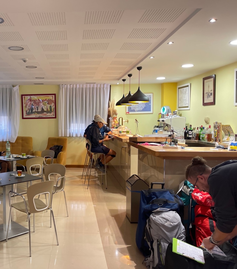
And the digs for this night,and our rest day ( 2 nights in all ) is rated 9. on Booking.com HOSPEDERIA MONASTICA PAX . It’ ll have to do….
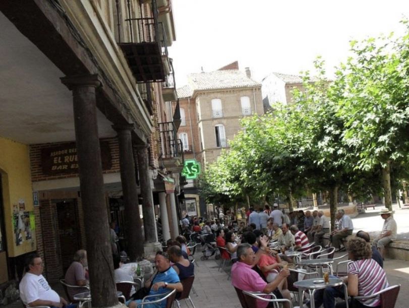
In the old part of town. We shall probably take ourselves off to the BARRIO HUMEDO “A district made to delight the senses, the Barrio Húmedo is home to the essence of Leon. The weight of tradition can be felt in the old shop fronts, in the web of streets whose names are a testimony to the medieval guilds who worked there, and in the infinite number of bars and restaurants that have given the district its name. The local custom of tapas (small snacks served with every drink) here takes on almost religious dimensions. The Barrio Húmedo is a place not to be missed. The history of Leon, a very human city, full of culture and made for walking, is encapsulated in the Calle Ancha, one of the most beautiful streets in the city. A testimony to local hard work and talent, seen in the 19th century buildings that still do business there.” Quoted from leon.es.
The literal translation means “ damp quarter’ – say no more!APROVECHE !
It is a metaphor for the Road of Life. Each day the Camino gives us something new: a new experience, a new challenge, a new blister, a new joy, a new sorrow, a new achievement, a new defeat, a new friend. Walking the Camino affords us the time and opportunity to see, understand and accept what we have encountered both on that day and on our entire Road of Life.
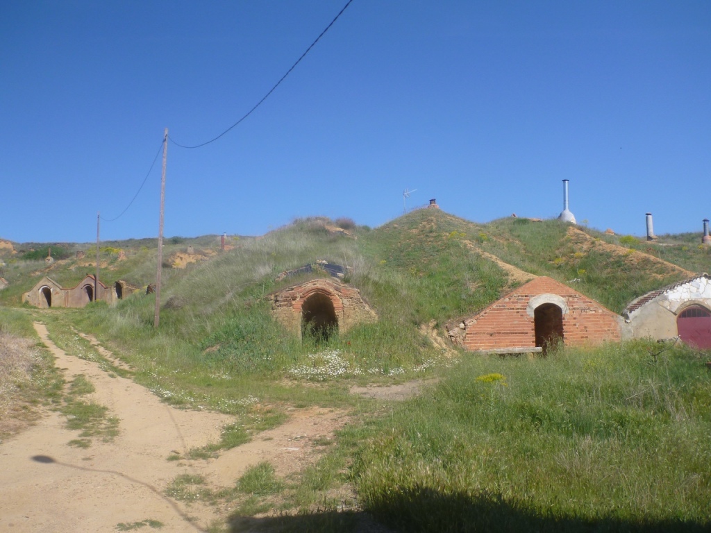
We had better take plenty of water on this stage. The advice is:- “ brace yourself for what is the second longest stretch of the Way without a town or village. You will spend almost three hours on a plain…the track is in good condition…About an hour after starting out you come to a picnic and rest area”SRAfter the area de Descanso the Camino rejoins the Calzada Romana at Reliegos. “ The modern village of Reliegos ,a former Roman village that was settled in the 10 th century, has few vestiges of its past ( though you can see many wonderful private family bodegas tucked into the hillsides like Hobbit holes…BB“If more of us valued food and cheer and song above hoarded gold, it would be a merrier world.” The Hobbit.”Now they are used as warehouses or,more commonly,for family reunions and the like” SR
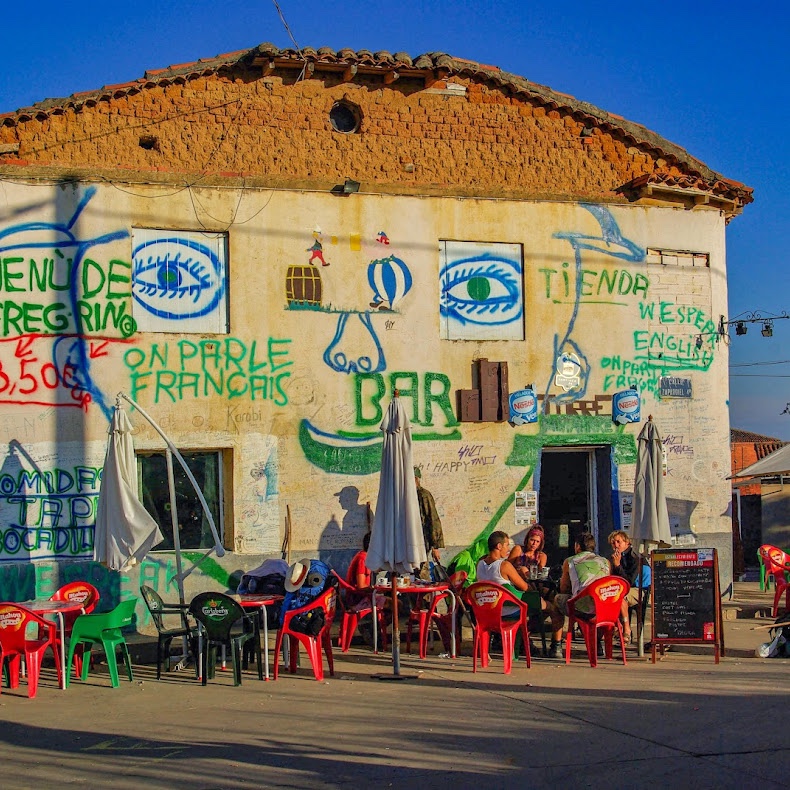
The famous „El Bar de Elvis“ in Reliegos, Spain, on the way to Santiago de Compostela
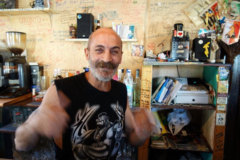
“ It was at Reliegos that the Astorga – Bordeaux Roman road and the French Way crossed. By way of complete contrast,WP informs us of this: Bar Elvis, quite possibly the most famous bar on the whole Camino,is located in the main square. The owner is quite a character…”
If you ever walk the Camino de Santiago, you should not miss a bar! This bar is definitely the strangest bar I’ve seen on the Camino. It reminds me of a movie, but I do not remember which one it was? The graffiti-covered Bar de Elvis in Reliegos comes after a long sweaty hike on the Meseta. I had a great time in this bar, crazy rock music and oldies, good food, fab tapas, the best “boccadillos”, excellent wine and of course a wonderful company. The Elvis Bar, the meeting place for tired pilgrims 🙂
Graffiti invited apparently…on the walls,not the boss!
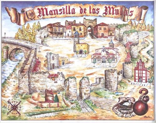
“ From the moment you leave Reliegos the outline of Mansilla May be seen. This is encouraging.” SR Just over 6 KM remain. “ You enter Mansilla de las Mulas through one of the surviving gates of its old wall of adobe and boulders,which dates from the twelfth century.” SR
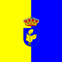
“ …it’s dense town walls – 3 metres thick in some places – enclosing the medieval centre….In the Middle Ages, Mansilla’s economy, in addition to pilgrim commerce, was as a mule market ( las Mulas ), which supplied the the region with these all-important animals for labour and transport “ RBThe town crest with saddle.
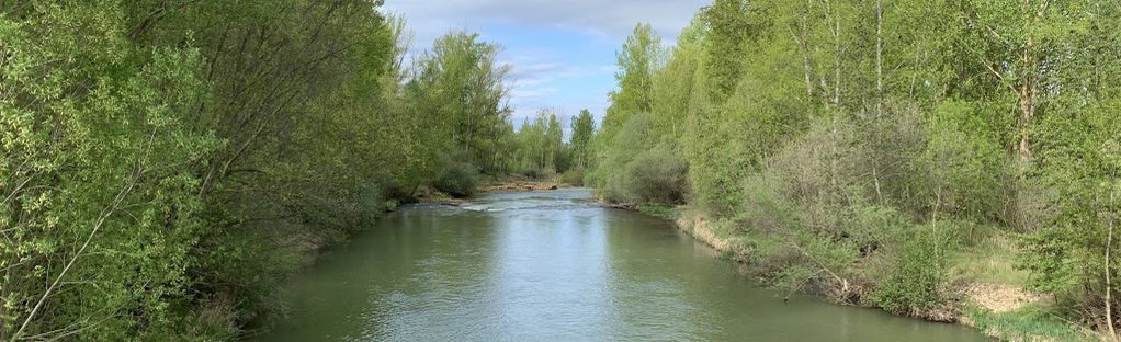
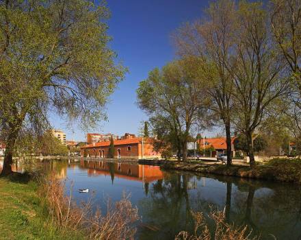
“ Today, the old town is full of picturesque plazas…pedestrian promenades and riverside paths along the Esla river” BB And if you fancy a dip “ There is a nice place for a swim in the river
The River Elsa
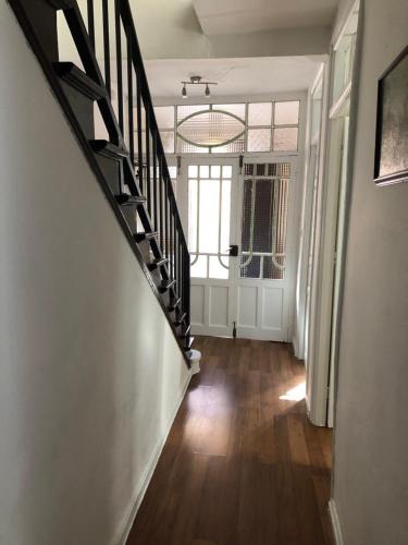
Accommodation is in Casa Bella – a whole house to ourselves.
“We were not meant to confine ourselves within classrooms, offices and apartments. Our destiny lies outdoors, where we can walk, run and move freely. Trust me, nothing rejuvenates the soul more than the satisfaction of having covered a great distance on foot, under the warmth of the summer sun. If this does not bring you joy, then you urgently need to find your way back to your inner self.”RICHARD ROHR
Fine weather for the morning and a promise of rain for the afternoon. So after gathering our packed lunch – we both enjoyed these lunches everyday this week – we made for Porlock.
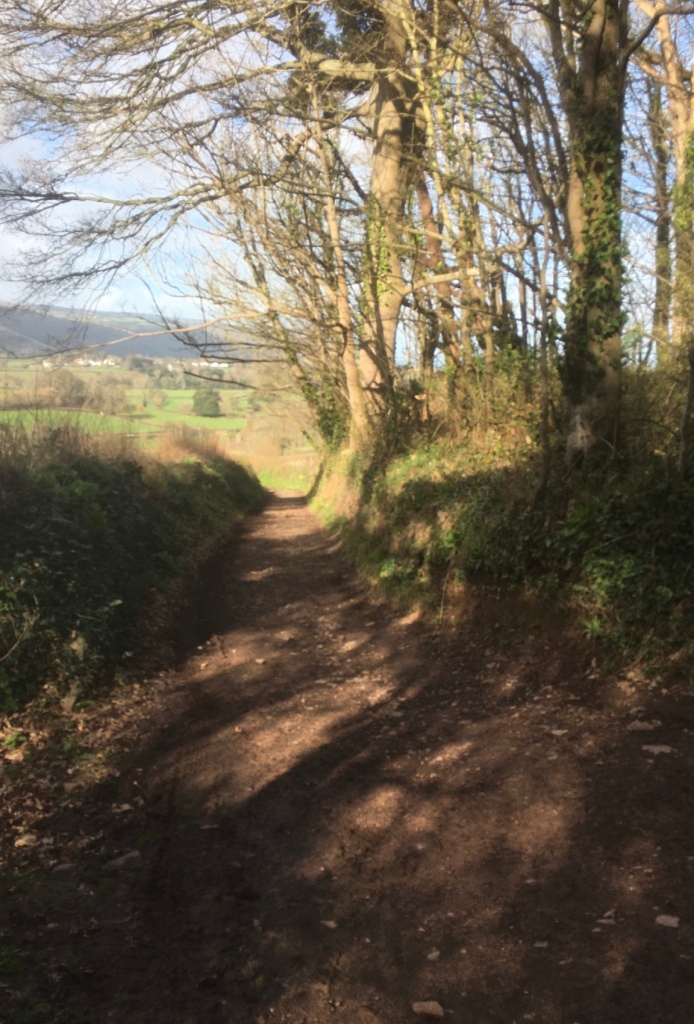
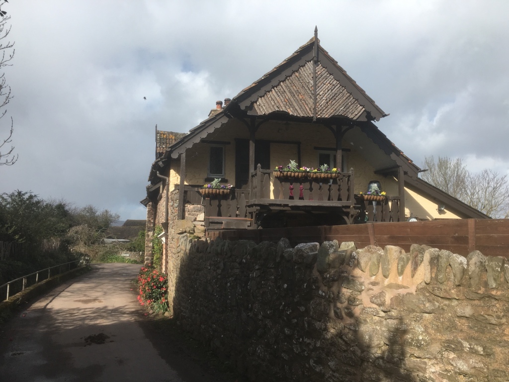
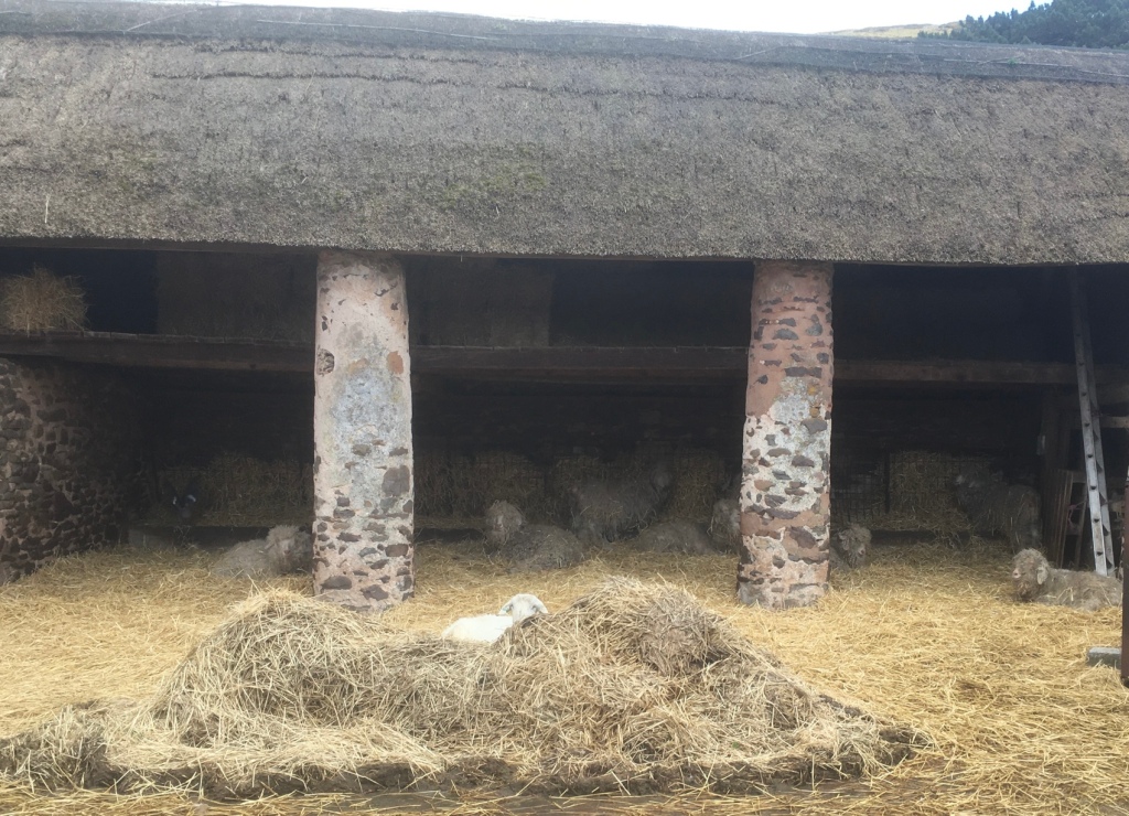
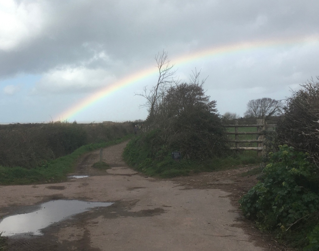
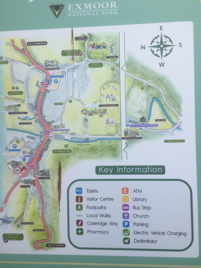
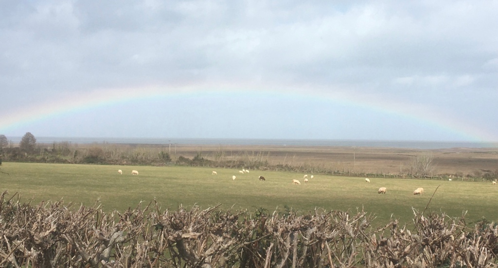
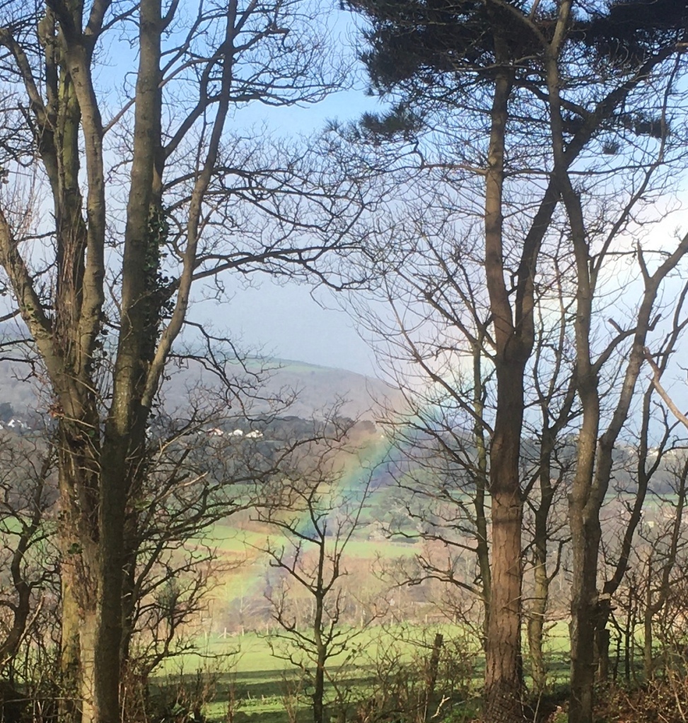
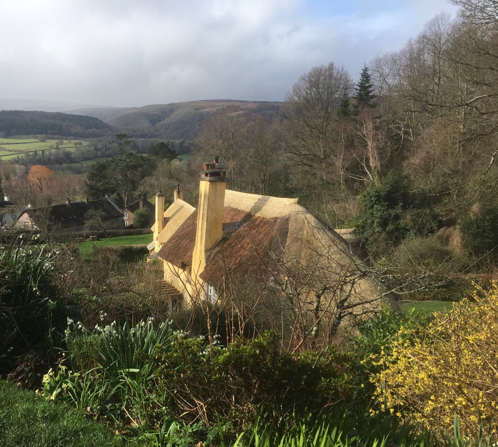
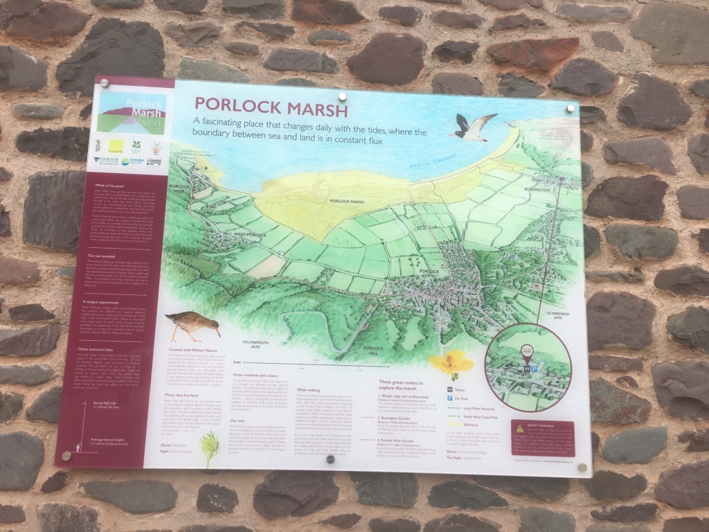
Quiet paths and lanes took us through the previously visited villages of Allerford and Bossington.Nicely situated Swiss style chalet and balcony.I stopped to admire this hedge.Peekaboo with the white sheep in the hay, but look carefully to pick out some shaggy,grey haired seniors resting under the thatched roof.Approaching Porlock a rainbow over the sea – a portent of what was to come ?A useful, easy to follow map.
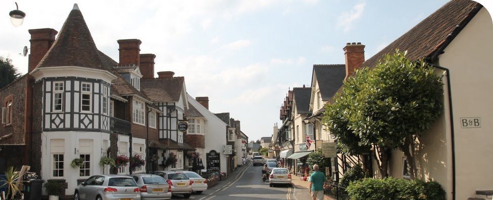
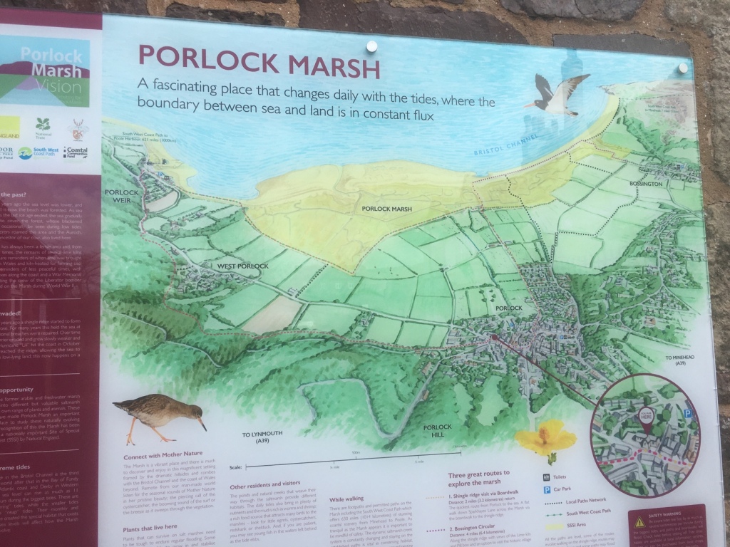
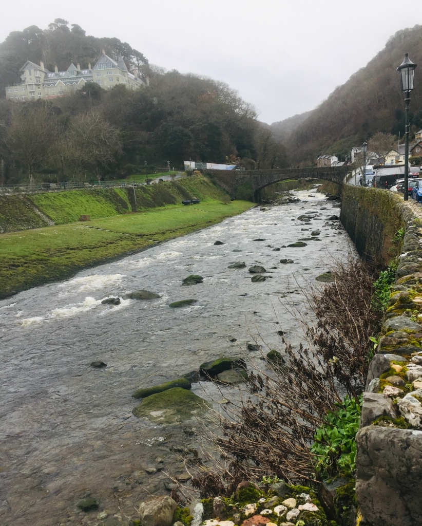
Porlock, it has to be said, is very much in Somerset and proud of the fact! The village first appeared in print in the 10th Century as Portloca from the Old English words meaning ‘Enclosure by the harbour’ and at the time of the Domesday Book in 1086 it was Portloc. Under the shelter of the infamously steep Porlock Hill, the village enjoys a micro climate that makes it significantly milder and warmer than the mighty Exmoor at its hinterland.The Saxons developed Porlock as both a port and fishery, which inevitably attracted the unwanted attention of the Vikings.
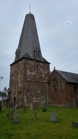
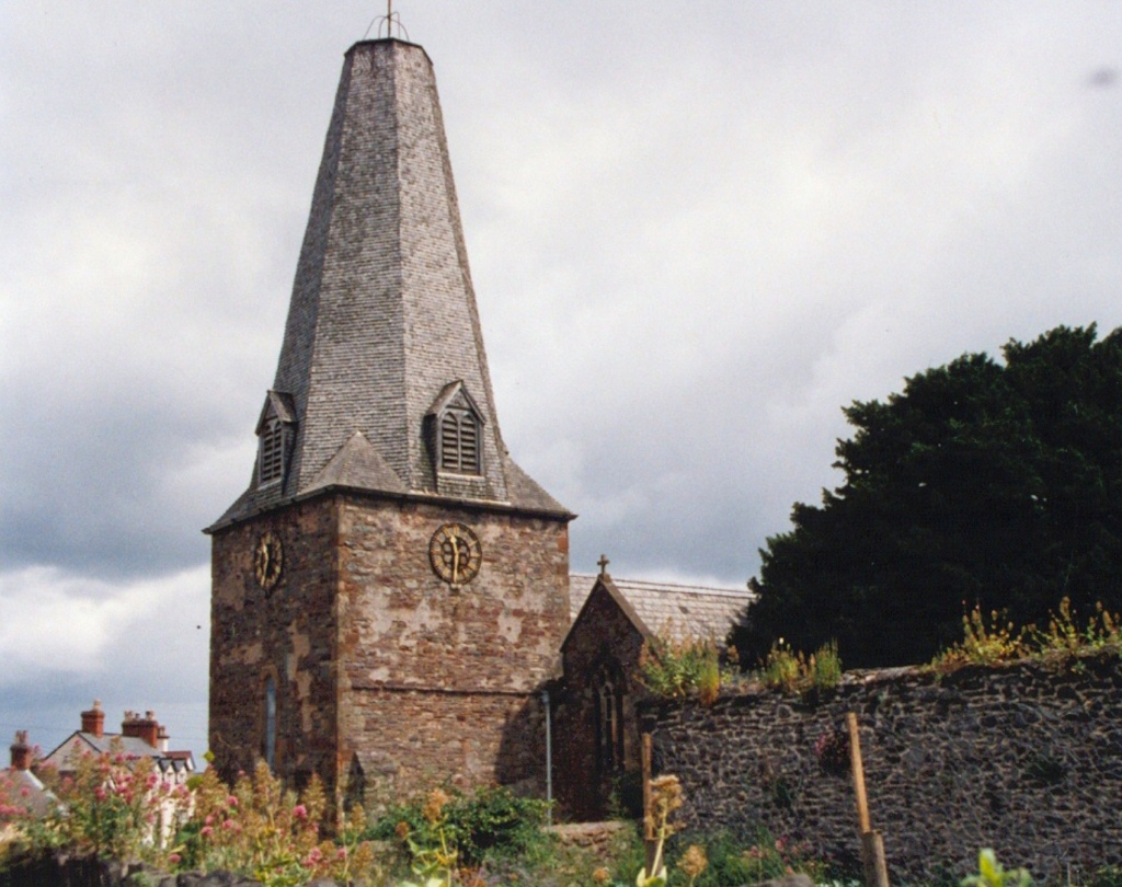
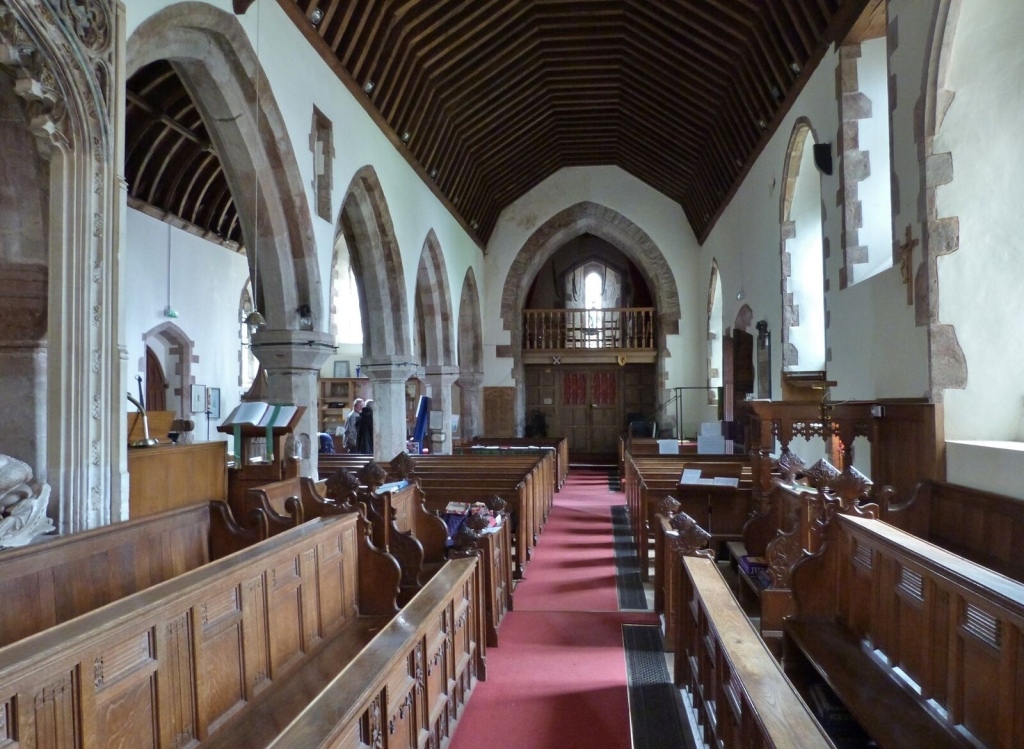
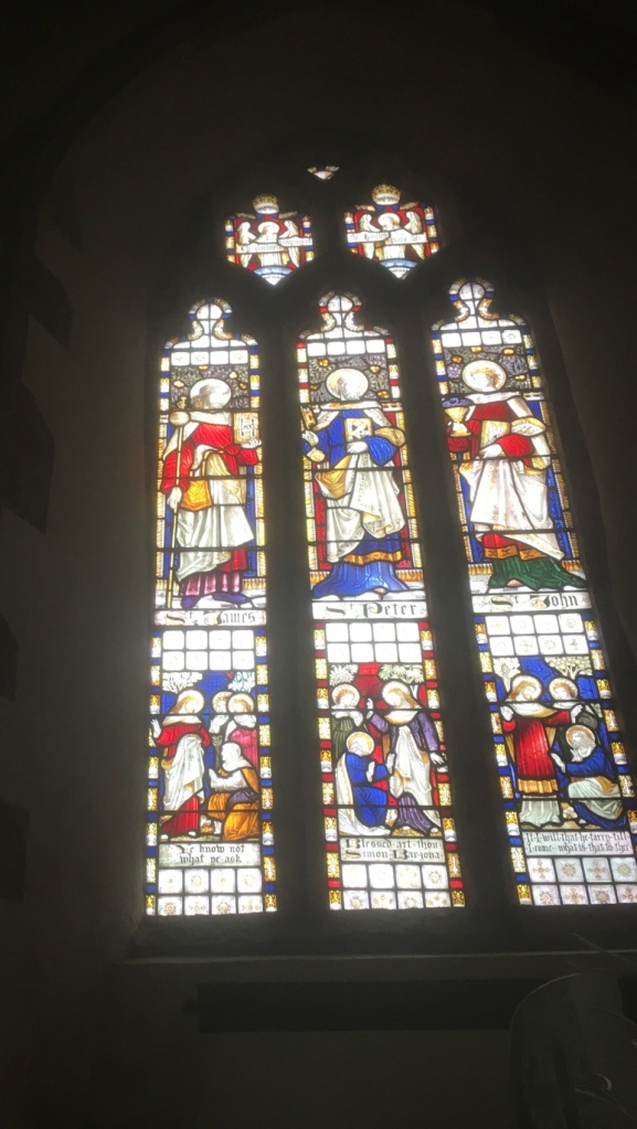
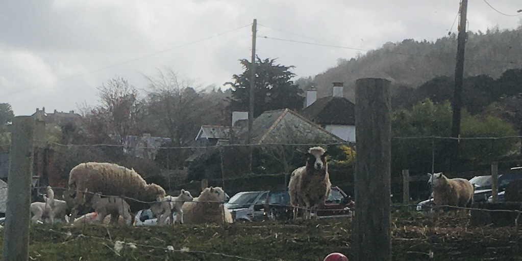
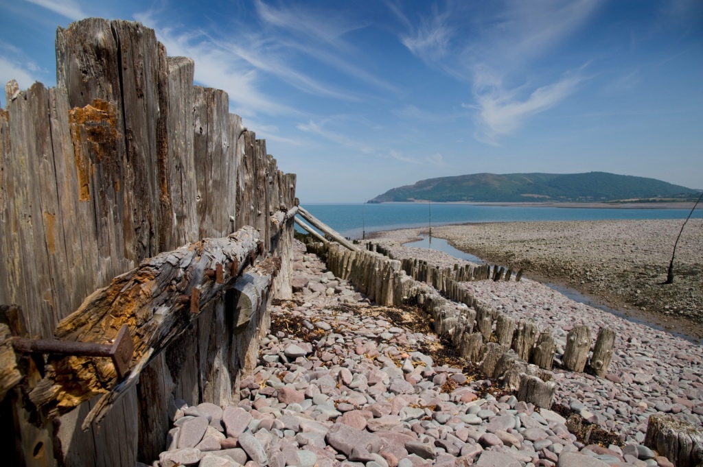
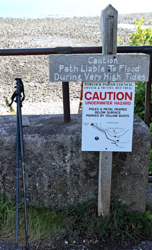
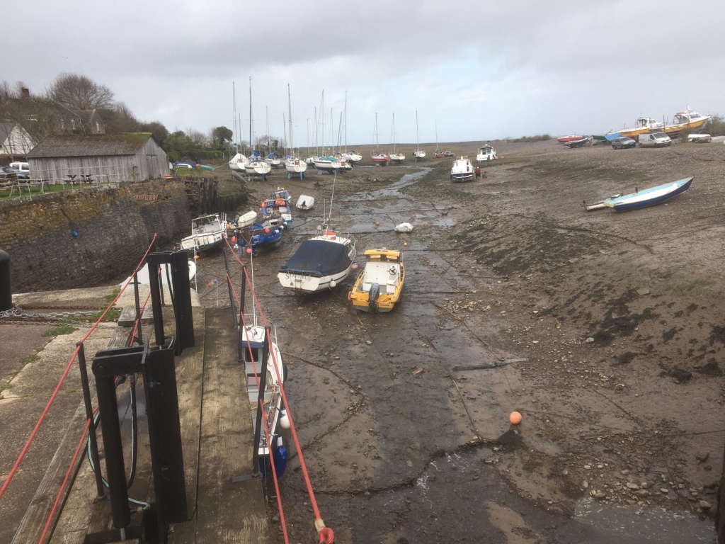
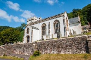
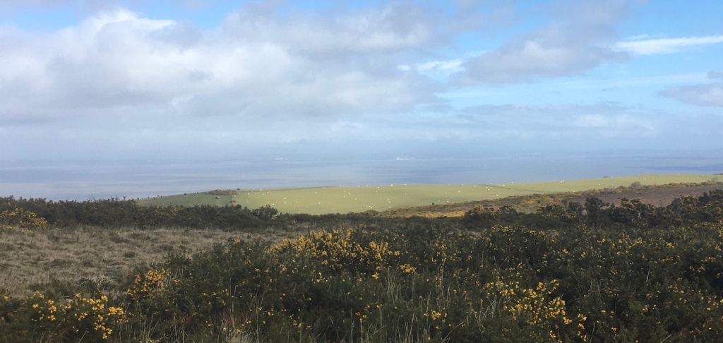
The arrival of the Normans brought the building of Porlock’s superb Parish Church with its dedication to the Celtic Saint Dubricius, a former Bishop of Llandaff and, legend has it, the man who crowned King Arthur.The grade I listed Church of St Dubricius dates from the 13th century, and includes many interesting and varied architectural details from throughout it’s history, including it’s unusual spire! The Church holds regular Sunday services, and special events throughout the year including a flower festival. Rumor has it that in 1703, during a storm the top of St. Dubricius Church steeple was completely destroyed but others say there is no evidence to prove this because they claim its roof line appears flat due to an added light beacon on the building’s surface. The church includes two windows from Norman architecture with remnants dating back before 1120 and 15th Century crosses found within its yard are believed by some historians as proof for when it first opened. St Dubricius was a 6th century Celt, but did not just stick to his home country. He travelled across the land from Herefordshire all of the way down south to Exmoor in order to perform many acts of healing on those who needed it most during this time period. It is said that he became an archbishop and crowned King Arthur with him being officiant at Queen Guinevere’s wedding held later on! In the churchyard you will find a Yew tree said to be over 1000 years old. An ancient law protects yew trees dedicated to St Dubricius.A large and costly Chantry tomb for Lord Harington (d. 1417) and his widow, Elizabeth Courtenay (d. 1472) stands under one of the aisle arches, but was not thought to be its original position.The church is on the Porlock Pilgrim Trail and it was no surprise to find St James in the stained glass window,complete with staff.Porlock’s meandering high streetJust after leaving Porlock in the direction of the Weir, we came across these newborn lambs.Rainbow number two over the marsh Walking along part of the Marsh along the Coastal Path was very tricky in places because of the small boulders brought in by high tides.The harbour and much of the surrounding area is part of the Porlock Manor Estate, which has been linked to the Blathwayt family since 1686 when William Blathwayt, Secretary of State to King William III, married Mary Wynter. Porlock was one of the Somerset manors left to Mary and has since passed down the Wynter-Blathwayt line. The ancient port of Porlock Weir has existed for more than a thousand years, having been documented in the Anglo-Saxon Chronicle. Over the centuries it has played a vital part in the life of eastern Exmoor, being one of the few places along the rugged Exmoor coast capable of providing a haven for small craft. Given its isolated position within Exmoor, this sea route was also the easiest way to and from the area. In the 18th and 19th centuries the main exports were flour and corn, bark for tanning, bricks, pit-props for the Welsh coal mines and oysters to Bristol. Imports included limestone and coal from Wales, which were used to make lime in local kilns.We took the Woodland Trail,climbing up above the Marsh for a scenic walk back to Porlock.This is a rugged part of the Somerset coast and quite unspoilt by tourism- a great day’s independent saunter,if a little damp for the last five KM.
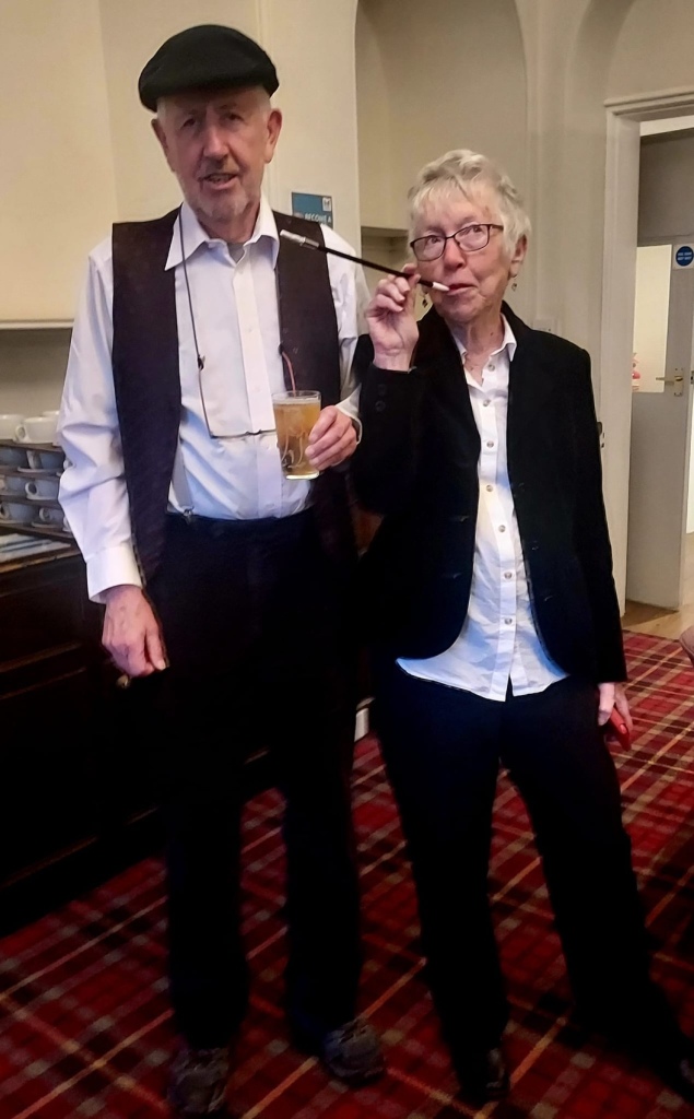
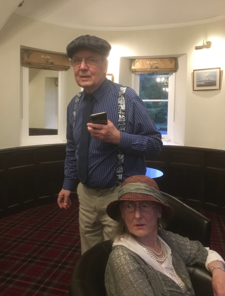
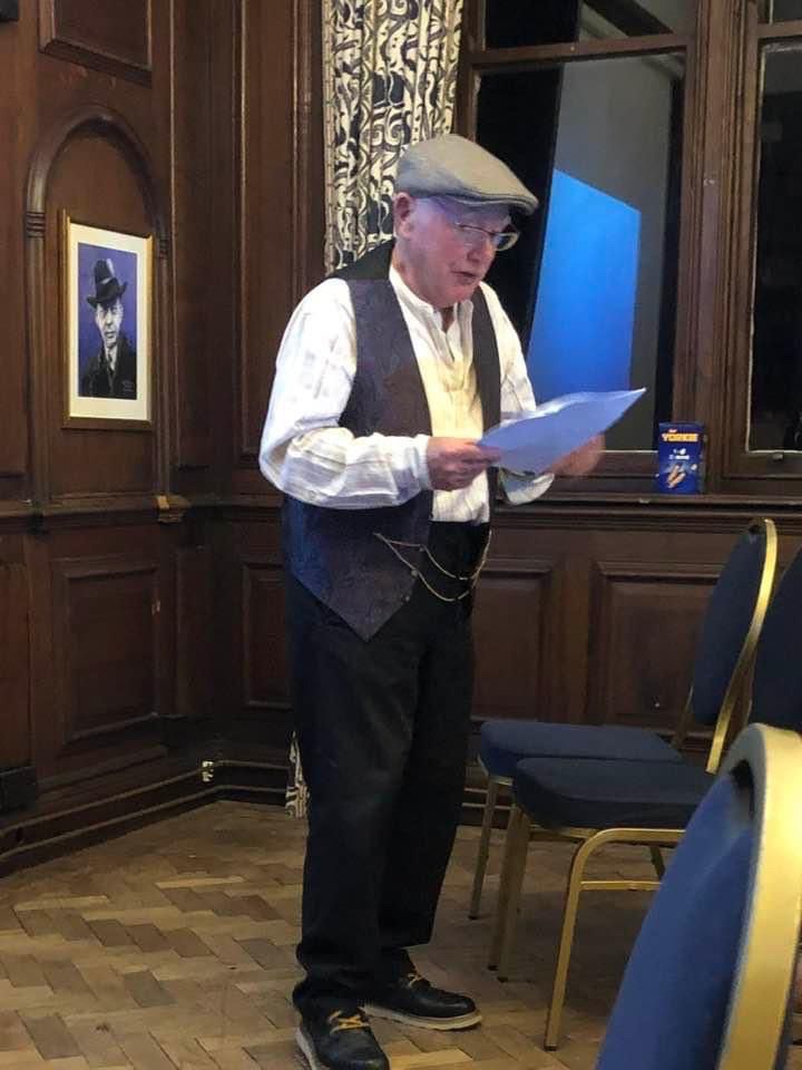
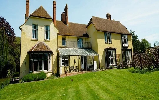
After a shower and a rest we were ready to join in our last evening’s entertainment- A Peaky Blinders / Brummagem Evening .
Ramblers and guests put on their best Peaky Blinders gear .“ Ooh, look at you!”Brumbeat selections- you can’t beat’em! Our four days’ Spring break at Holnicote House was thoroughly enjoyable – good company,food and drink, fine weather and great walks .
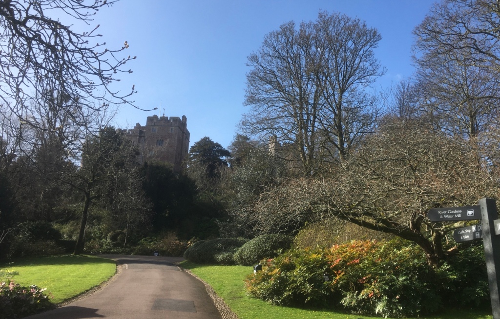
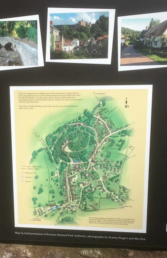
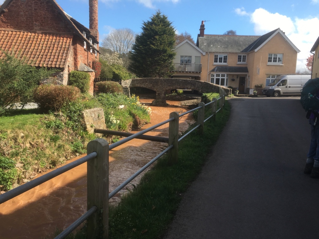
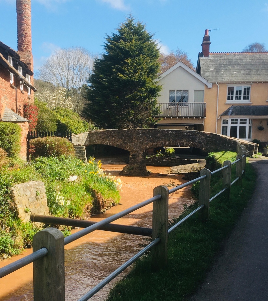
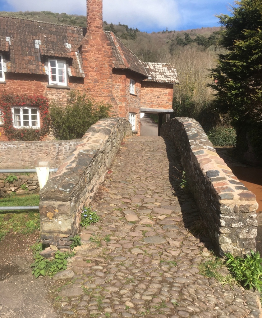
Wednesday was a “ free” day with a short walk on offer if wanted. Most people planned to visit locally and so we decided on a morning at Dunster Castle and then over to Lynton and Lynmouth. From Somerset to Devon via Porlock Hill.
Unexpected opportunity for a “ Selfie” in DUNSTER Castle.A fine morning for the tour.
Dunster Castle: Dramatically sited on top of a tor, a castle has existed here since Norman times
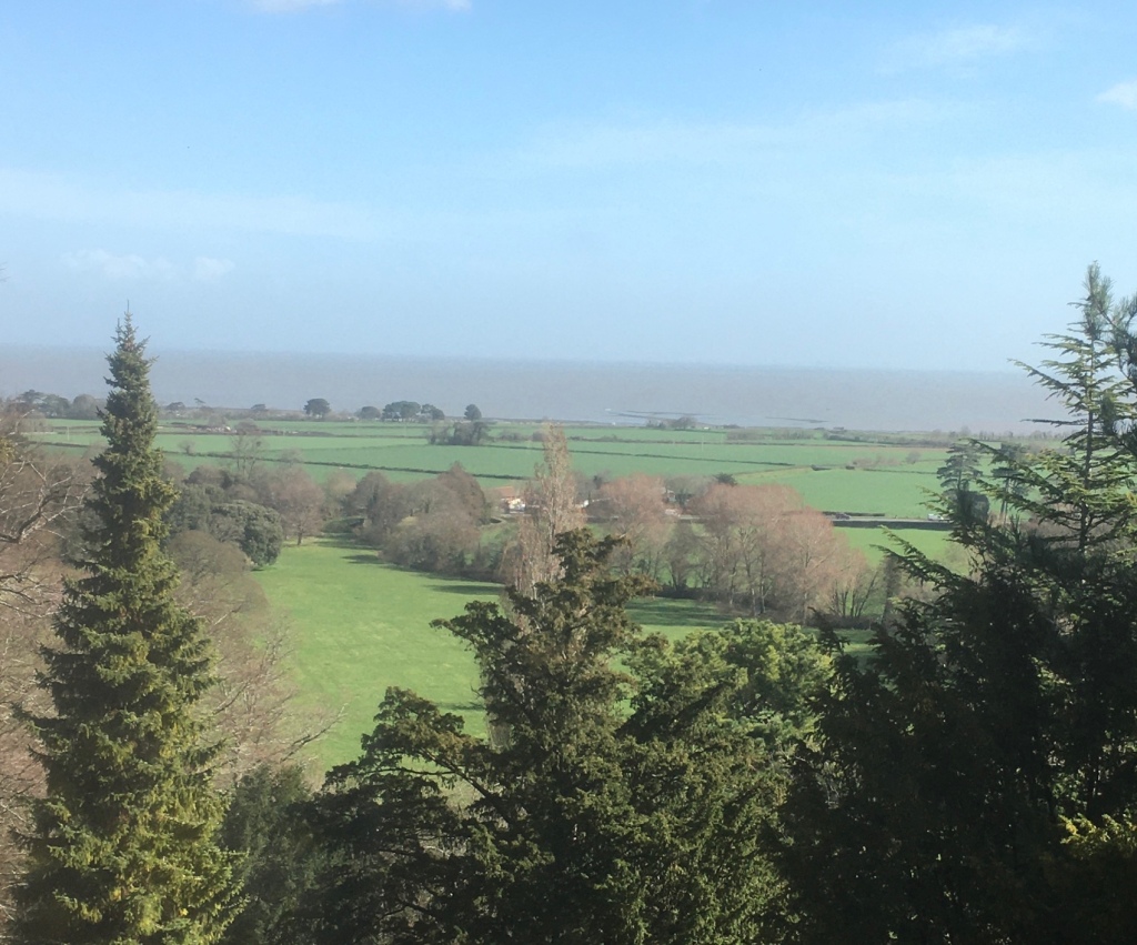
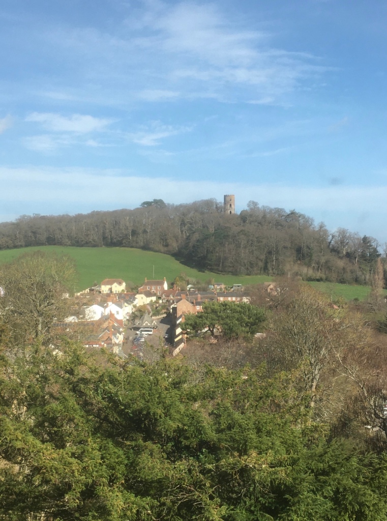
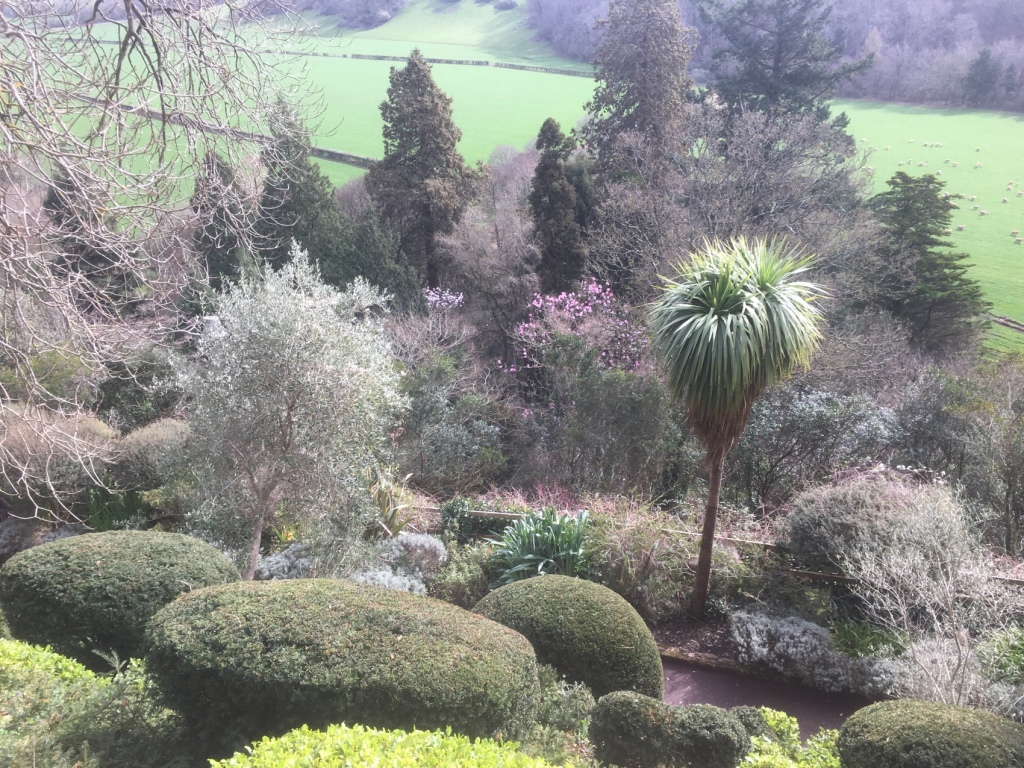
A fortress that became a family home for the Luttrells, who lived at Dunster for 600 years, the castle was extensively remodelled in the 1870s to create a Victorian country house.The castle boasts breath-taking views over Exmoor, Somerset, and the Bristol Channel.A Folly in the distance A view from the extensive gardens that surround and almost crown the castle .Olive trees thrive here.We saw a number of fellow ramblers here.Another exotic specimenAn ingeniously planned setting for sun loving plants.
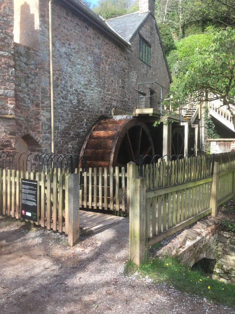
We then walked down to the Water Mill alongside the River Avill.
It’s a working mill and Hannah couldn’t resist buying a couple of bags of flour.
A very enjoyable and informative morning, followed by a coffee in the village – a bit on the twee side but pretty enough I suppose.
The village Yarn Market
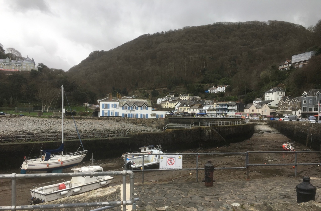
The afternoon was spent in Lynton and Lynmouth after a crawl up the infamous Porlock Hill behind a tractor towing a trailer full of sheep.
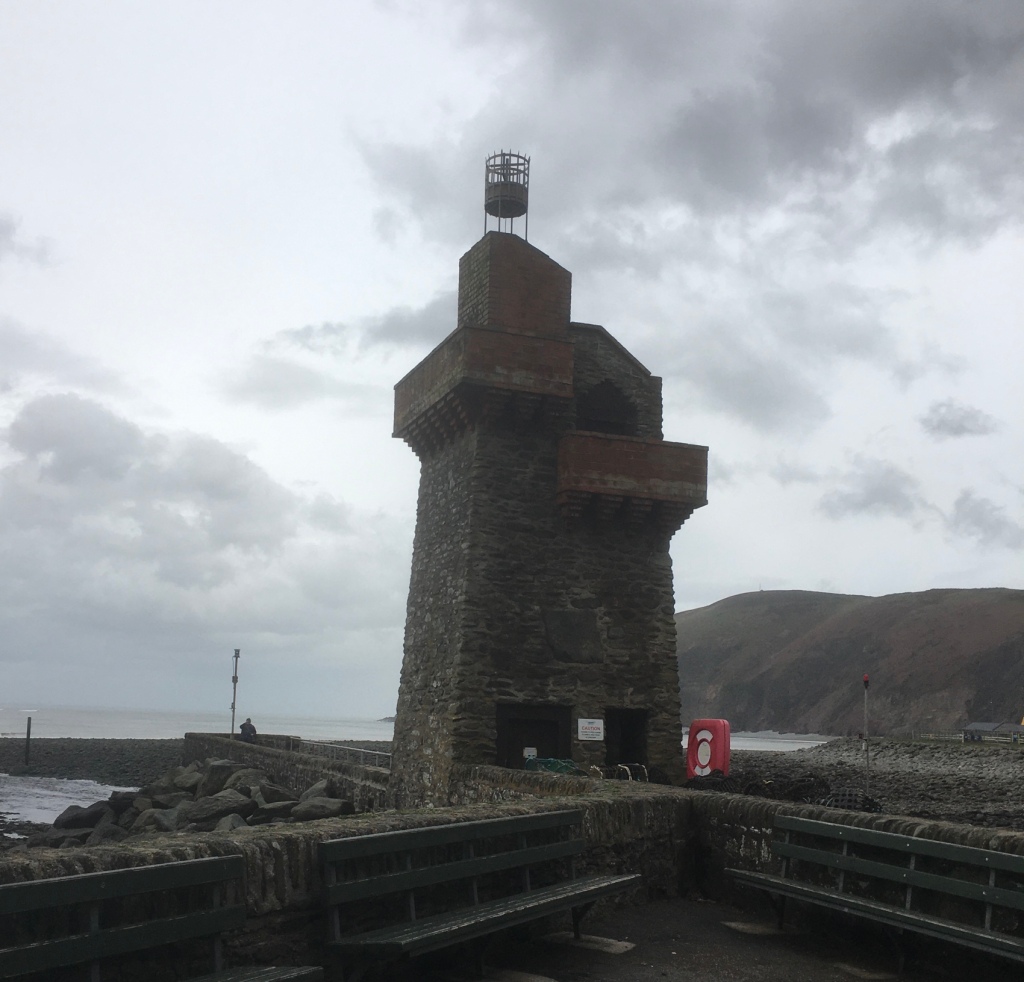
The tide was out.A watchtower.
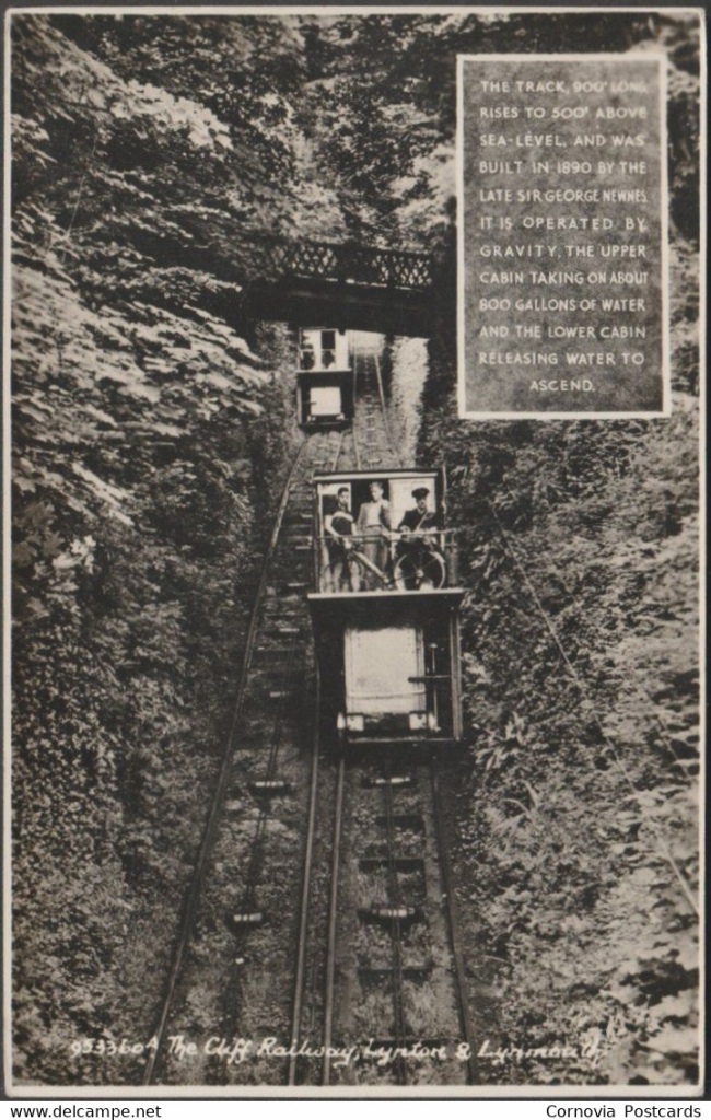
The highlight of the afternoon,albeit an expensive one,was the ride on the cliff railway – it has an interesting history. In the 19th century, the high cliffs separating Lynton from Lynmouth were a major obstacle to economic development. The twin villages mainly relied on sea transport because land travel was extremely difficult over Exmoor. Coal, lime, foodstuffs and other essentials arrived at Lynmouth in sailing vessels, but this freight had to be carried by packhorses or in horse drawn carts up the steep hill to Lynton. The cliffs also posed problems for the growing tourist industry. From the mid 1820’s holiday makers began to arrive at Lynmouth on paddle steamers from Bristol, Swansea and other Bristol Channel ports… but a daunting hill faced those who decided to walk up to Lynton. Ponies and donkeys could be hired at 6d a time, but the steep gradients severely tested the unfortunate animals. Other tourists travelled up Lynmouth hill in carriages, but the horses that pulled them had a very short working life.
The idea of a funicular was discussed for several years and eventually work commenced. Late in 1885, a major project was proposed which included the construction of a solid pier, an esplanade and ‘a lift from the said pier or promenade to Lynton’. The pier, to extend 112 yards into the sea, was intended to enable the resort to attract a bigger share of the growing steam-excursion traffic. Many of the paddle steamers had not been calling at Lynmouth where passengers had to be ferried ashore in small boats, instead visiting Ilfracombe where tourists could easily disembark at the deep-water pier. The construction of an esplanade, which survives today, was to start from a point near the Rhenish Tower and provide access to the pier. The proposed ‘lift’ would make it possible to carry up to Lynton the large numbers of people that would be landed from the steamers at the new pier.
Work began on the lift construction in 1887. It took less than three years to complete, a remarkable achievement considering that the entire excavation relied on manual labour.
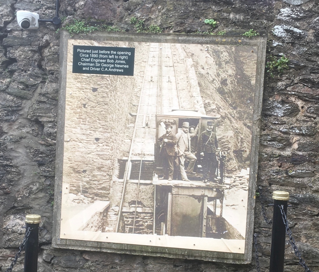
Blasting operations soon took place on the cliff. By December The North Devon Journal could report: “The excavations for the purpose of a hydraulic lift between Lynton and Lynmouth is steadily progressing. Many thousands of tons of material have been removed from the hillside”. The Cliff Railway was finally opened on Easter Monday (the 7th April) in 1890. A large crowd gathered at the Lynton station to see Mrs Jeune, Lady of the Manor of Lynton, perform the official ceremony. George Newnes conducted her to a raised dias under the wall of the reservoir from which the cistern of the car would be filled. After receiving a bouquet of flowers from Bob Jones’ little daughter, Mrs Jeune pulled a lever releasing the first car which glided forward on its first journey, while the second car simultaneously started on the upward track.
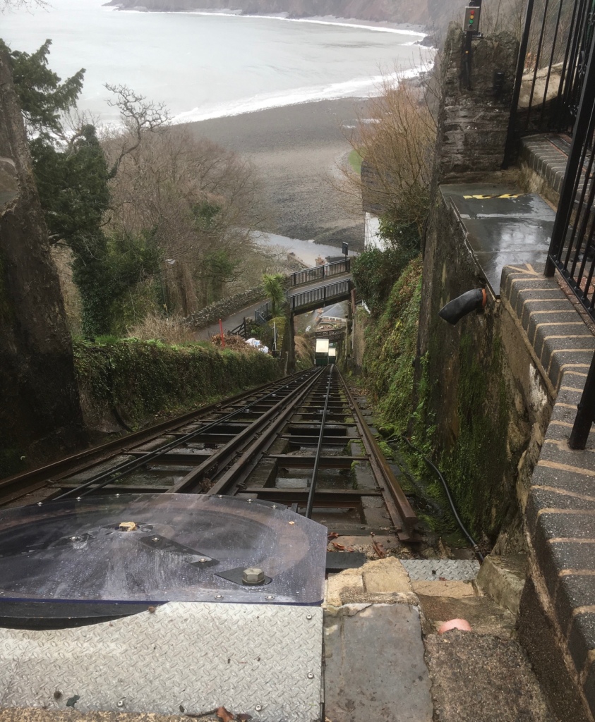
Nearly opening time.All aboard!
We then had a look round Lynton.
A good number of “art” shops up here and a decent charity outlet.
The weather was closing in as descended to Lynmouth. There had been severe flooding as described here :-
ON FRIDAY 15 AUGUST 1952, THE TINY VILLAGE OF LYNMOUTH SUFFERED WHAT COULD BE DESCRIBED AS THE WORST RIVER FLOOD IN ENGLISH HISTORY.
On the day itself, just over 9 inches (230mm) of rain fell, 6 inches (150mm) of which fell in a few short hours in the afternoon/early evening. Add in the 6 inches (150mm) of rain that had already fallen in the first two weeks of August, then it is no surprise that the top of Exmoor was unable to absorb the rainfall and was totally overwhelmed.
The town has recovered and there are some remaining cottages of note.
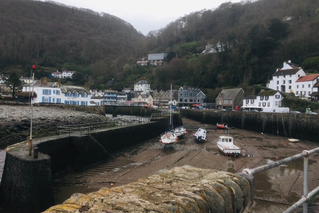
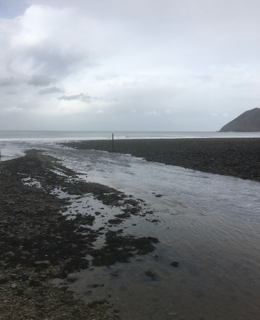
Plus some enticing restaurants We ate there on a visit pre-Covid.A pedestrianised row of shops mostly selling woollen items, a range of sweets and pottery The river is the most attractive feature – water dominates the setting of the town Tide is outLynmouth is known nationally as Little Switzerland ,with its steep hilly setting characterised by deep woodlands, river gorges and rocky walking trails. Well worth a visit even if “ Switzerland “ is a little overstated .
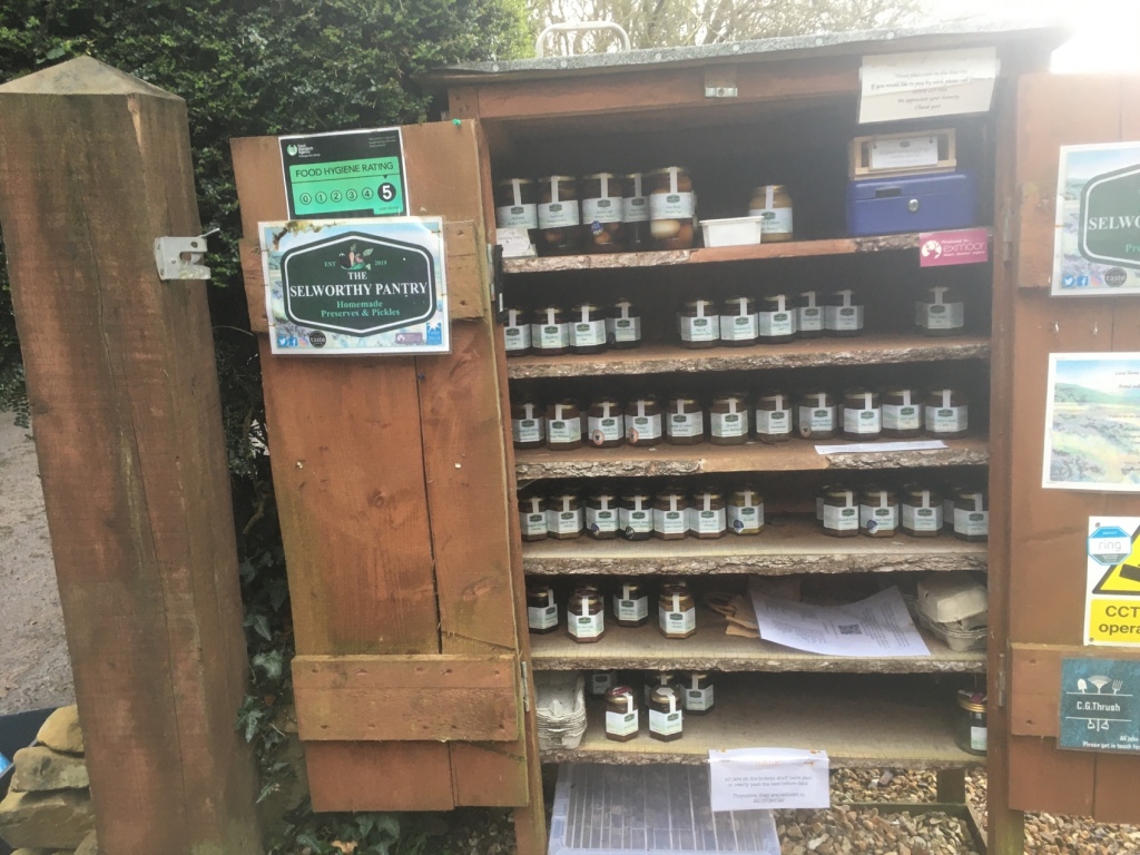
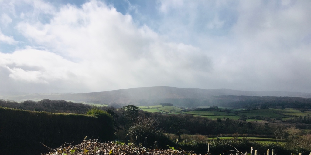
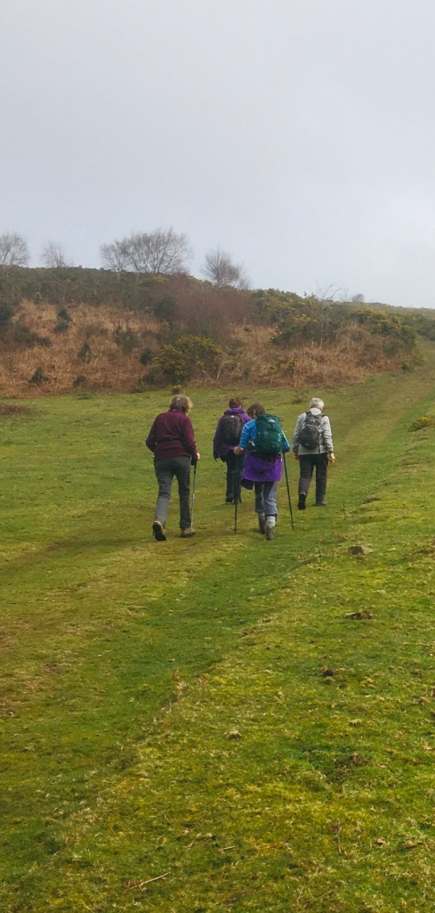
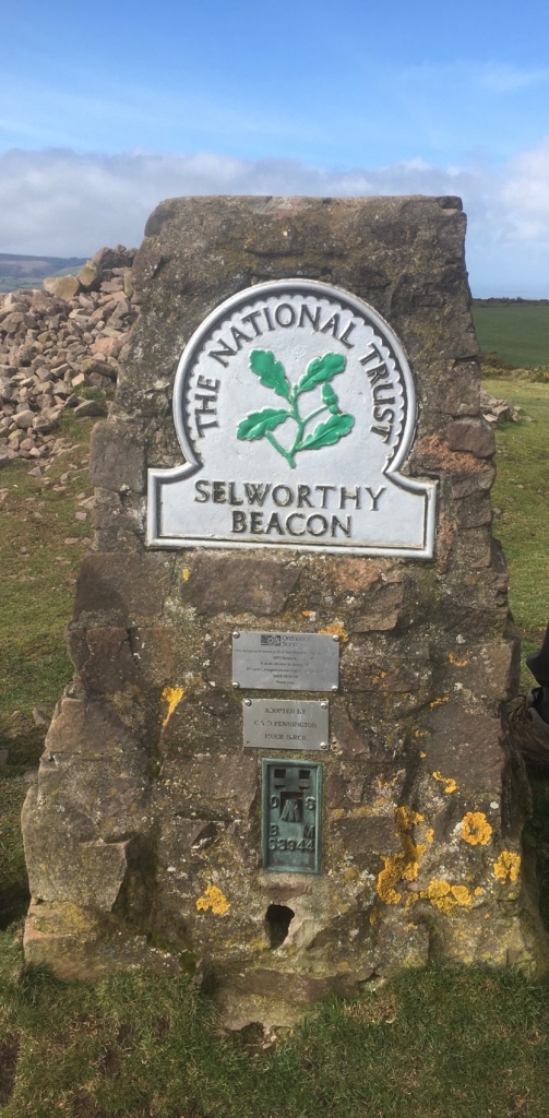
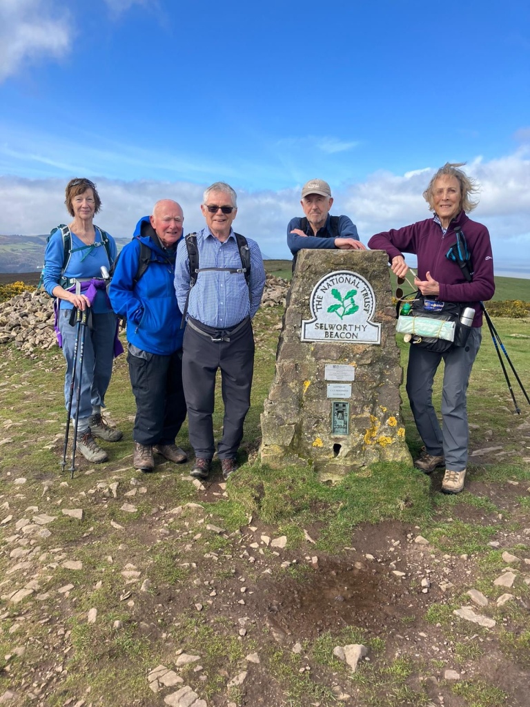
A choice of two walks today. One taking in Porlock and the other rather more strenuous walk up to Selworthy Beacon and back via picturesque villages.We were pleased to see sunshine as earlier forecasts promised rain.A light shower on the climb up to Selworthy Village and a rainbow to compensate.A typical cottage hereaboutsWith locally made produce on saleClimbing still further above the villageSelworthy is a village of picturesque thatched cottages which is part of the National Trust’s huge Holnicote Estate, which takes in over 12,000 acres of Exmoor coast and countryside. The charm of Selworthy is the wonderfully preserved thatched cottages and the historic All Saints church. The church is perched on the side of the hill, and the view from the porch out over the Vale of Porlock to the moors beyond is quite superb. Highlights in the church include the 12th century font, painted nave ceiling, and 18th century gallery.Amazing ceilingNever far away from running waterUnderfoot conditions were good and very often we enjoyed grassy pathways.Selworthy Beacon
Its elevation is 1,013 feet (309 m
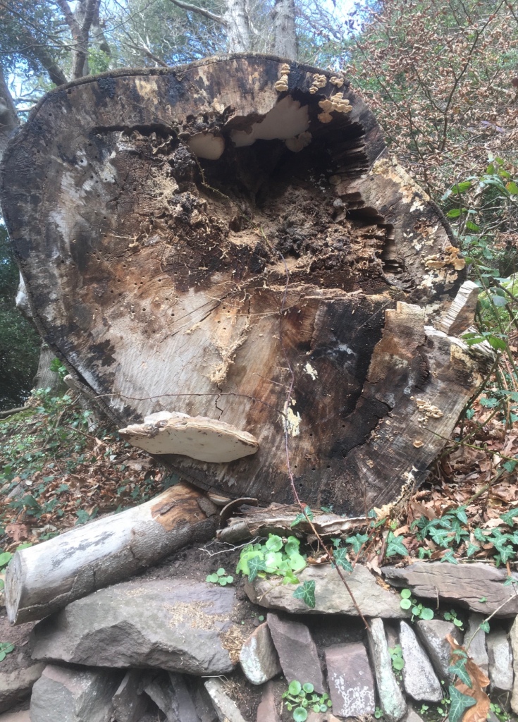
This sixteenth century Beacon was (as its name implies) the site of a beacon to warn of impending invasions.Sea viewsLooking down towards Porlock MarshPorlock to the rightThere followed a long and in some places quite tricky descent.A dramatic image of a fallen tree“Watersmeeting”! And what a contrast between the two watercourses.We eventually reached sea level in Bossington‘s National Trust car park.Bossington
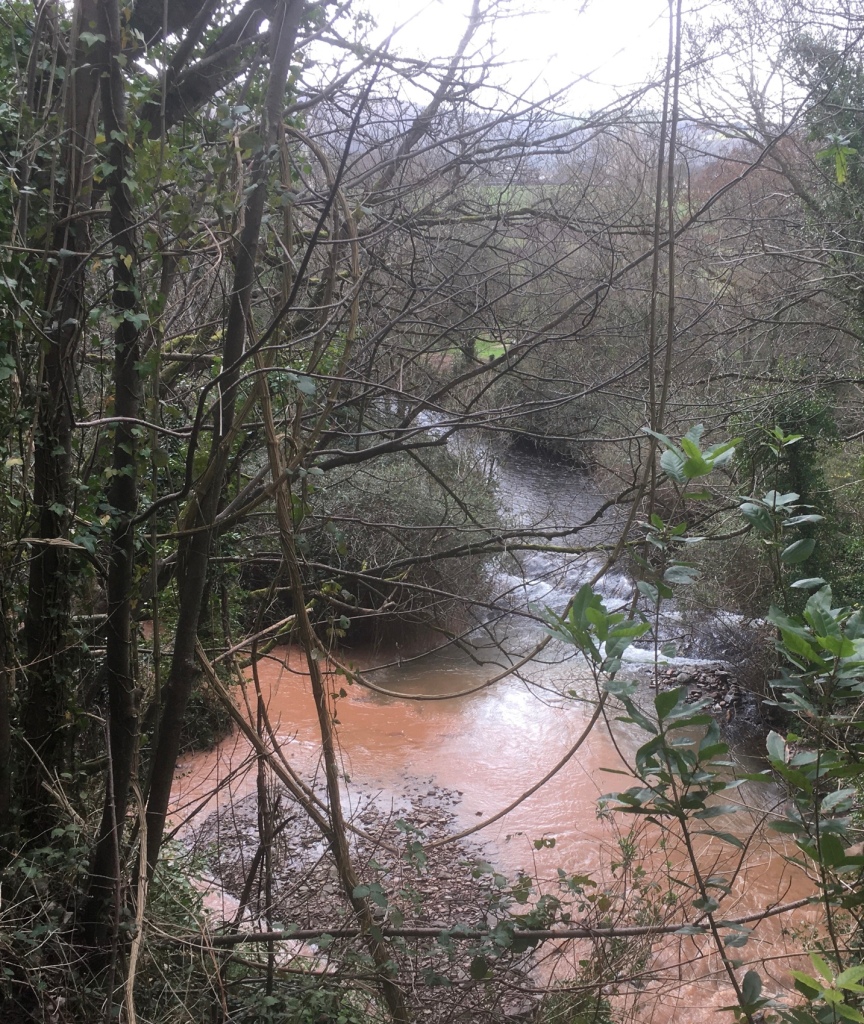
A picturesque hamlet in Selworthy parish, on the National Trust’s Holnicote Estate. Distinctive cottages with chimney stacks and bread ovens bulging from the facades line the single street.Aforesaid bread ovens.We then traversed Lynch with its GRADE II listed Chapel of Rest by passing its Mill,now a guest house which boasted of Tennis and squash courts as part of its “ exclusive” amenities – last things I could have done with! A tea room would have been good,though!Allerford is a small pretty village, located just east of Porlock, and home to the iconic and historic Pack Horse Bridge. The picturesque 15th century bridge which spans the Aller Brook is a Grade II listing structure supported on two segmented arches. The village is full of attractive period houses. Within the village is the West Somerset Rural Life Museum and Victorian Schoolroom, an attractive thatched building that served as the village’s school in the 19th century.
A rural settlement between the moorland hills of Dunkery Beacon and Selworthy Beacon; when it rains on the surrounding moorland the water is forced through the village. Allerford is at the heart of nationally important research work to see how moorland management can reduce the flooding risk that communities such as Allerford face. The enquiry draws very much on the experiences and archive images from the 1952 Lynmouth Flood Disaster, with extension activities along the Lynn included. The Packhorse BridgeWe crossed over the muddy coloured stream and followed a path back to Holnicote. A distance in the region of 8 or 9 miles, depending on whose Fitbit you relied upon. Regardless of that, it was a very enjoyable walk, led by Mike.
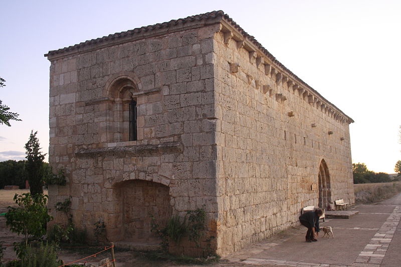
Hontanas is a town that has numerous fountains and hence the etymology of its name, “fountains”. In fact, the name of this small town comes from fountain (fontana) and possibly alludes to the small springs that were in the place and that could have become an authentic oasis on the route, after several kilometers of harsh Castilian plateau. The town had a hospital for pilgrims called San Juan, although it was popularly known as Mesón de los Franceses. It was located in a building on the main street that currently houses one of Hontanas’ shelters.
Domenico Laffi recounted the following in his Trip to the West (Editorial Sildavia): “After, with the help of God, this totally deserted sandbank, we arrived at the village called Fontana and spent the afternoon there. It is hidden at the bottom of a stream that you can hardly see until you find yourself in it. Besides, it is small, unfortunate and poor. It only has ten or twelve houses, I mean huts covered with straw, to protect them from the snow, where only shepherds live.” The scenery has changed a lot, except that you don’t see Hontanas until you’re glued to it. Now she is neither poor nor much less unfortunate.
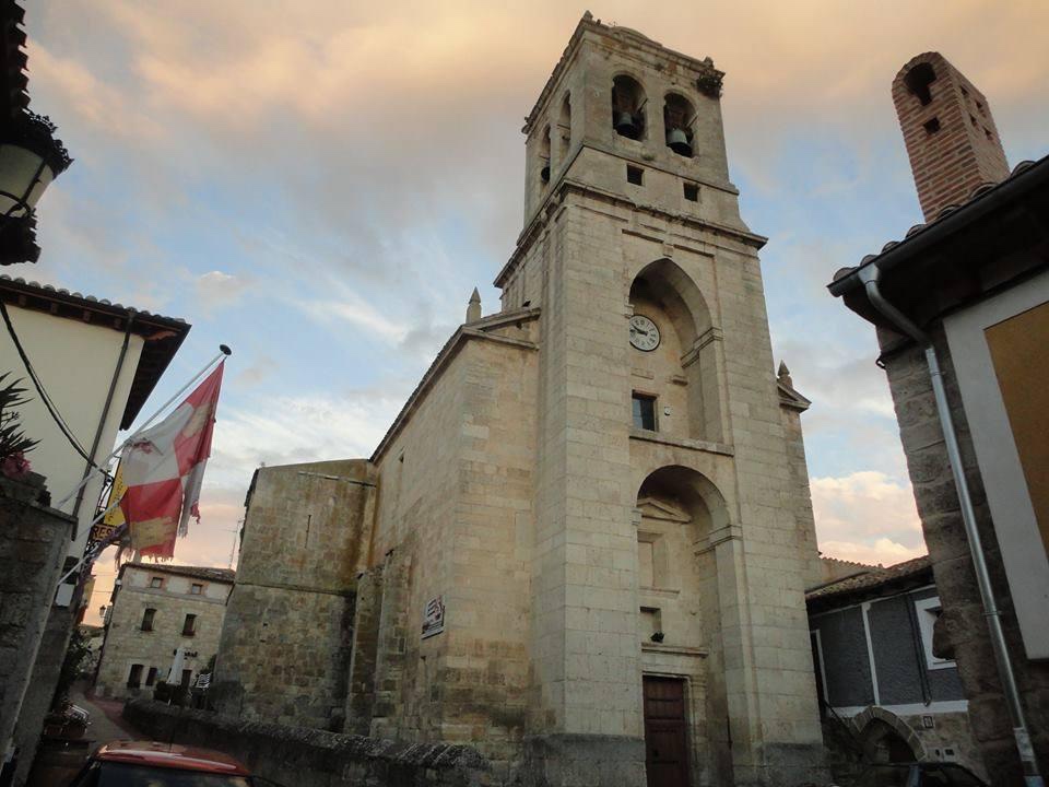
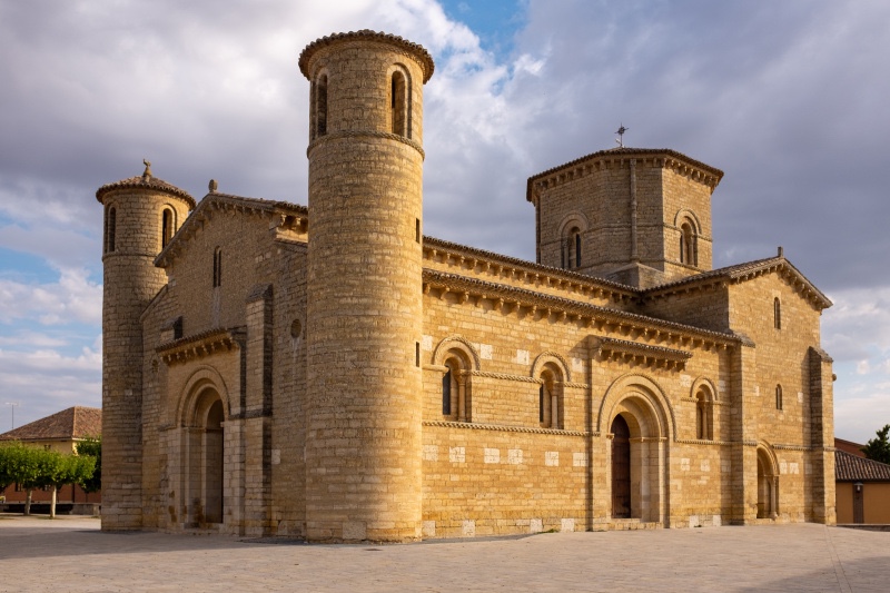
The parish church of Hontanas presided over by a tall and strong tower, is dedicated to the Immaculate Conception. It was originally built in the Gothic style, in the 14th century, although it was neoclassically reformed over time. It shelters a baroque altarpiece, the work of the mountaineer Fernando de la Peña. Inside there is a magnificent copper processional cross with enamels and figures typical of the 13th century. Its style suggests that it is made in Spain, in the late Romanesque style.
There is a niche with images of leaders and holy people from many faiths across the world ,honouring all of humanity’s sacred traditions- a strong ecumenical feel – a lovely modern twist. BB These days the fountains still pour day and night, but it is the local pool which does most of the refreshing.WP
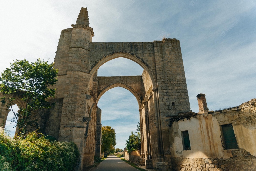
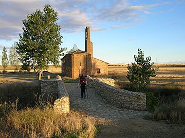
A very few KM or so,out of Hontanas and after a gentle descent, the Convento de San Anton is reached.
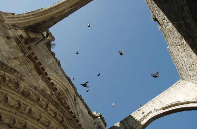
The ruins of the monastery and pilgrim hospital of San Antón is a delightful space that seems to embrace the camino, its archway spanning the road itself. Once a sprawling complex there is little that remains.
The albergue here has never seen better days, and the efforts of a dedicated team of volunteer hospitaleros keep the place as traditional as can be expected.
The niches in the archway, previously used by monks to deliver food to late arriving pilgrims, are now a popular spot to leave written messages.WP
The Arc of San Anton was founded in 1146 under the patronage of King Alfonso VI. It was formerly the main Preceptory of the Antonian monks in Spain. This order was dedicated to the care of pilgrims along the Camino de Santiago and to cure those who suffered from the “Fire of San Anton,” a disease that spread during the Middle Ages because of an undetected fungus that grew on grains. The monks helped pilgrims and were conferred with the Cross of Tau, a sign of protection against evil. The Cross of Tau is a symbol also associate with the Knights Templar. According to a local source, The Arc of San Anton was also once one of five Knights Templar Commanderies associated with the town of Castrojeriz. The Cross of Tau – The tau cross is a T-shaped cross, sometimes with all three ends of the cross expanded. It is called a “tau cross” because it is shaped like the Greek letter tau.
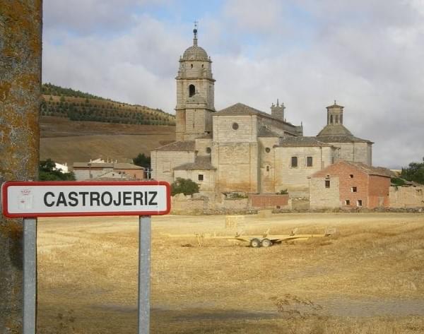
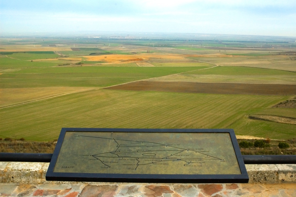
“ As we leave these splendid ruins behind, the Convento de Santa Clara opens up to our left (1/2 Mile ) where you can buy one of the wooden crosses made by the nuns. Castrojeriz now opens to view in front of us. The prominent castle ( ruins ) stands sentinel over the town and surrounding countryside. Note: the town straddles a long,winding road.JB
The layout of the Castrojeriz road-path is deceptively long and, unlike some of the smaller examples, it has been extended to encompass several parallel streets. Its three churches are worth a visit, and a hike to the castle ruins offers a view of the surrounding land only paralleled by the climb out of town. WP
HISTORY The houses along the road were built with an invisible secret, that of a tunnel that runs the length of the city and connects the cellars. In addition to being private property of the owners, its exploration is hampered by the construction of dividing concrete walls; a civil war era security measure to preserve welfare. The city was, and still is, passionately divided. That will not prevent you from enjoying the charm it offers pilgrims. WP
Most pilgrim-related services can be found along Calle Oriente , but the largest pharmacy and groceries are closer to the main road.
Also along the East is the Hospital del Alma ; part art gallery and part meditation space and exactly where you want to go if you’re looking for a bit of peace and quiet.
In the main square there is a small pilgrims shop, one of the last of its kind. The owner is quite the character and has managed to keep up with the times, trading the usual small-town items for the kind of high-tech gear modern-day pilgrims are looking for.
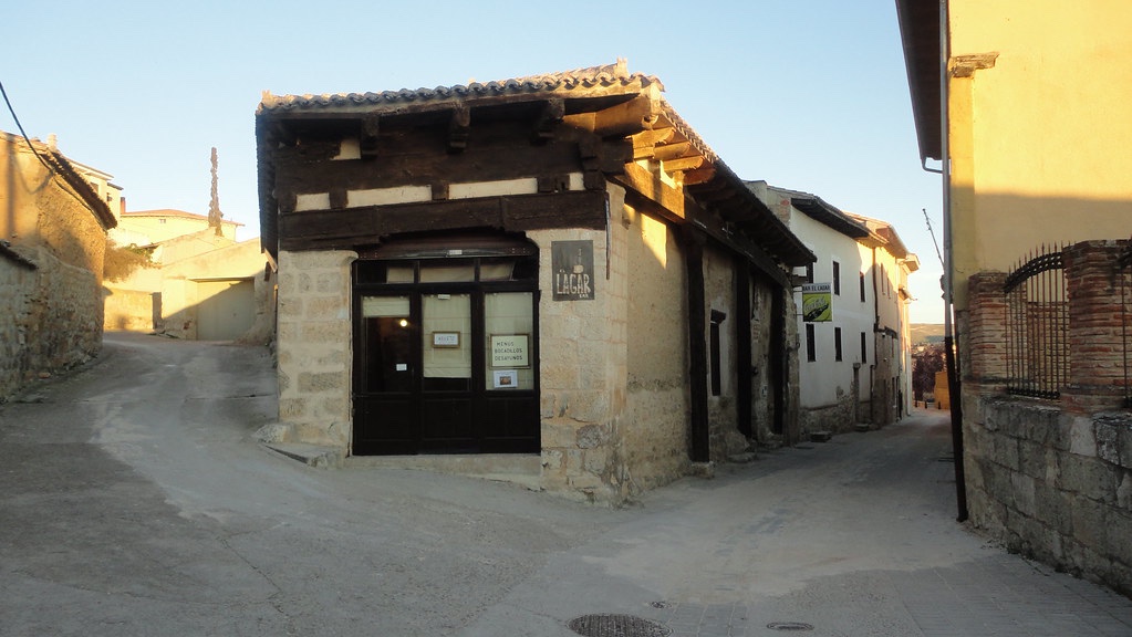
On the way out of town is Bar Lagar, named for the well-preserved grape press in the center. Check it out for a glimpse of how things were once made.WP
Let’s hope it’s open we pass by.
A fellow pilgrim asked “Are you nervous about the meseta?” “The what?” I naively responded, thinking it was some sort of tribe or gathering. After having it briefly explained to me I replied, “Why would I be nervous?”. And that’s exactly how people should respond. But it is very different from other stages of the Camino and an important part of the way. There are some amazing villages, beautiful ruins and other sights to see, the people are friendly, it’s very affordable day to day and the Spanish culture in this area is fantastic. It is also considered a time of inner reflection for many. I think pilgrims who skip this entire section of the Camino are really missing out on a unique experience. A quotation from a recent post.
https://music.youtube.com/watch?v=THz_YLFMpXM&feature=share The Walk by Steve Miller. “ Now if you don’t know what it’s all about Come to me and I’ll show you how Well do it fast, well do it slow Then you’ll know the walk everywhere you go
You can walk, and you walk, now you walk You gonna walk, you gotta walk it, Just a walk Just a walk Just a walk Just a walk”.
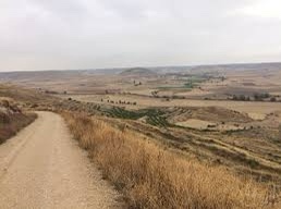
LEAVING CASTROJERIZ – “ One of the most beautiful vistas of the Meseta is 3.5 KM after leaving Castrojeriz. A steep climb leads up the slope of the high ridge, Alto de Mostelares . You will be rewarded for the hard effort to get here with limitless views of the yellow and green wheat fields of the Meseta looking like a patchwork quilt.” BB The Alto de Mostelares is the highest of the peaks you will encounter along the meseta, but it is not as difficult as it appears from Castrojeriz.WP
“ At the end of the slope where the trail levels out again you will spy another reward, the refreshing Rio Pisuerga with the Ermita de San Nicolas along its Eastern bank. BB
The Ermita de San Nicolás , like the ruins of San Antón before Castrojeriz , has a long history of caring for pilgrims. Both are on their own far from cities and as a result don’t necessarily get the amount of traffic they deserve. Perhaps that’s for the best, as pilgrims often claim they’re the most memorable lodges along the way.WP
Seven arches on the Puente de Itero dating back to the 11th century. We are now entering the province of Palencia.
“ Between the village of Itero and and the point of entry to Boadilla you will see just one tree. However,before finishing the stage you come at least to a climb and a little pine wood . Today you have had your first taste of Tierra de Campos” SR “Tierra de Campos is a natural region located in the autonomous community of Castilla y León, which spans the provinces of Palencia, Valladolid, Zamora and León. The French Waypasses through this area, allowing you to enjoy an excellent natural environment during the journey. The gently sloping plains stand out in this area, generally treeless and with a clear steppe appearance. It is worth stopping to discover its charms.” From Viajes de Camino de Santiago.
“ Three kilometres after Itero de la Vega you’ll cross the Canal de Pisuerga,a man made canal built to irrigate farmland in this wheat growing territory. The Castilla canal is one of the most important hydraulic engineering works carried out between the mid-18th century and the first third of the 19th century in Spain . It runs through part of the provinces of Burgos , Palencia and Valladolid in the autonomous community of Castilla y León ( Spain ) and was built to facilitate the transport of wheat from Castilla to the northern ports and from there to other markets. However, before the arrival of the railway , it became obsolete. Wikipedia
On approaching Boadilla del Camino you will notice “ the fields…are dotted with Palomares – dovecotes – find your way towards one and explore the interior which holds thousands of niches”WP
“ The original population of over 2000 that once served several pilgrim hospitals here continues to decline – a characteristic of many rural communities along the way . But the reawakening of the Camino is beginning to turn the tide “ JB
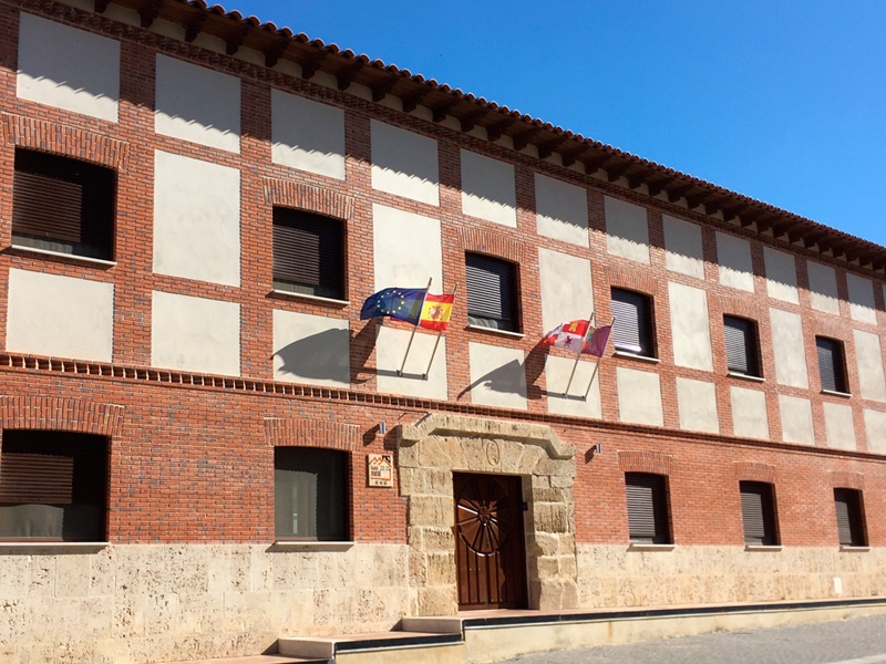
Hotel Rural “EN EL CAMINO” is our base for tonight.
“Excellent Location, great hospitality, love the owner, very accommodating. Restaurant, and hotel is clean and very nicely done. Right on the Camino! A recent review
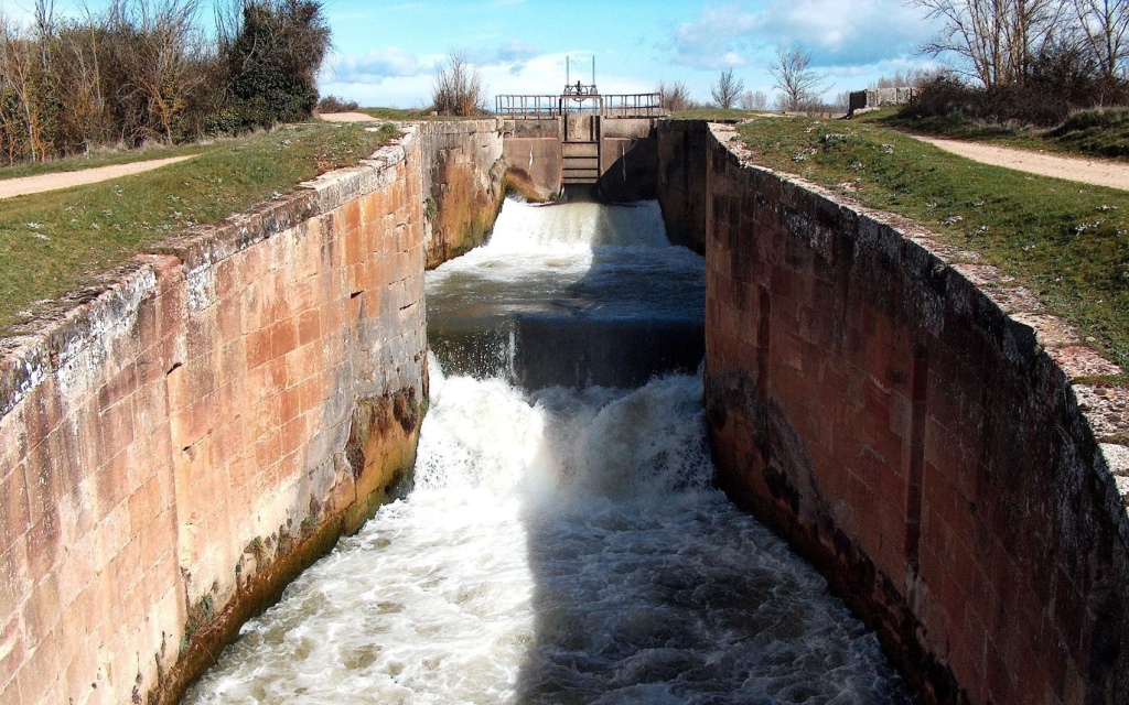
7 Km does not present a challenge and that is no bad thing; it does provide opportunities, however – some respite after a hectic three days, or a chance to revisit Castrojeriz , maybe take a walk to ESCLUSA,a peaceful vantage point on the Castilla Channel with its 200 year old engineering works and four locks.
There is also the possibility of a boat trip from hereabouts.
“I am curious – what is the rush to get through the meseta? Perhaps another way to approach it is to choose some of the ‘recommended places on the meseta and plan your walk to reach those each day. For example…
“I prefer Hontanas over Hornillos, and Hospital San Nicholas over Castrojeriz. Albergue En el Camino in Boadilla is a great stop, for the garden and the warm hospitality,” QUOTE FROM “ Six Reasons Not to Skip the Camino” .
“ The first five kilometres of this stage are easily the most beautiful in terms of landscape…..you soon come to a man made feature which will make the rest of your walk to Fromista pleasant and interesting: The Canal de Castilla” . From SR.
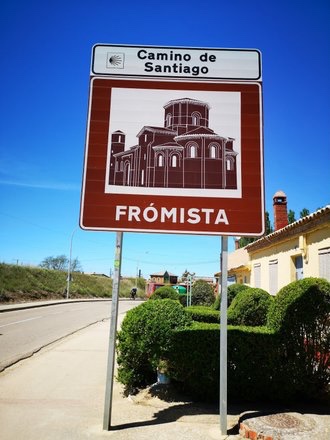
“ The walk along the towpath,beside Elms,observing the birds in the reeds and hearing the slow movement of the water goes all the way to Fromista.Just like Brindley Place.“Frómista is the southernmost city along the Camino Francés and the epicenter of wheat growing in Spain. Its rises and falls over the centuries were finally steadied with the arrival of the canals in the late 18th century; they brought proper irrigation and an abundant source of power for mills. In the center of town sits the Iglesia de San Martín, which underwent a rather unfortunate renovation in the 19th century. In the process, many of the more artistic elements were removed for reasons of decency. Quite a few decorated capitals make for an interesting, if not amusing, visit. Two other churches, San Pedro and Santa María del Castillo, are generally open to the public.” WP
“The town of Fromista is one of the most attractive sights to be found along the Way ….“SR
“ The importance of Fromista to the Camino is evident in the fact that there were several pilgrim hospitals here in medieval times…Fromista is derived from the Latin word for cereal frumentum this area having provided copious supplies of wheat to the burgeoning Roman Empire.JB
Fromista, population circa 800, comes at the end of the sixth stage in Picaud’s original pilgrims’s guide. It is believed the town was first inhabited by the Celts, then Romans, to be completely destroyed by the Moors during the 8th century.
It was repopulated during the 10th century; aided in part by Donna Mayor, wife of Sancho III, who founded a Benedictine monastery.
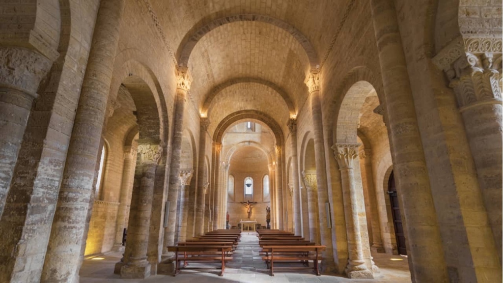
Today the only surviving part of the monastery is the Church of San Martin. A statue of San Telmo, (St Elmo), the patron saint of sailors, presides over the village square; he was born here in 1190 and his remain are interred in the cathedral in Tuy, Pontevedra, on the Camino Portugues.
San Telmo
The Romanesque Church of San Martin is an imposing building dominating the center of the plaza where it is located.
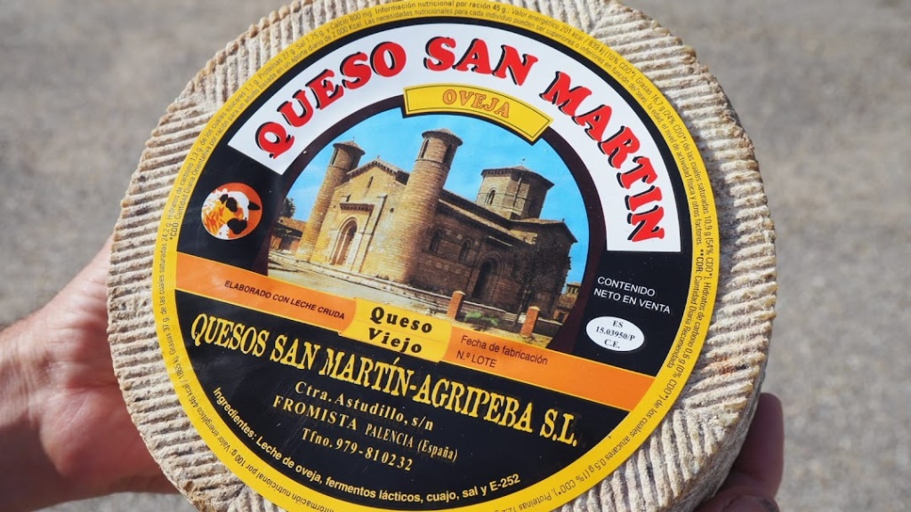
As a complete but appetising contrast you could visit Quesos San Martín Frómista,famed for locally made cheese.
Would be good on a bocadillo.
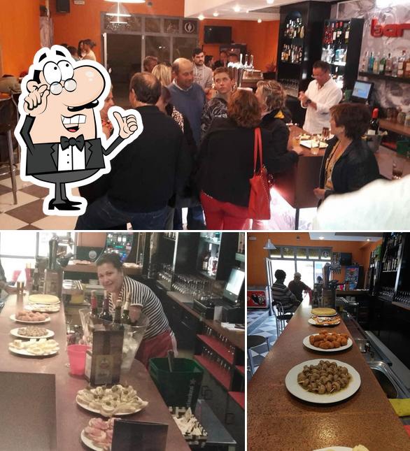
For a more substantial lunch,Bar Vulcan’s tapas are highly recommended.
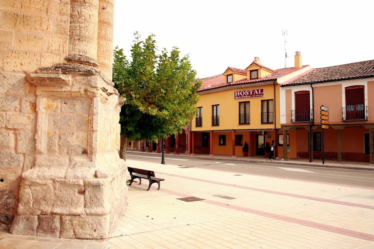
Accomodation for the evening is in HOTEL RURAL San Pedro.
“· A beautiful hotel with a lovely smell of potpourri when entering. Sweets in bowls dotted around various places .a nice touch I thought” . Recent review.
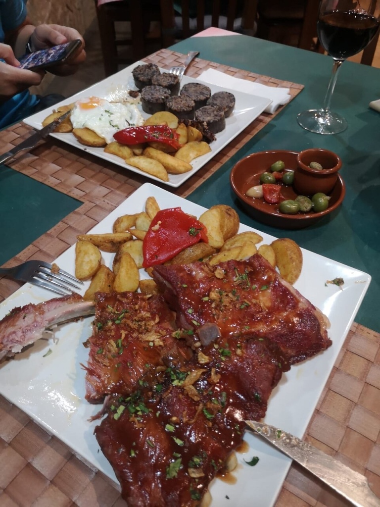
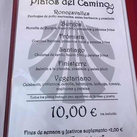
And for dinner,El Chiringuito Del Camino has these hearty dishes.
There are vegetarian options,too. PELEGRINOS MENU – Prices may have risen slightly by May 2023!
And every day you wonder why you are doing this, and every day you give thanks that you can.”
Yes, the gratitude I feel at being able to do this in such a beautiful place, is everything.
Leaving Sahagun,“ Four kilometres after leaving Sahagún, you have a choice: Stay on the Medieval route known as the Camino Real,or detour to the Via Romana
– also known as the Calzada Romana …which follows the old Roman road…adding a little over 1 kilometre to the whole trek . You won’t see much of the Roman road;it is largely under dirt and gravel. BB
Apparently the advantage of this detour is to take you away from the highway ( A-231) that the Camino Real parallels in places. JB says “ stay on this ( left) side of the bridge and continue along the gravel Senda alongside a quiet country road with shade,parallel to the autopista. Either way we will be moving on through the cereal and grain-covered plateaux of Leon.
Pleasant park-like stretch
It will be advisable to stock up on water and snacks as there is a distance of some 12 KM with little in the way of support services.
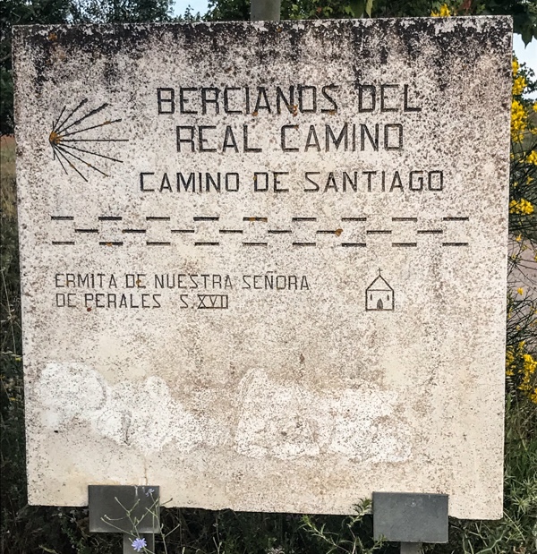
Another reason for staying on the Real “ is to see the 17 th century hermitage ,Ermita de Nuestra Senora de Perales…Both a rest area and sacred site for the people of Bercianos.” BB
Looks inviting.
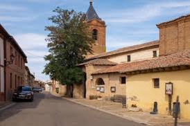
The next Puebla of any consequence is Bercianos del Real Camino.
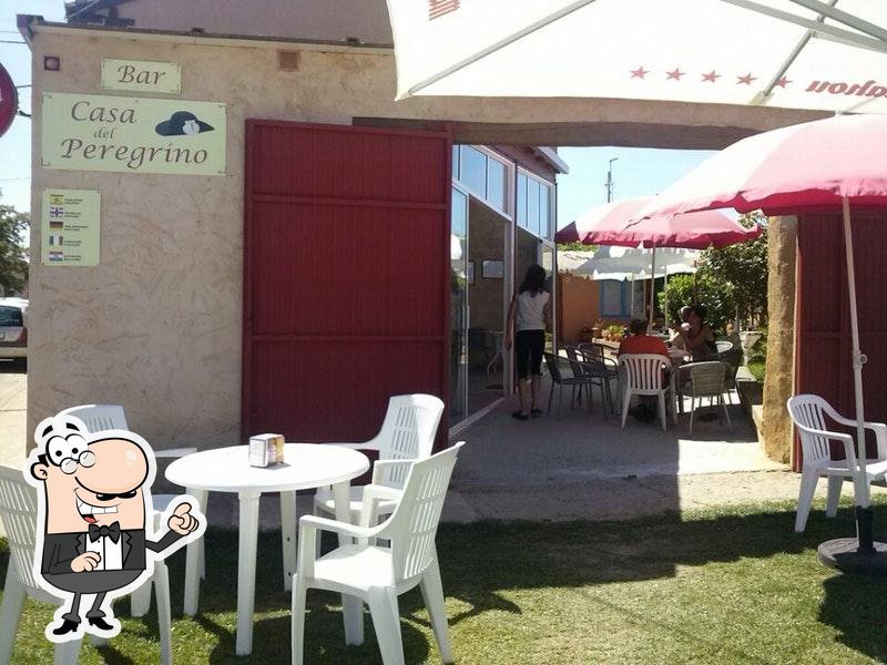
According to JB there is a Bar Casa PeregrinoThis looks hospitable.
We shall pick up the route “on the Western edge of the village passing wetland reserve Laguna Olmo and then onwards under the autopista to continue on to El Burgo Raneros.” J.B
The Laguna at sunrise – A bird hide on the left .
“ After a walk of almost two hours on the plain,you come to the pleasantly surprising town of El Burgo Ranero…(it) might at first glance look like a typical small town where you can rest and remove your boots…However, you need only to take a short walk and have a careful look around to see that this is a town that offers a great deal”. SR
The village church. “ If you are passing through at the right time of year ( late May ) take a close look at the stork nests on the tower. If you are lucky you may catch a glimpse of the babies waiting for lunch” WP
“ Some say El Burgo Ranero gets its name from el burg granero,a grain or granary town,and others from el burgo ranero, a place abundant with frogs ( ranas), a part of the town legacy thanks to the nearby pond. Take your pick; they’ve got plenty of both” BB
“ The frogs add a nice touch ,ribbiting along the small lagoon on the northeast side of the town…” BB
“ El Burgo Ranero owes its existence to both wheat and wool. “ WP “ the wheat and wool business that once sustained it has been displaced by mechanisation “ WP
“ The village probably came in to bringing the early 12 th century , but is set on a much more ancient pathway where sheep had been moved from pasture to pasture over millenia. ( Shepherding and transhumance – a word we get from Spanish,the practice of moving sheep from summer to winter pastures and back again – have been practised here ever since farmers and herders inhabited Iberia” BB
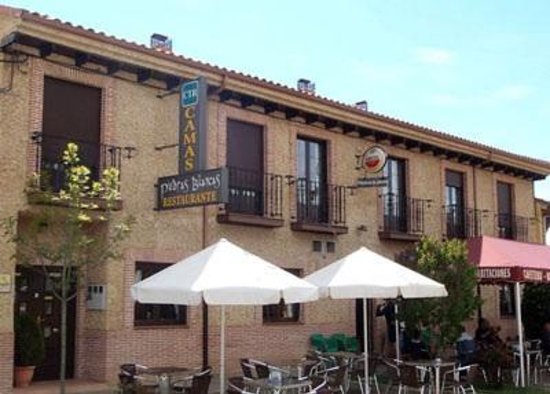
Shepherding.Our accommodation H. Rural Piedras Blancas. It is family run with a lively bar frequented by locals and Pelegrinos alike. Recommended for its traditional, family style meals.Local water colour.
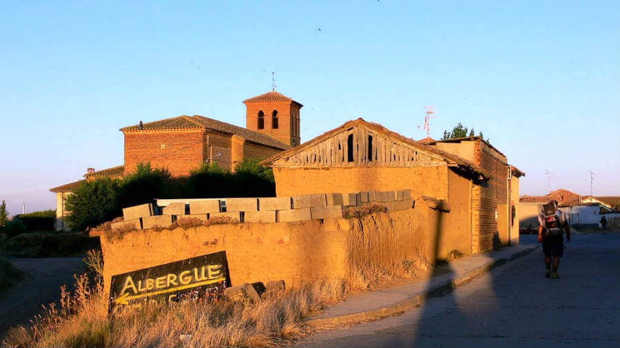
“To come to the knowledge which you have not, You must go by the way which you know not.” “Ledigos wins the award for the most confusing Camino signs. Fear not,both directions will take you to Terradillos de Los Templarios.” WP
It’s a short walk to Terradillos.” After the relative luxury of Carrion we know experience rural simplicity,thankfully bypassed by the N-120. Formerly a stronghold of the Knights Templar nothing,on a physical level remains of this noble Order but it’s spirit lives on in the place name..” JB
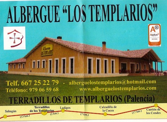
“ The Albergue Jaqueline de Molay is named after the last grand master of the Templars ( who was tortured and burned at the stake in 1314 )…………………….The Templar name is a reference to the legend of the Templars’ hidden golden hen or goose,possibly still buried here in Terradillos.
“ The true gold is the hospitality,along with the daily meditations written on chalkboard in the garden. A recent one “ Sometimes you have to lose yourself to find yourself”. The village has a general store and a bar” .BB
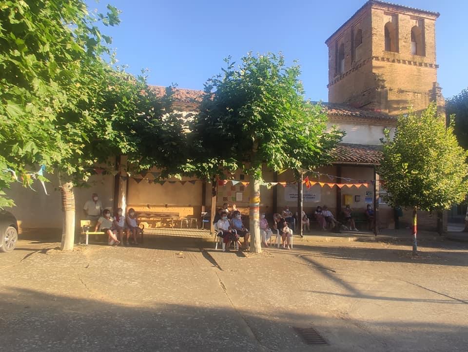
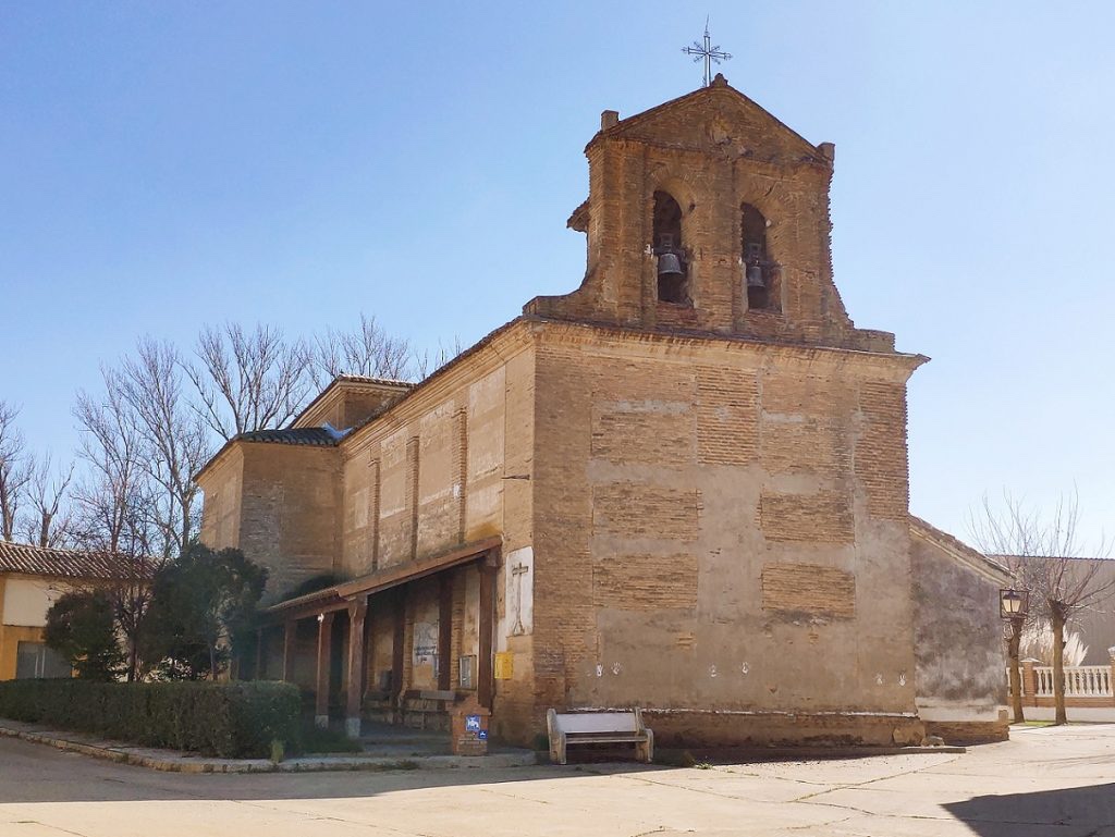
Not too further on is “ a seemingly sleepy little village,Moratinos.” BB
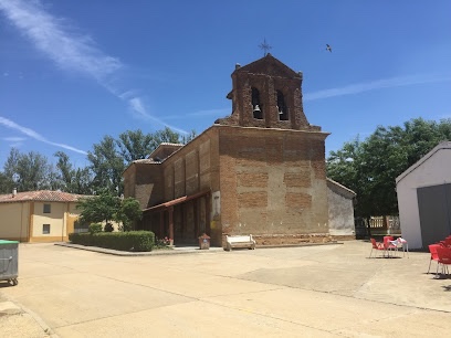
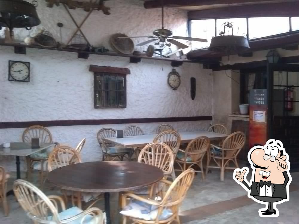
Iglesia de Santo Tomas,Moratinos.“ decked out in colourful Knit yarn creations that are strung across the chuch plaza and wrapped around the trees. These “ yarn trees” are the project also of the Asociacion Cultural de Moratinos,who wanted to add colour to their village.Not bad for a population of 58 ! “We will then continue onto a pleasant gravel track ( away from the N-120 ) all the way into San Nicolas del Real Camino” JB There is a bar and restaurant in the village square along with parish church.Iglesia de San Nicolas Obispo ( it’s humble exterior also serving as a pelota court ! ) JB On the edge of the village is Casa Barrunta, a ranch-and-tavern like restaurant. “ This is some of the best food on the Meseta,served with the biggest heart and professional flair.”Lunch anyone?
PROVINCIA DE LEON,“part of the autonomous region of Castille y Leon and offering the most varied terrain on the Camino. We start off with a continuation of the now familiar Tierra de Campos with its flat and well irrigated agricultural land.” JB
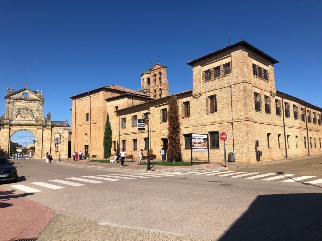
Then we reach the evening’s rest place,Sahagun, in Hostal San Juan, after crossing the Medieaval bridge at Ermita de la Virgen del Puente.Although an established Alojamiento in Sahagun,the Hostal did not feature on the CORREOS drop down list of accommodations when I was just recently booking our luggage stops. It was only after an E-Mail to the Correos,together with proof of the Hostal having someone on duty between the hors of 08.00 – 14.30, that a polite agreement was reached! To give the CORREOS credit,they were quick to respond and set up my stage on their website.“SAHAGUN is one of the towns that prospered greatly under the powerful order of Cluny which at one time controlled as many as 300 monasteries and churches along the way” SR. “ It seems to combine all the joys of close-to-the-land village life with ease and amenities of city life.” JB“If you join the locals for a drink on the Plaza Mayor, you’ll begin to feel a harmony here” JB There’s a strong possibility that we will!The Santuario de la Peregrina. As we began our Camino in Saint Jean Pied de Port,we will have passed the halfway point to Santiago. “ This warrants a celebration- you’ve gone almost 400 kilometres ( 250 miles )! You can mark the moment…in the Santuario de Pelegrina to receive your halfway certificate…in pretty cursive script.THE HALFWAY CERTIFICATE
Sixty-seven kilometres to the south-east of Leon we find Sahagún, a historic city that stretches on top of a smooth mound, whose nerve centre is the main square, or Plaza Mayor, which still has its original porches.
In the streets we can see some houses with brick and wooden structures, and some others that were built with clay and straw. The local artistic heritage, the legacy of a booming past, includes remarkable buildings such as the monastery of San Benito el Real, from which only a Neoclassical arch still stands; the Mudejar churches of San Tirso and San Lorenzo, from the 12th and 13th centuries, respectively; the convent of the Benedictines, presently the site of the Sahagún Museum; and the sanctuary of Peregrina, in the outskirts as described above.
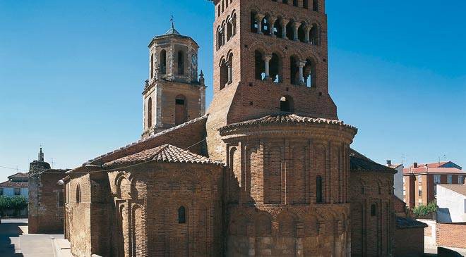
San Tirso San Lorenzo – A mix of Romanesque,Mudejar and Gothic from the early 13 th century.Quite a place! Photo from JB’s Guide.
Awoke to another sunny morning . All ready for today’s saunter.
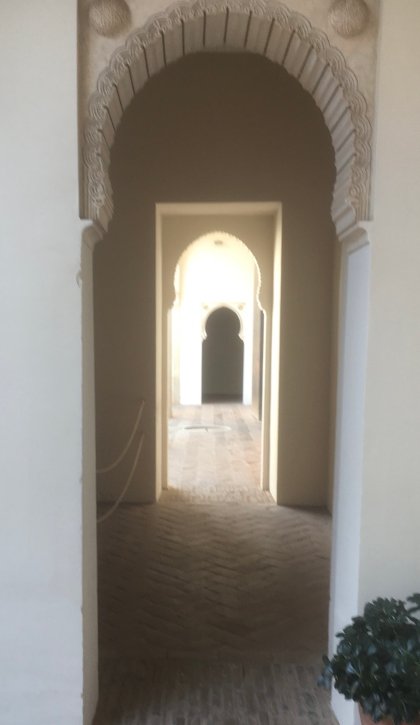
Patio number 3
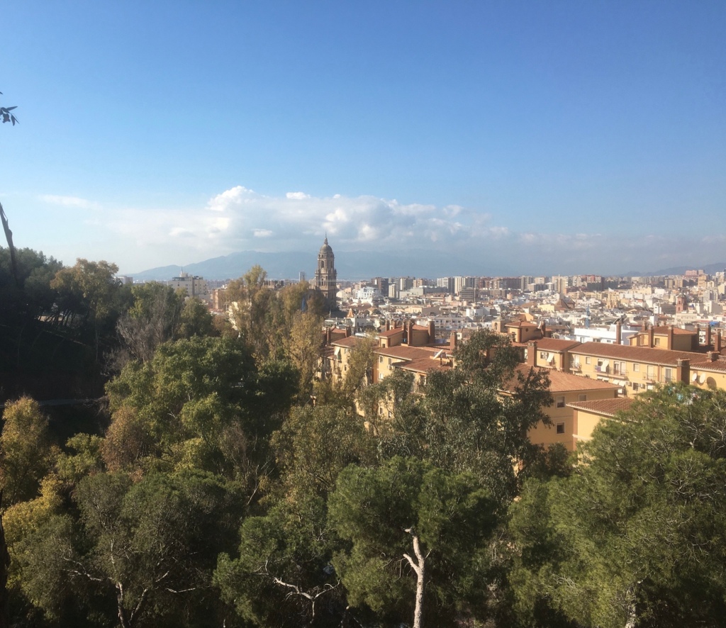
Leaving Plaza de Merced,we began a steady uphill walk.
Traffic free all the way up to the top and along a tree lined boulevard .Cathedral in the distance
Nearing the top we were looking forward to coffee.
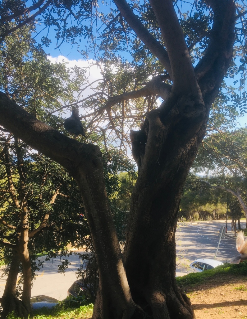
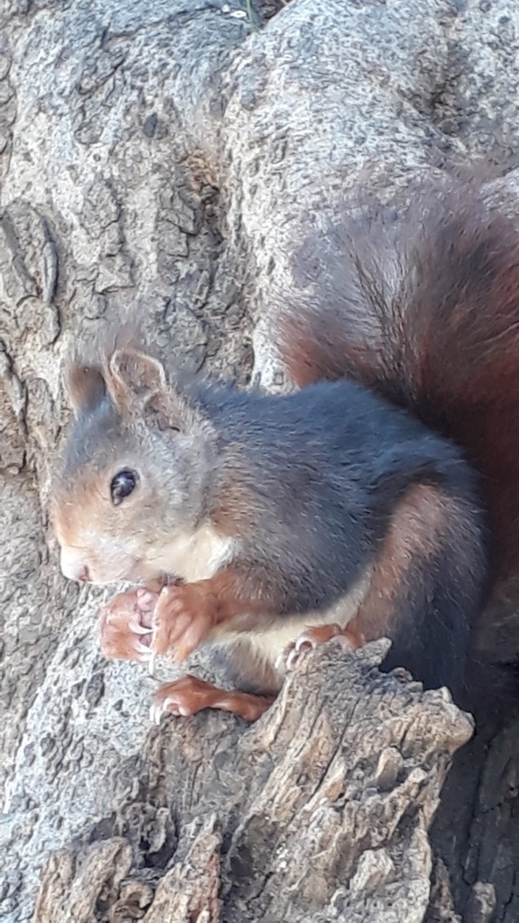
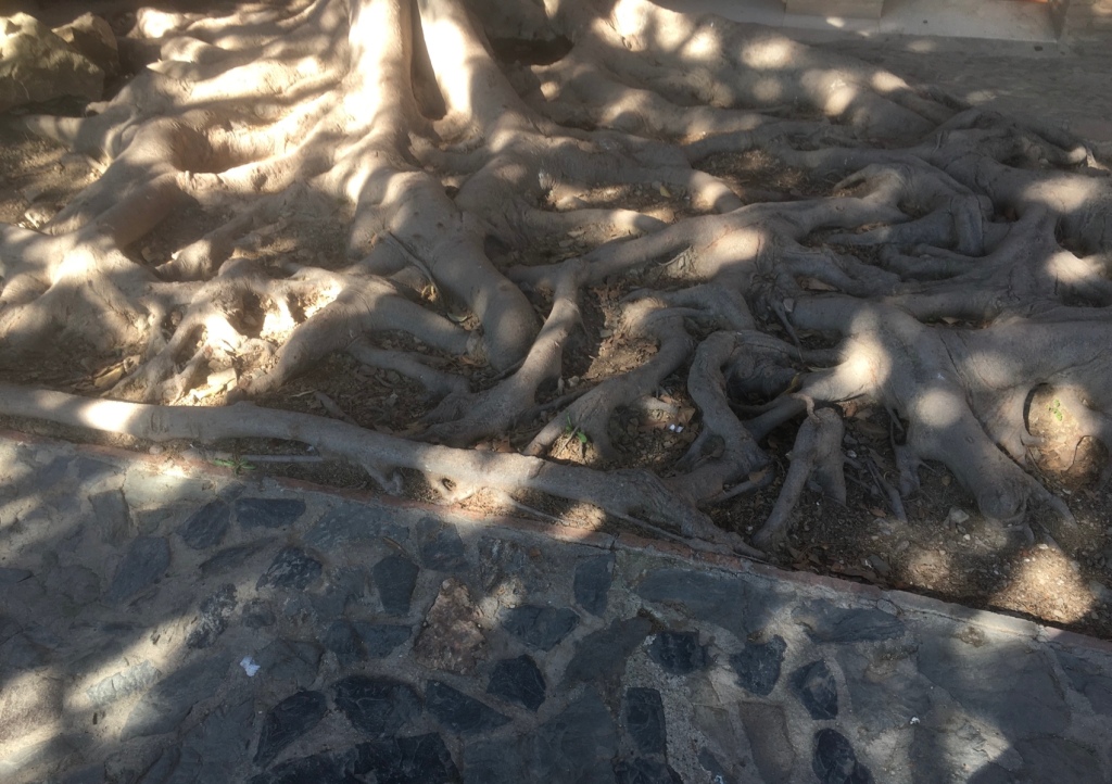
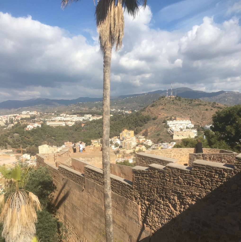
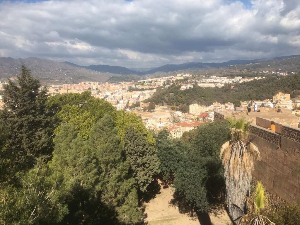
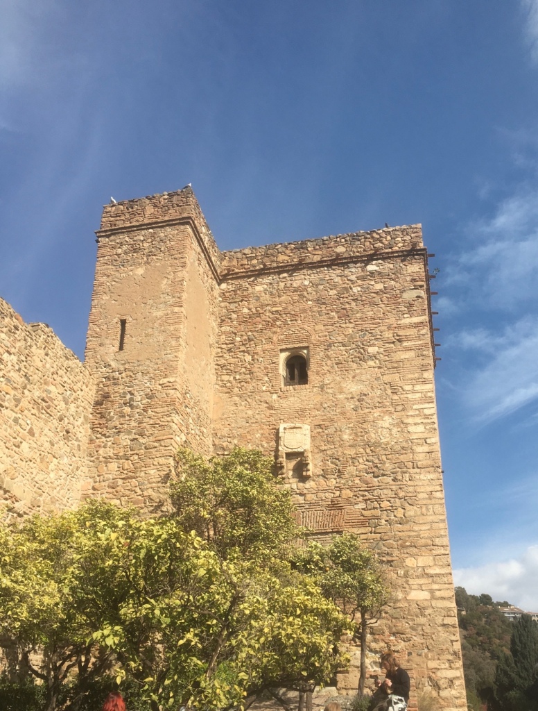
We were on the lookout for red squirrels.He’ s hiding behind the tree trunkOh what big claws you have!The roots of a rubber tree by the Castle cafe.We made our way afterwards into the Castillo The history of the Gibralfaro Castle dates back to the 14th century , when it was built. This served to protect the Alcazaba and the entire city of Malaga , since it extends over more than 21,000 square meters. Likewise, the natural enclave of this place is also impressive. HISTORY OF GIBRALFARO CASTLE It is a Muslim fortress built in the 14th century AD to house soldiers and to control access to the capital both by land and by sea, so its height, approximately 132m above sea level , was key. for said task. It arose as a defensive support for the citadel, with which it was once linked through the outer passage of the coracha that today is inaccessible. Its current nickname, “Gibralfaro” , derives from the Arabic word “Jabal-Faruk” (mount of the lighthouse), and it is that the Phoenicians, the first settlers of Malaga, also took this mountain as a settlement and established the lighthouse on its top. gets name
A fascinating remnant of Malaga’s Islamic past are the sheer walls of Gibralfaro Castle , spectacularly perched high on the hill overlooking the city. Built by Abd al-Rahman I, Cordovan emir from the 8th century and rebuilt later in the 14th century, when Málaga was the main port of the emirate of Granada . Gibralfaro Castle , also called Castillo de Málaga , is particularly notable for its twin centers: the castle garrison built on top of a rocky hill overlooking the city and the fortified Islamic Palace or Alcazaba, situated at the foot of the hill, both connected by a defensive back.
The Gibralfaro fortress dominates the entire city, and is located on the crest of a long hill located 132 m. above sea level, whose steep slopes descend towards the sea and towards the city. Since time immemorial, this fortress was the great watchtower not only to observe the population settled at the foot of its western slope, but also the accesses to it by land and sea.
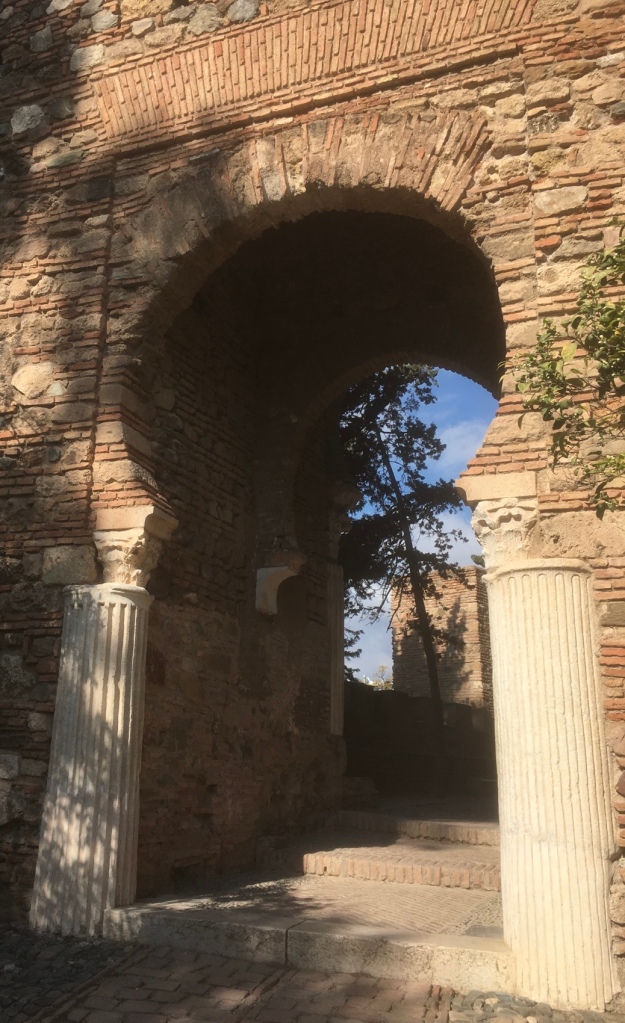
Very few Arab remains are preserved inside the Castle due to its military use, and to the many interventions that occurred in Christian times, such as the disappearance of the mosque and dependencies. Later it was partly blown up by the French, together with the ammunition that they could not transport, when they left the city during the War of Independence. The powder magazine of the Castle is currently occupied by an Interpretation Center.
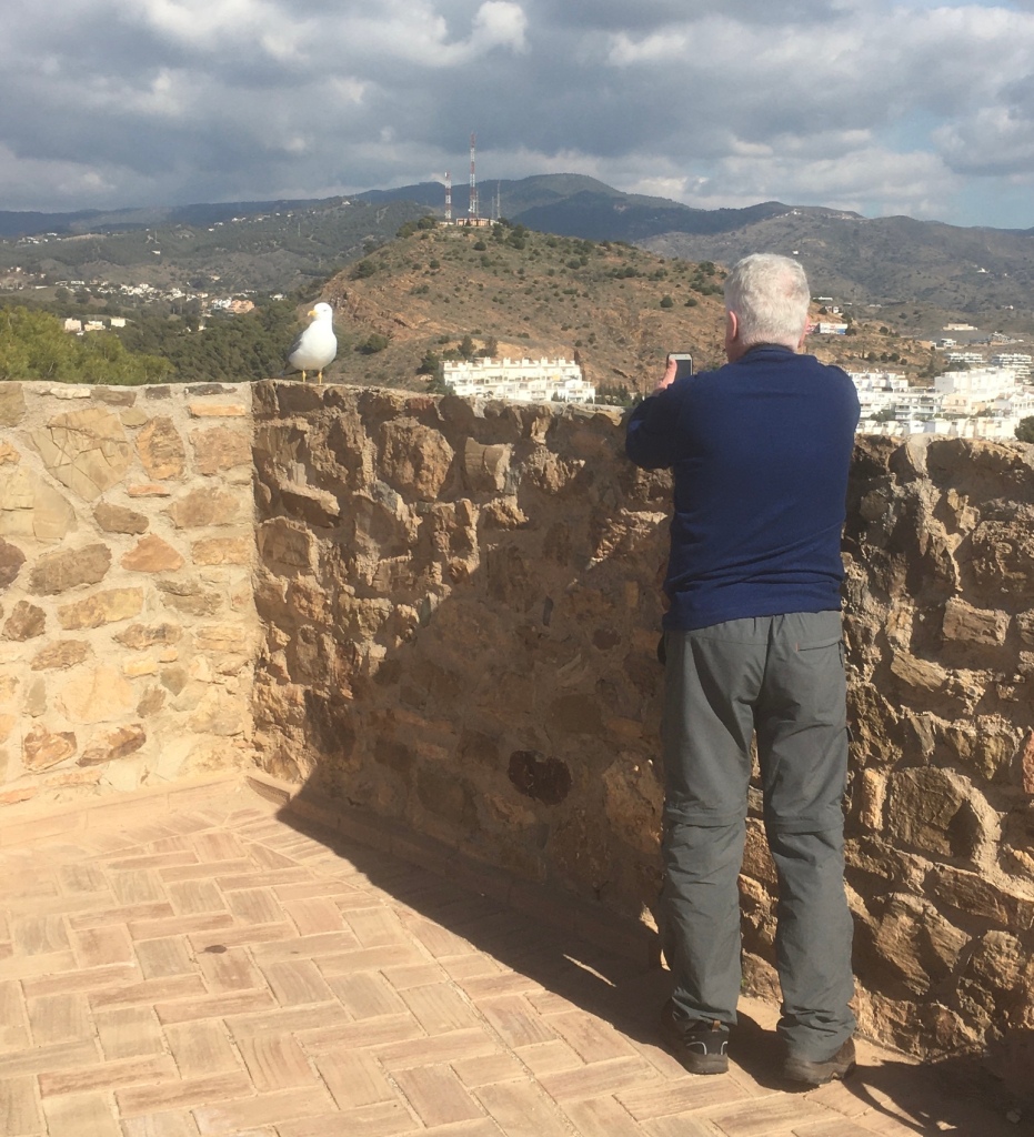
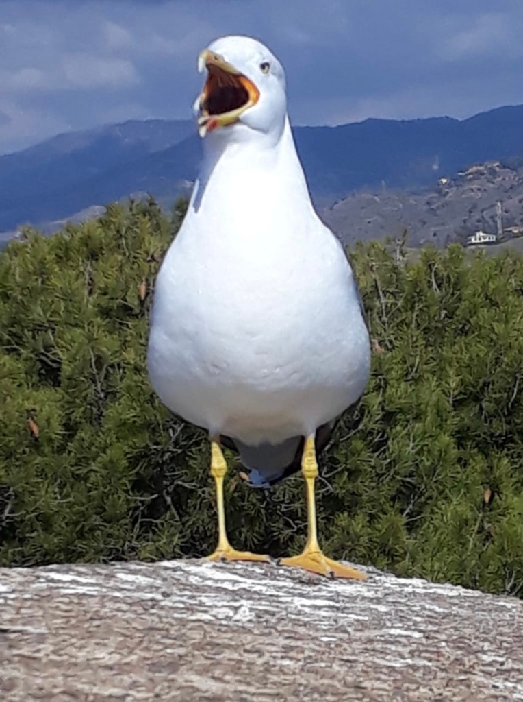
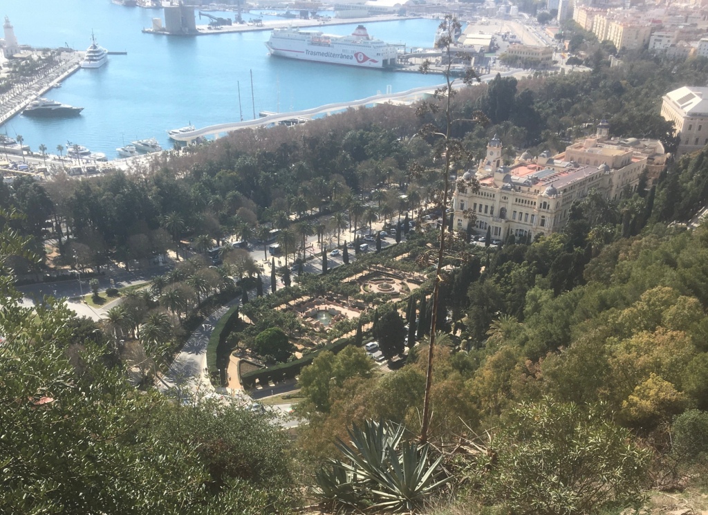
The castle is famous for the three-month siege in the summer of 1487 by the Catholic monarchs, Ferdinand and Isabella, after which Ferdinand occupied the site, while his queen took up residence in the town. For a time, it was considered the most impregnable fortress on the Iberian peninsula. It has two lines of walls and eight towers.Some more great viewsMatt getting a close up of a yellow legged GullWe made our way downwards towards the ALCAZABA Penny’s favourite spot – the park and a very exclusive hotelHistory of the Alcazaba
What’s the meaning of Alcazaba? The word Alcazaba comes from Arabic ‘AL-qasbah’ and refers to a fortification within a walled town.
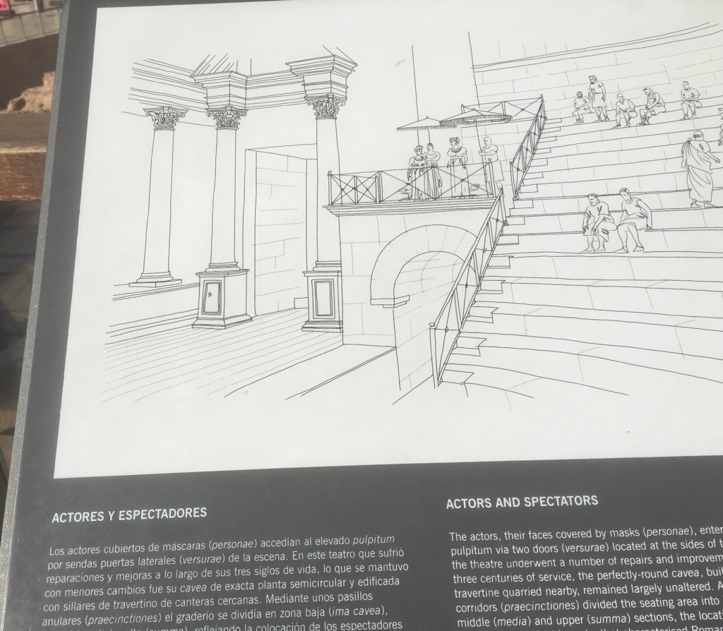
The Alcazaba of Malaga is a fortress palace built between 1057 and 1063 by the Muslims and at the request of the king of Taifas Berber in Granada, which used elements of the ancient Roman theater that sits at the foot of the palace. Due to the Muslim origin of the Alcazaba, its name arises, which in Arabic takes the meaning of ‘citadel’
Built between 1057 and 1063 by the Moors, the Alcazaba of Malaga was, at its height, comparable to Granada’s Alhambra in terms of its splendour and the impressiveness of its fortifications. The Alcazaba is located at the foot of Mount Gibralfaro and overlooks the city of Malaga. A huge citadel, it spanned 15,000 square meters. Its fortifications, which included double walls and 110 towers, guarded the harbour and the city from attack.In the 13th century, a 2nd fortress was added. With the increased use of gunpowder in Europe, the Muslims knew that if the Christians conquered the mountain they could use cannons to fire down on the Alcazaba. So Gibralfaro Castle was built at the top of Mount Gibralfaro to protect the Alcazaba and the city (more on Gibralfaro Castle here). The two castles were connected by a ‘coracha’, a walled corridor allowing soldiers to move from one castle to the other. In addition to the impressiveness of its fortifications, the Alcazaba was also a palace. Within its walls were gardens, ponds, sumptuous halls, a deep well and a mosque.
The Alcazaba was put the to test in 1487 when the Catholic Monarchs tried to take Malaga. For four months the Muslim army, formed of 15,000 men (versus 80,000 Christians), resisted. Finally, having run out of provisions, they surrendered.
The Fortress was used by the Catholics after the takeover and was kept in good condition until the 17th century. At the time two events contributed to its deterioration: a severe earthquake in 1680 and the damage caused by an attack by French ships in 1693 (during the Nine Years’ War). After that, the fortress was used for various purposes including as a prison and a hospital.
In the 1930’s rehabilitation work began and the compound was declared Historical Heritage of Spain (now an Asset of Cultural Interest). The Alcazaba is today one of the most important Muslim works preserved in Spain.
I like the tops of the mountains in the distance.
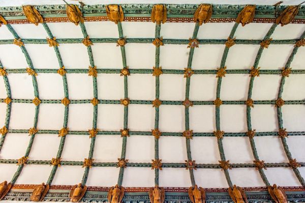
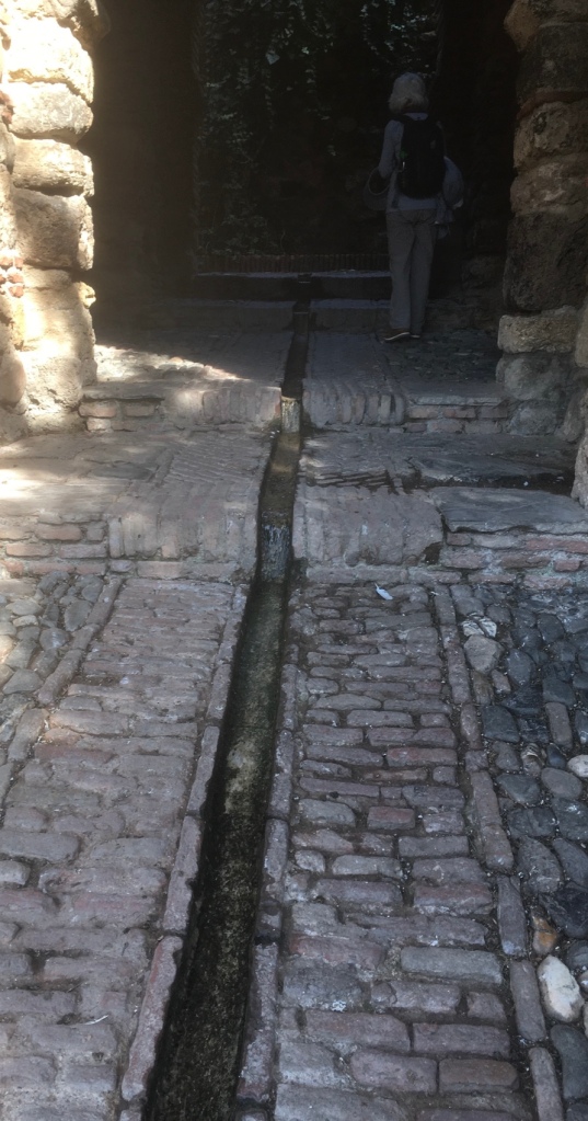
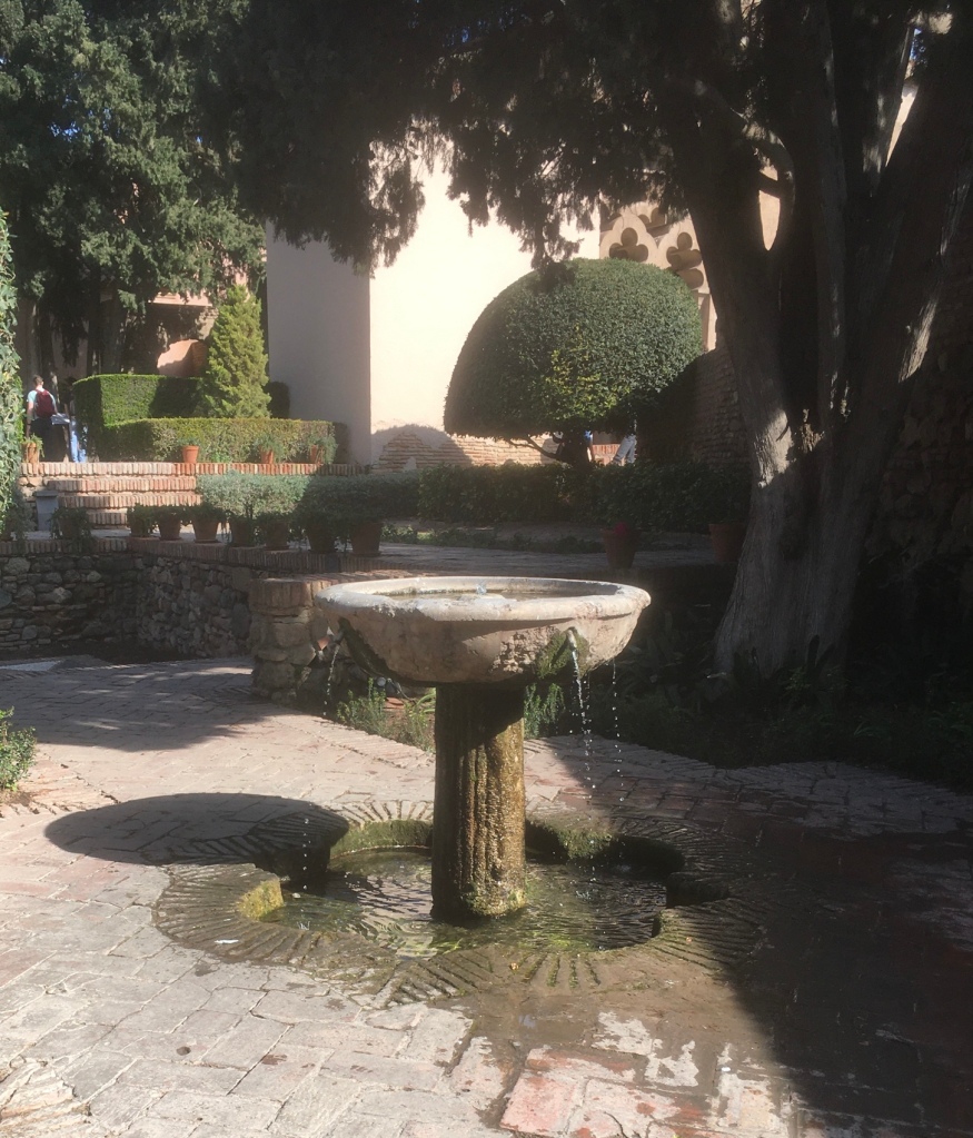
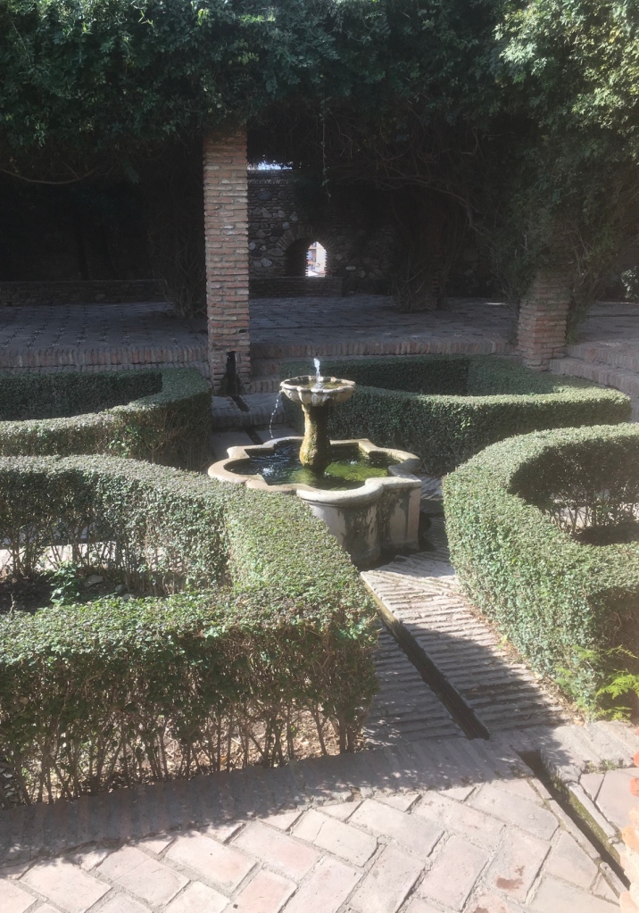
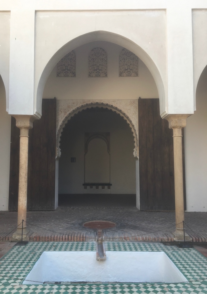
The almost constant features in the Alcazaba are those of water and shade.
The rivulets that ran through and across rooms and corridors reminded me of the Alhambra in Granada. These are distinctly Moorish designs and obviously appropriate to what are for most of the year very hot temperatures.
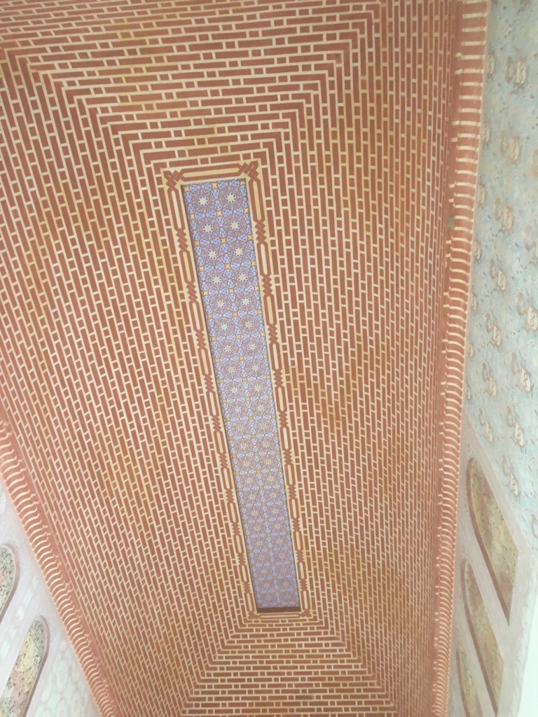
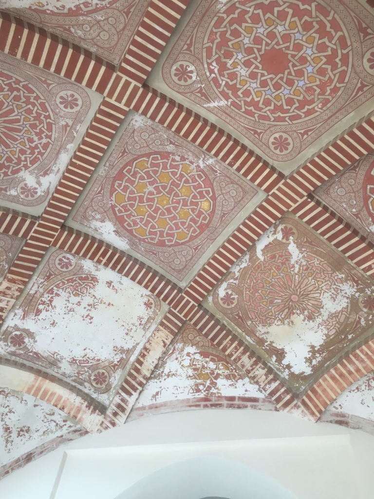
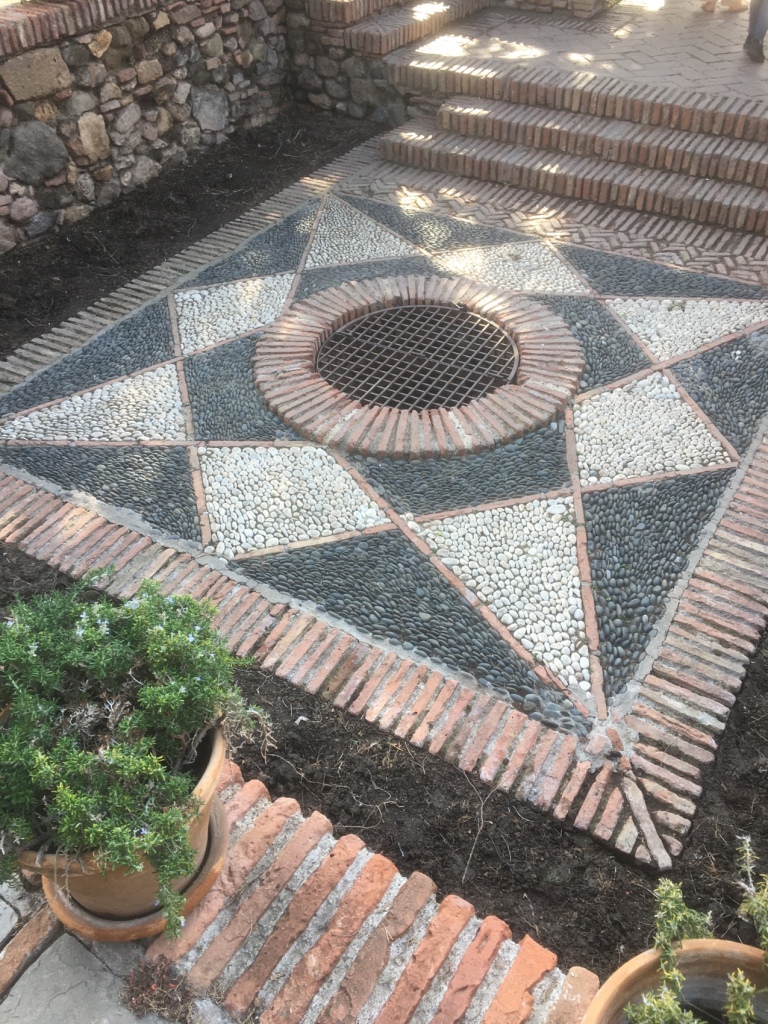
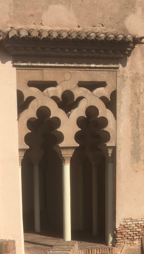
The other classic Moorish feature is that of design and artwork- none of it figurative; no statues nor pictures – but delicately patterned and repetitive.
The ceilings in particular are striking.
Some of the water features…
These feed into different rooms.This well is over 30 metres in depth.
Archways and pattern work.
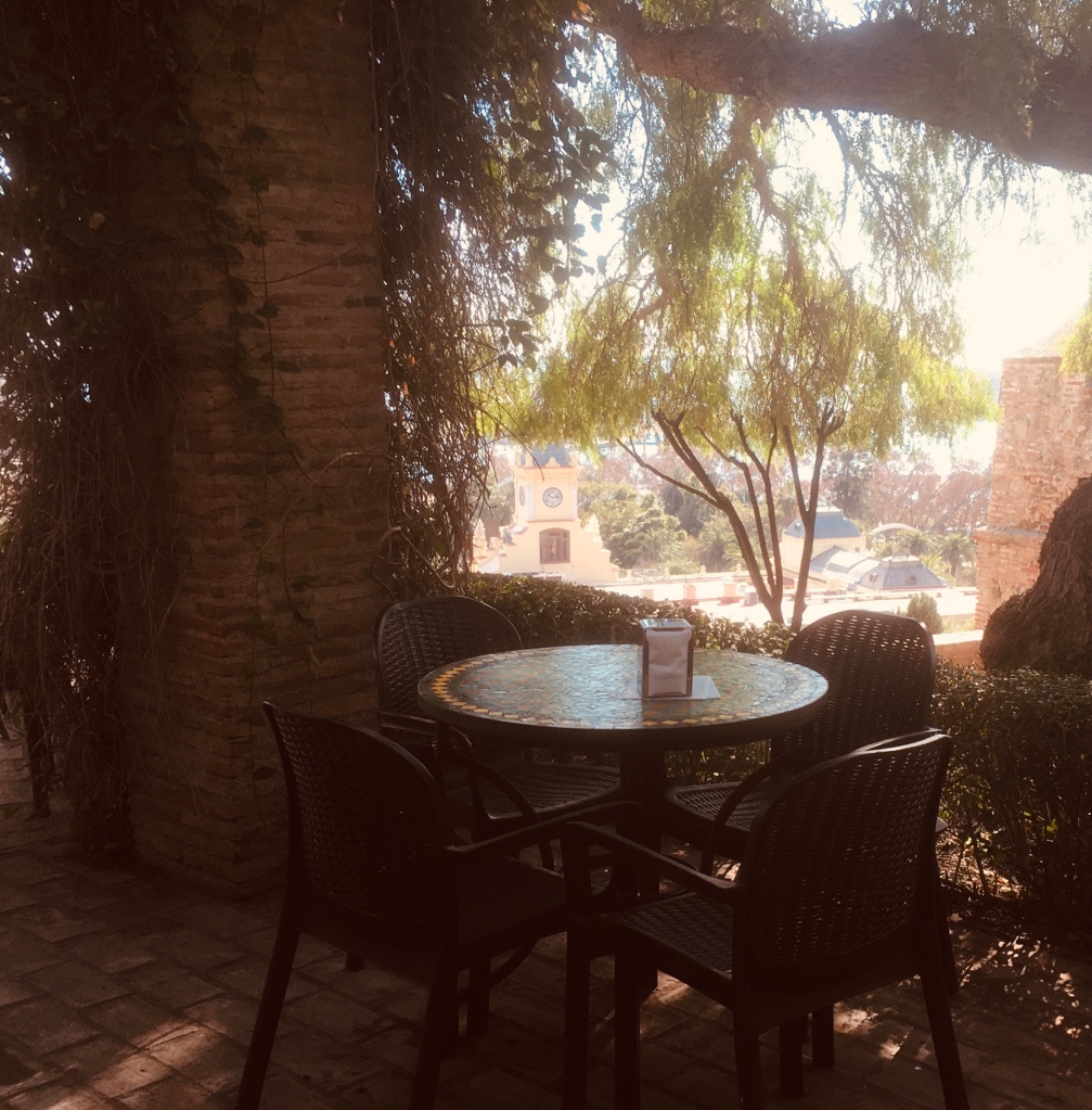
The Bar has good views and and is typically very shady – we enjoyed some excellent Bocadillos along with the cold drinks.
Home made frozen lemonade was Penny’s choice.
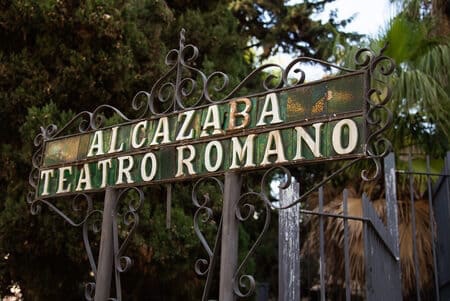
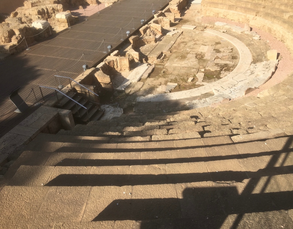
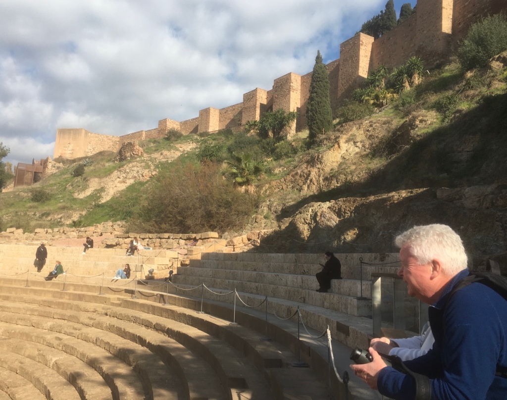
Finally, it was another short walk down to the Roman Theatre.
Then it was a walk back to the apartment and a sunny balcony. This was my last full day in Malaga. We finished the evening in a local Tapas bar, MESÓN EL BUCO. I was spoilt by Penny,Brid and Matt – they helped to make it a memorable stay – it was the first time I had “ wintered “ in Spain, hopefully not the last. MUCHAS GRACIAS