This is a sample from the guide book Recommended by Sloways
We called in at a local supermarket enroute to the start of this stage and stocked up with bananas, cereal bars and water as there was a long stretch before coming to a a cafe . We had enjoyed an excellent breakfast at the hotel which would sustain us for the most part. We walked past the Duomo .
Rob capturing the stained glass.
We then traversed the famous setting of the annual “Palio” a mad horse race around the periphery of the square.
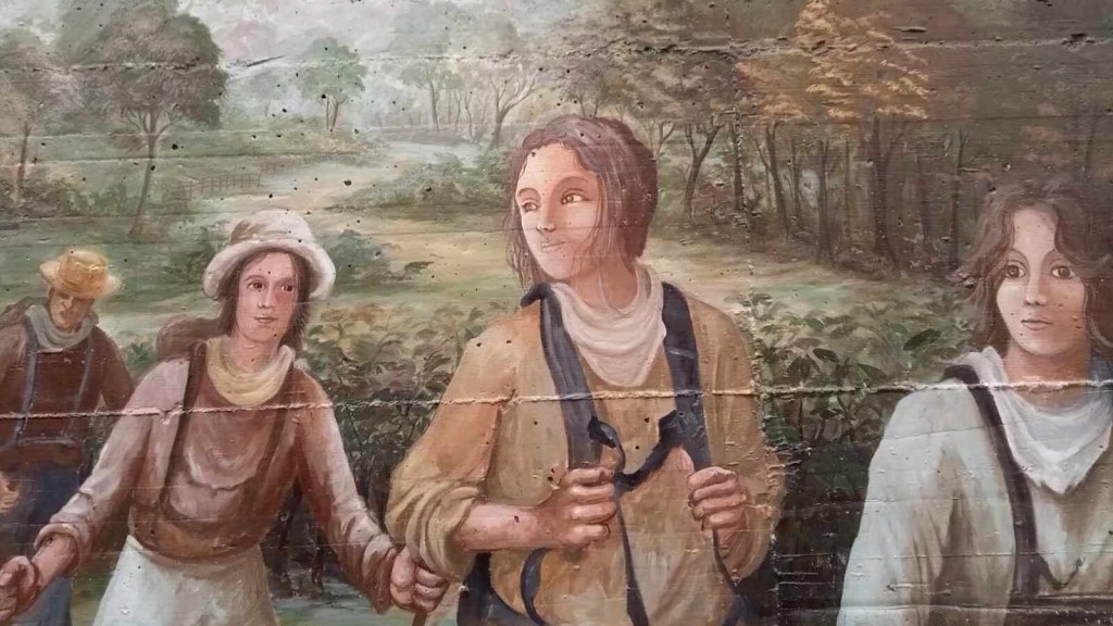
JUNE striding out…
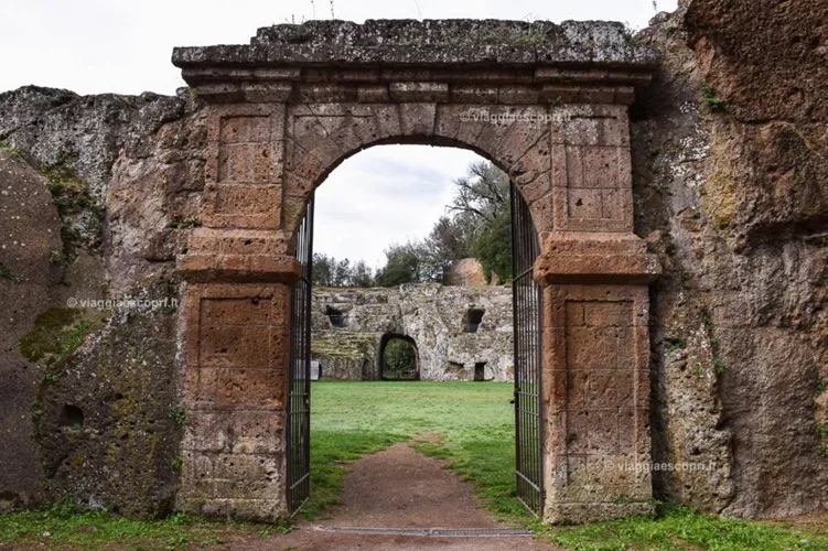
We were making our way to the Porto Romano to exit this wonderful city.
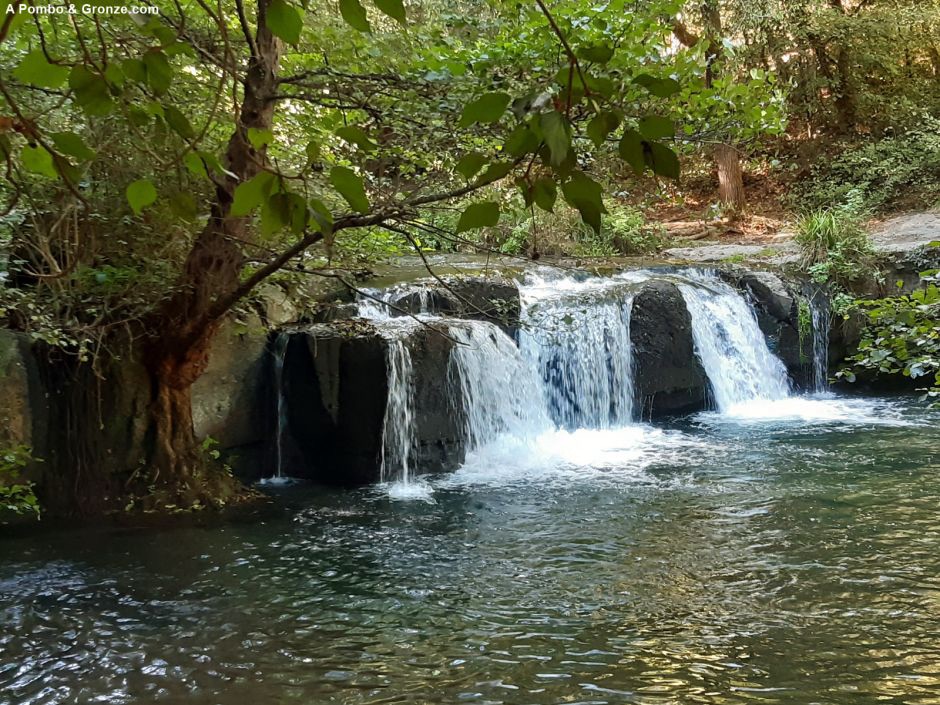
Out into the countryside with its non stop vistas It was heating up – 28* and counting, with only spasmodic stretches of shade.A well sign posted stage so far.We paused by this stream for a drinks break and Christina captured some birdsong on her APP. a Blackcap and a Nightingale.
The soil,takes on a distinctive grey colour for a wide expanse in this area.
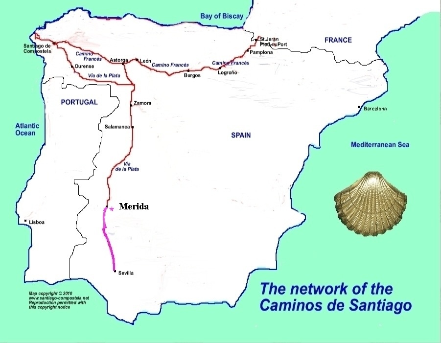
The Crete Senesi (Sienese Hills) is a region located south of Siena in Tuscany, Italy. It’s characterized by rolling clay hills, woods, and semi-desert landscapes, creating a unique and unspoiled beauty. The area includes the towns of Asciano, Buonconvento, Monteroni d’Arbia, Rapolano Terme, and San Giovanni d’Asso.
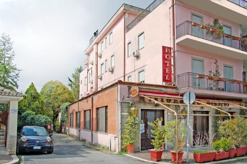
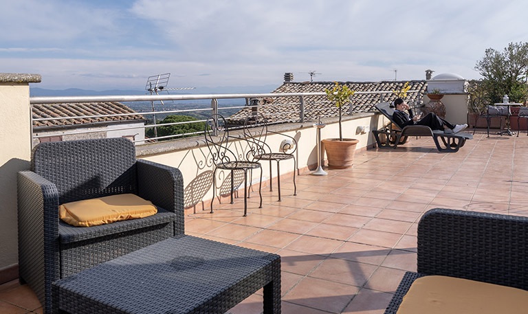
we reached the outskirts of Monteroni eventually with temperatures in the 30s.A diversion from the main Francigena.An interesting connection.An allotment alongside one of the impressive villas along the the way. Eventually, after a climb uphill we came to our hotel.BORGO ANTICOThe terrace for “ Sharpeners” and tales of heated woe!The dining room, where, after a rest and recovery we enjoyed a typical Tuscan dinner including wild boar.
Thanks to group,members for some of the fine photos
Tomorrow’s walk is to Buonconvento and Tom has promised a shortcut!
Four stages to the journey today with most of us up at 05..00. Taxis to Digbeth coach station for the 07.05 to Luton airport . It was 20 minutes late but made up most of the time via a convoluted route,taking in stops at Bham airport,Coventry – slow there – Northampton, Milton Keynes, Luton town and eventually …. The airport ! I may have missed one stop out,I think.
En route
Getting through baggage check in and security was very efficient- 30:minutes, although I got frisked about six times at security 🤨. Then flight departure from Gate 43…after 20 minutes everyone had to disembark from the bus to be told the plane was in operative,please go to gate 11, the other side of the airport. Arriving there, checked in for the 2nd time…sorry you’ll have come back from the entrance to the planes because this plane developed a puncture on landing. After an hour, we checked in for the 3rd time and eventually got on board, people remained in good humour, however,and the flight was enjoyable , the captain making up 25 minutes.
June and Rob celebrating take off!The Swiss Alps
Pisa airport was a doddle and our minibus awaited our departure- I had whatsapped them about the delay. A 90 minutes ride through the Italian countryside to Siena and our hotel which was very welcoming .
We enjoyed a cold drink on their patio with Swallows dive bombing everywhere and everyone loved the setting in the evening sunshine. We adjourned to a nearby restaurant for dinner which was great value ,with humorous friendly sevice.
“The last leg starts with a long segment along the sidewalk of the Via Cassia, very traffic congested. Once passed the Grande Raccordo Anulare (Great Ring Junction) the Path enters the green Insugherata Park, a wild oasis in the outskirts of Rome. Then it enters once again in the traffic of Via Trionfale, for then entering Monte Mario park. The view from the overlook of “Mont Gaudii”, the happiness’ Mount, will let you forget the pollution and the traffic, before of the descent to St. Peter’ square, your destination. Frequent eat and drink points and fountains along the itinerary.” GRONZE
Leaving Giustiniana, we cross above the A90 Autostrata tunnel,turn right and pass through the gates of the InsugherataNature Reserve – an hour’s welcome respite.
Insugherata Nature Reserve History, nature, and spirituality merge in one of the largest green areas within the city: 740 hectares of a territory of an immense naturalistic and historical-archaeological value. The Insugherata Nature Reserve hosts, in fact, numerous remains of sepulchers and Roman villas. The most famous is undoubtedly the so-called Nero’s Tomb, along the Cassia. Datable to the II-III century AD, it is actually the tomb of Publio Vibio Mariano, Prefect of the Third Gallic Legion. In the area of the Acqua Traversa, where Villa Manzoni is now located, the villa of the emperor Lucio Vero once stood (161-169 AD). The excavations carried out in 1999 for the construction of the new Octavia flyover have revealed the presence of tombs relating to an Etruscan settlement of the 6th century BC. Along Via Trionfale, bordering the reserve, the Traiano-Paolo aqueduct, built by the Roman emperor (98-117 AD) and restored in 1612 by Pope Paul V, passes through an underground path. It leads to the Trastevere district, the water of Lake Bracciano, and reaches the Gianicolo Fountain. The area of the park, in part corresponding to the ancient estate already registered in the Alessandrino Land Registry (1660) with the name of Inzuccherata, also preserves the ancient Casale of the Insugherata, together with some publicly owned farms. From here, too, passes the Northern trail of the Via Francigena, the ancient itinerary of faith, which for centuries has accompanied pilgrims and visitors from Central Europe to St. Peter’s Basilica.
Then through the Roman residential neighbourhood of Sant’Onofrio, two blocks on we reach the Via Trionfale,one of Rome’s historic main arterial roads – cafes, etc,.
We then follow the Via Igea, turning right on to Via della Camilluccia along which we meet the entrance to Monte Mario Park The Monte Mario Nature Reserve extends in the north-western part of Rome and takes its name from the highest cliff (139 metres) of the Farnesina hills, which dominate the Tiber valley. Geologically speaking, the area consists of sand and gravel, from which numerous fossil remains originate. Inhabited since prehistoric times, in the Roman age, Monte Mario housed numerous residential villas. Used in the Middle Ages to plant vineyards and vegetable gardens, from the Renaissance on, the noble families chose the hill as place of residence due to its dominant position over the city. One of the most distinguished examples of Renaissance villas is Villa Madama. In the park area are other historic mansions. Among them are Villa Mazzanti and Villa Mellini, home to the famous Astronomical Observatory. Villa Mellini
Following footpaths we should get our first sight of Rome.
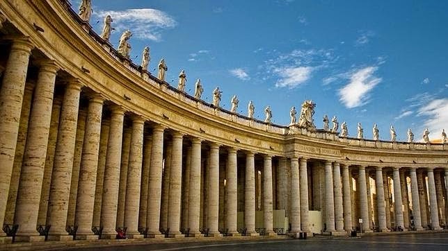
St Peter’s Basilica We descend along switchback paths to the lower gate of the park. Carrying on for two blocks to the wide and green Viale Angelico which we follow for 2 KM.Passing the Vatican City walls to enter the Colonnade of St Peter’s Square.The Colonnade of St Peter’s Square – Gian Lorenzo Bernini designed the colonnade that frames St. Peter’s Square in Rome. The square’s elliptical shape and the colonnade are a defining feature of the square, symbolizing the Church’s embrace of the world. The colonnade, built between 1656 and 1667, is composed of 284 columns and 88 pilasters, arranged in four rows. 140 statues of popes,martyrs,evangelists and saints carved by Bernini and his students.
St Peter’s Basilica, still after 500 years, the largest church building in the world at an astounding 15,000M2
Sylvia Nilsen writes: “During the Holy Year of 2025, pilgrims who go on pilgrimage to the four Holy Doors of Rome (Basilica of St. Peter in the Vatican, Basilica of St. John Lateran, Basilica of Santa Maria Maggiore, Basilica of St. Paul Outside the Walls) will receive, on request, an official ‘testimonium’ – a certificate proving they have undertaken a pilgrimage to the Tombs of the Apostles Peter and Paul.
The testimonium can be collected at the official Jubilee InfoPoint, located in via della Conciliazione 7, in Rome. Info Point. This certificate is a testimony of the pilgrim’s spiritual participation in the Jubilee, a year of grace for all men and women in the world. The testimonium will be personalized by the volunteers at the InfoPoint with the name and surname of the pilgrim, and the date of the pilgrimage.
In addition, those who arrive in Rome on pilgrimage by foot or by bike, having travelled one of the many paths towards the eternal city, will be able to receive a special, even more personalized Testimonium.
The official Testimonium of the Jubilee will carry a special watermark, with unique properties, guaranteeing its authenticity and certifying it as an official document of the Jubilee. Thus, each certificate will become a unique and significant memorial of the spiritual journey undertaken.
Pilgrims are asked to apply only for the official Testimonium which can be collected only at the InfoPoint in via della Conciliazione 7. Info Point
For large groups it is advisable to book the Testimonium in advance by contacting the InfoPoint.”
At some point we shall need to get to our hotel accommodation for the next two nights – Hotel Domus Sessoriana,Piazza Santa Croce. The hotel is 6.5 KM from the Vatican City. There are buses and obviously taxis. I am hoping Sloways will provide some definitive advice. 5 ways to travel from Vatican City to Domus Sessoriana, Rome,according to the “Rome to Rio” website- Bus 13 mins, Taxi 3 mins,Subway 13 mins, Walk 28 mins.
“Good location, lots of options for public transport, very kind receptionstaff.”
“There were great places to eat nearby and a 24 hour bar across the street.” Two recent reviews The following day is a “ free one”
“Leaving Campagnano you can adimire the enchanting views of Latium countryside, before coming at Veio Park, where you flank the Church of Madonna del Sorbo. Cross the inhabited area of Formello, where there is a wonderful hostel in the historical Palazzo Chigi, in order to undertake a long track later till Isola Farnese and La Storta. Bar and water in Formello and Isola Farnese.” Both the Francigena and the Caminos to Santiago de Compostela have strong links with the EU.With the weather likely to be warm ,we need to take plenty of fluid with us, although there will be at least two villages with facilities. We leave Campagnano via the Porta Romana gates ,heading slightly uphill ,following signs to the Santuario de Sorbo, then entering Parco VeioSanctuary of the Madonna del Sorbo and an enthralling porcine narrative : – “There is a legend that tells the tale of the founding of the Sanctuary of the Madonna del Sorbo. It runs thus: There was a young man of Formello who kept his pigs on the grazing land in the Valley of the Sorbo. One day he noticed a sow run off alone and return and hour later. Having watched the animal repeat this for several days in succession his curiosity was aroused and he decided to follow it. The sow climbed the hill to the Sorbo tree where it sat on it’s haunches raising it’s forelegs as if in prayer, and gazed fixedly at the icon of the Virgin and Child nailed to the tree. The Madonna spoke to the swine herd telling him to run to Formello and tell of the apparition saying that, should they not believe him, she would perform a miracle. So it was that when no one believed him, the swine herd thrust his mutilated arm into his pocket and drew it out complete with hand. Thus convinced the people of Formello carried out the Virgin’s wish and built a sanctuary at the site of the apparition. They kept the Sorbo tree with the icon of the Madonna that had spoken to the swine herd, as it stood, building the church round it. The new church became a place of pilgrimage.”The Assumption of Mary into Heaven and a chance to get a stamp in the pilgrim passport.Park of Veio – With nearly 15,000 hectares, the Veio Regional Natural Park extends north of Rome between the Via Flaminia and Via Cassia and includes the so-called Agro Veientano. It is the fourth largest park in Lazio and covers an area of natural, historical and cultural interest. It includes the municipalities of Campagnano di Roma, Castelnuovo di Porto, Formello, Magliano Romano, Mazzano Romano, Morlupo, Riano, Sacrofano and the 15th Municipality of the Province of Rome. The network of trails is signposted by the CAI and covers 99 kilometres, including the Via Francigena.A wide gravel road takes us through pasture land towards Formello.Erected by the VF Confraternity of Formello.FORMELLO A medieval town a few kilometres from Rome, in the heart of the Veientano countryside: Formello, crossed by the Via Francigena, is rich in history and immersed in a splendid natural landscape.
Starting from the Piazza named after Donato Palmieri, local painter and pupil of Vasari, who painted the frescoes in the church of San Lorenzo, we pass through the ‘Porta da Capo’ dating back to the Chigi era. From here begins Via XX Settembre, the main road through the town and along which the main buildings are located. On the 15th-century Piazza San Lorenzo are Palazzo Chigi, the Church of San Lorenzo and its Oratory of the Nativity, and the Council Building; continuing on we come to the Church of San Michele Arcangelo and then to the other monumental entrance to the town, the ‘Porta da Piedi’.
After refreshments we depart along the central street as it descends among old stone and stucco homes,reaching the valley floor where we reenter the Parco Veio. The road becomes a path through Alfalfa and Bamboo trees, then heading up past a sports complex. After crossing a bridge look carefully for a poorly marked left turn onto a gravel road. Shortly we come to a Veio shortcut option ( 1.8 KM ) offering a shorter route to Isola Farnese, bringing us alongside Etruscan archaeological sites and an ancient mill.
The centre of modern Isola Farnese is a non descript ,disappointing commercial cluster where the Via Cassia meets the Via dell’Isola Farnese. Medieval Isola, easily missed by walkers, is a cluster of buildings around the castle ( now a wedding venue ).
La Storta Sacro Cuore church
Although La Storta is the official ending of this stage our accommodation is RESORT LA ROCCHETTA in La Guistiniana.
This is situated a little further on from La Storta – bus Urbana #201 “Mancini” from La Storta is a possible, alternative option. “A 3-star hotel in Rome in the La Giustiniana area, the Resort La Rocchetta is immersed in the greenery of a residential neighborhood, within the Veio Regional Natural Park – crossed by the last stretch of the VIA FRANCIGENA -, a few meters from Via Cassia , close to the main communication routes and the gates of Rome. Converted from an old farmhouse and immersed in the greenery of a lush garden, the Resort La Rocchetta is an oasis of peace with large outdoor spaces, convenient parking and a generous buffet breakfast service. “ We stayed one night during our Francigena pilgrimage
“We stayed one night during our Francigena pilgrimage.Beautiful building. Clean rooms. Friendly and helpful staff.” RECENT REVIEW April,2025 Restaurant Antica Osteria Da Pietro has good reviews – 11 minute walk.
Sutri Necropolis Mostly fields and forests walking with refreshing stops at Monte Gelato and Monterossi. Bearing in mind that it is Sunday,best to take plenty of water/snacks just in case bars are closed.Apparently Campagnano is a small town typical of Lazio,full of life in the evenings,particularly in the more modern piazza just outside the Porta Romano gates.Sutri’s Ampitheatre is the departure point and once again we are presented with the dilemma of a choice of routes. A quieter exit along Via Dei Creti which adds 3.2 KM to what is already a longish day, or to keep to the official route by turning right just after the Ampitheatre towards the SP40.
Shady forest trails.
We pass the National School of Golf,quite a contrast to the surrounding countryside and make our way towards Monterosi,slightly uphill.
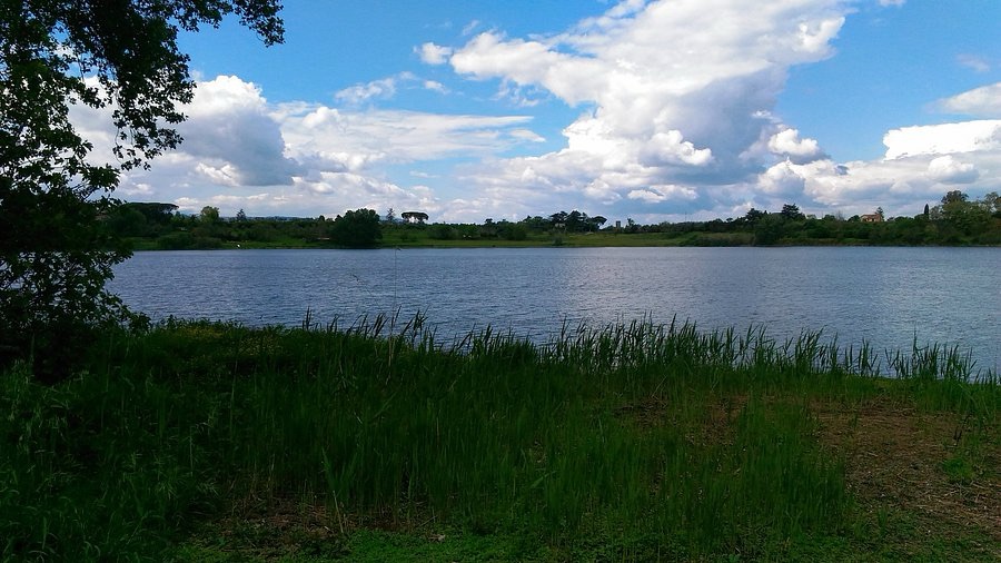
The town has a long and colourful history including invasions, papal interventions and assassinations. There is a small 30-hectare volcanic lake within the city limits.
Lago Monterosi.
The unusual Renaissance-era Chapel of San GuiseppeHopefully it will be open .
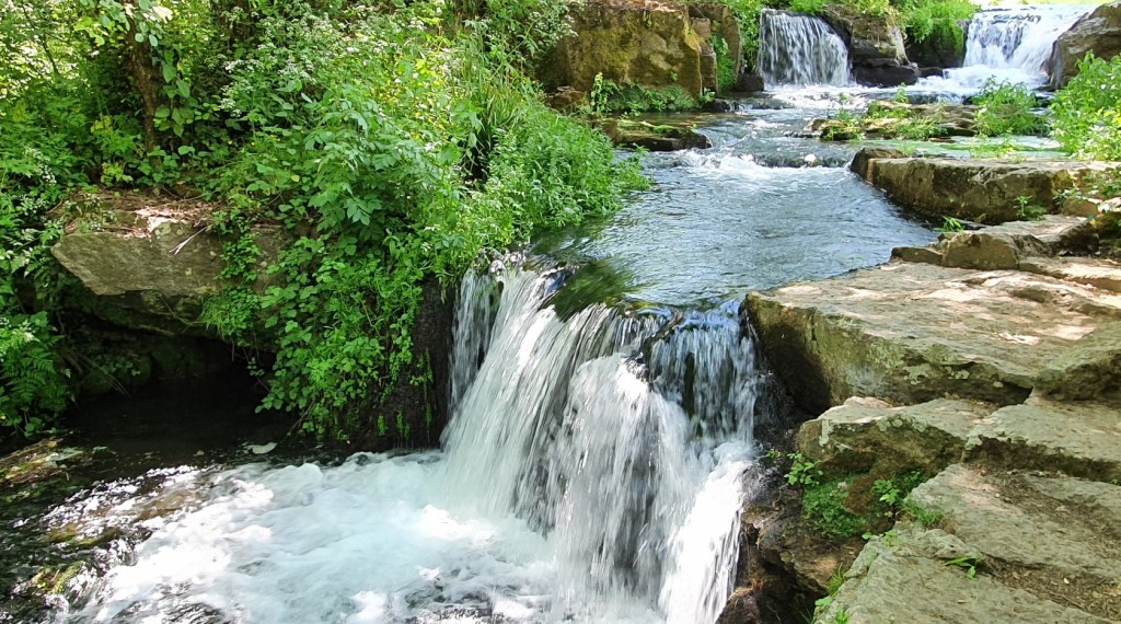
A straightforward route to the next stop of significance, Mont Gelato with its renowned waterfalls.
Monte Gelato Falls are a series of small waterfalls which form part of the Treja River and can be found in the Treji Valley Park. This is a popular picnic area at weekends,especially trippers from Rome.
We fork left after the park and walk upwards along an asphalt road, through hazelnut orchards. We come close by the Vallelunga motor racing track ( No Italian drivers’ jokes please…oh go on then ). We descend to cross the bed of a season stream,running alongside the Parco Regionale Di Veio.
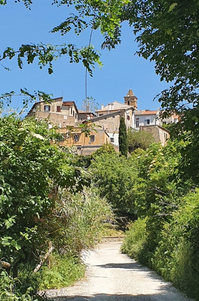
Today’s saunter, not unusually, ends with an uphill climb on switchbacks before sighting Campagnano.
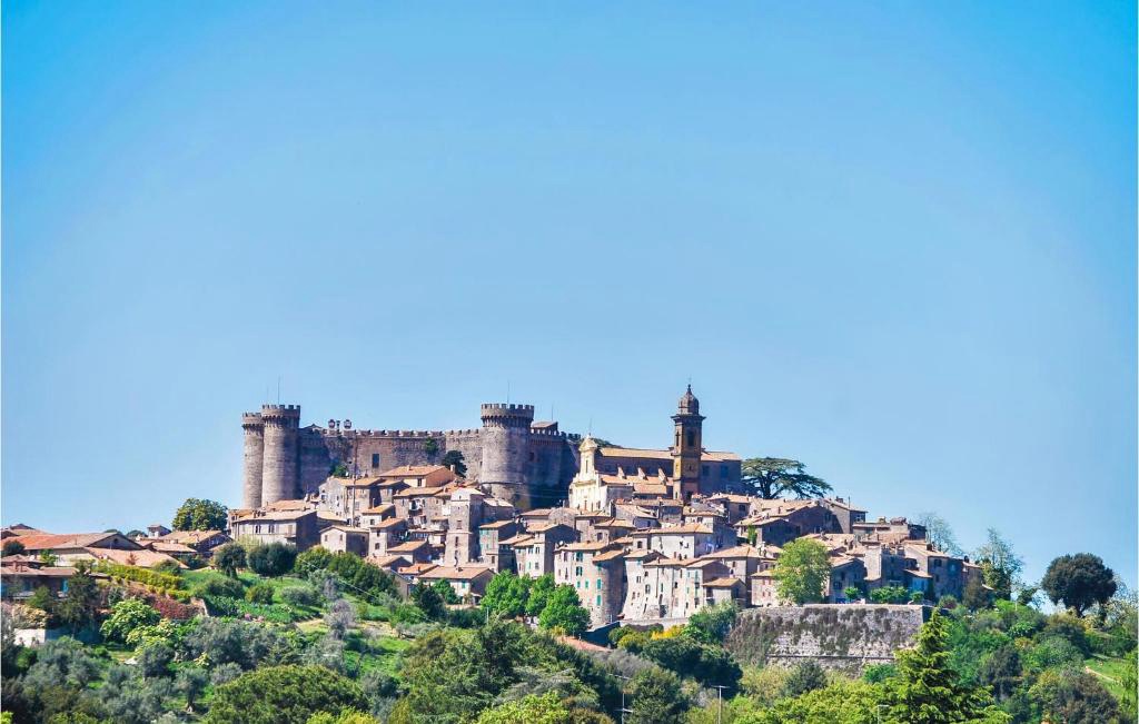
A pretty town in the gentle Lazio hills north of Rome, Campagnano di Roma retains the atmosphere of the Middle Ages. Its “medieval borgo” has towers and sinewy streets to enjoy, and the ancient Porta Roma, gateway into the city, still stands proudly next to the City Hall, and opens onto Corso Emanuele, the main street. It is lined with pastel palazzi, shops, eateries and coffee bars, before spilling out into Piazza Leonelli, with its fancy fountain by Vignoli in the middle guarded by an old clock tower. The Piazza della Fontana Secca, or dry fountain, features antique basins where spring water collected, both washing clothes. The church of San Giovanni Battisti was built in 1515 and features some fine frescoes. The archeological museum shows off artifacts found in the area, which was an Etruscan zone before being taken over by the Romans. The red town hall. In the evenings,people make for the Parco Pubblico, the centre of activity.ALBERGO BENIGNI Via della Vittoria 13, Campagnano di Roma
“An ancient restaurant, born in the early 1900s as a tavern-inn, expanded and renovated over time. Our cuisine is typically Roman, over time it develops and becomes more creative, reinterpreting traditional Roman-regional dishes.” HOTEL WEBSITE
RECENT REVIEW – A stop on the via francigena to room hotel in square in the newer side of town. WiFi excellent good shower comfortable bed etc. I had dinner in hotel very good meat cooked over charcoal Breakfast included all you need ham cheese etc
FLeaving Vetralla, we travel a beautiful stretch in a thick forest, before arriving at the little church of the Madonna di Loreto. From here we cross an immense hazelnut grove and skirt some monumental oaks, before arriving at the Torri d’Orlando, ruins of an ancient monastery. We continue towards the delightful village of Capranica, and then towards Sutri, a little-known pearl along the Francigena, with its Amphitheatre dug into the tuff, the Mithraeum and the beautiful historic centre. Water and refreshment points only in Capranica.
It’s a long stretch to Capranica so we shall need plenty of water and snacks. Capranica is described as a “ delightful “ place .
The first stage of today’s walk will take us through leafy green forests
After the Bosco Monteofogliano Park, via the village of Giardino, there is a lovel trail for the next 4 KM, under trees, interrupted only by only a meadow and a brief walk across a roundabout . We need to look for a right fork that goes downhill that emerges into an orchard. We then cross the Via Cassia and after a further 1.5 KM arrive at the Orlando TowersLegend says that these three towers were built by Orlando ( Italian for Roland ),a favourite general of Charlemagne and subject of the epic 11th C. poem” The Song of Roland”. In fact,historians suggest two of the towers are funeral monuments from the Roman period and the other the remains of a bell tower from the 10th c. Roland’s words before death: “Here must we stand to serve on the King’s side. Men for their lords great hardship must abide, Fierce heat and cold endure in every clime, Lost for his sake, if need be, skin and hide.”.
After a further walk through hazelnut orchards, we cross-cross railway tracks, traverse a modest creek by a bridge until we come to Capranica.
City gatesClock tower – Capranica is situated on the top of a ridge and consists of a long cobbled road with little side streets and the Church of San Pietro in the middle.
After a lunch stop and refreshed we continue towards Sutri, ( if not, then a bus or taxi ride to Sutri )
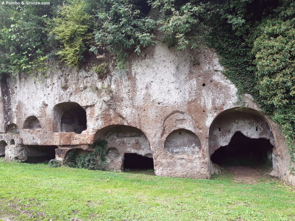
Fosso Mazzano stream alongside a shady path for 2 KMFoot Bath anyone?There is soon a choice to visit the Etruscan Archeological Park , one of the finest Etruscan sites in Italy, or head up the hill to Sutri.SUTRI – as charming a place as any on the Francigena but with a history far older than most . The medieval town is clustered atop the ridge of tufa stone.
B&B Notti d’Oriente – Our accommodation for this evening on the via garibaldi 51, 01015 Sutri, in the centre of the old town.
“I stayed here for one night whilst walking the Via Francigena, but I would happily have stayed longer. My room was well-equipped with kettle, dining table and a good bathroom, and there was access to a shared kitchen. The lovely lady who greeted me was very kind and helpful, and Sutri is a pretty little town. Recommended.”
Bar Salza, nearby is recommended for APERITIVOS in the Piazza Camilo, nearby. Also, Jin To EnoGintoneri, a minute away.
M12.05.2025 Via Francigena Viterbo – Vetralla We were up early, because yesterday we went to bed early. It’s our first day, so we have to prepare well. A sunny day is forecast, so plenty of sunscreen. To avoid blisters, tape your feet. A common mistake is that one tries to take care of blisters once they’re here. Gotta make sure they don’t show up. That’s why all the tape. Then we went to see the sisters for breakfast, but we were there all alone, and decided not to do it anyway. Called the nurses to ask if they could leave our backpack there. We decided, considering my knee issue, to walk light this year. So we let 1 backpack be transported from lodges to lodges, and there we of course put the heaviest pieces in, and what we do not need on the way. I carry a small backpack with the camel bag in it, and Liliane carries a smaller backpack with what she thinks she needs on the way. The nurse informs the person in charge of the rooms to be sure if our story is correct, was ok, and we were allowed to leave our backpack there, and we could go. We walk through the Pizza della Morte, where we had a good dinner yesterday, passing the Vicolo dei Pellegrini, and so on past the Palazzo Farnese, to the Piazza San Lorenzo, with the Cattedrale di San Lorenzo, and further the Palazzo de Papi. Here the VF is not properly specified, but I still knew it from last year. You have to go down a narrow metal staircase through a small gate. For those who come to me, this is the way to follow. Then continue to the Porta di Valle, which is still closed, so you have to go right to the Porta Faul with the Torre della bella Galiana, to then get to the Strada Signorino via the Camno Rosso. Mc Donald’s where we have breakfast. It all sounds a bit complicated, but it’s not, everything proves itself. And so after a nice breakfast with croissant and cappuccino we go back on the road, via the Strada Signorino. In Viterbo you can continue walking on the Via Francigena in several ways. You can take the long, “scenic” route via the Porta Romana, or the short one via the Strada Signorino, or in between via the Strada Freddano. We choose the short one via the Strada Signorino, which is also beautiful, because this road was carved completely out of the rocks, still by the Etrusks. Very impressive and beautiful. A disadvantage is that the road is also used by cars, but they drive slowly and are all friendly and give us space, and wave good day. At the end of the Strada Signorino, we come to a field road, and walk under the provincial road. Last year I went directly to the left, but now we take a little more time, and go to the right to the Chiesa di Santa Maria di Castel d’Asso (on the Strada Ponte del Diavolo -;)! ). I highly recommend it to everyone. It is a beautiful old church. There is also the official road sign of 100 km to Rome. On the way we came across another crab crossing the road. And when we got to the church, there was a volunteer cleaning up, because there had been a party yesterday. He offered us a drink, which we accepted with thanks, and we received a nice stamp on our credential. Then back on our steps to continue following the Via Fancigena. Further, a new resting place has been decorated, very beautiful. We follow the field path parallel to a busy road leading to Vetralla and Rome. Last year there were huge fields here with only coal, but of all kinds (red, white, savoy, spike, etc). Now there’s nothing on the field, and trucks will be hit by with stable manure, probably to work it into the field. There’s a huge pile already. Along the path there are a huge variety of flowers and plants. Time to open my Obsidentify app and see what plants are all on here. We walk further on the path, under the highway, and then a long steep climb begins, in the full sun, almost without shelter, we walk among the hazelers. It’s falling heavy. We meet another pilgrim, Will from Sidney, Australia, who also walks to Vetralla. And a little later 2 pilgrims from Canada, also on the way to Vetralla. We stop on the way under a hazel tree, to rest a bit and eat and drink. And when we leave back, we come across a resting place 100 meters further with a table and benches (I had totally forgotten that it was here). There was a couple, volunteers, riding their bikes down the path to make sure everything was clean and in order. Respect, and a big THANK YOU, to these people. Every now and then they also walk a route, to arrive in Rome at the end of next month. Very friendly people. The bank is at about the highest point of this stage, in any case there is a beautiful view of the valley. Walking is a bit smoother from here. We arrive at another resting place, where there is drinkable water. We’re going to rest a bit and eat and drink something. The 2 Canadians also join to rest and drink, and to chat. How further do we get to a b&b where there is a bench where the pilgrims can rest, and where there is also a stamp for the credential. Last year I also stopped here for a while with Fred, only because it rained. There’s a beautiful birdhouse hanging in a tree now. How much further can we choose for a shortcut, if we follow the Via Roma, or make a detour if we follow the via Francigena. It’s not too late, and we’re going for “the full tour”. We are not complaining, we pass by a place where you can refresh your feet (we don’t, we don’t have a towel), and a little further to a very old church, Chiesa di Santa Maria in Foro Cassio. A very old, but beautiful church. There is an info point that is staffed (by a young lady) by volunteers. You can write your name or a wish on a stone and put it there, and the lady will also make for us a stone with the symbol of the Via Francigena. Respect back, and thank you for these volunteers. Now it’s not far to Vetralla. Upon entering, we meet Will van Sidney sleeping in a hotel just outside Vetralla. We will continue after a short chat, and upon entering Vetralla you will pass by an “open air museum”, where there are all things depicting different old professions, furthermore there is a beautiful mural, and there is a building decorated in a nice way. Crossing the busy road, we’ll stop at the tourist service for another stamp, and then we’ll get to our accommodation. I’m calling the host that we have arrived, and sitting on the terrace of the bar next to the accommodation. A little later he arrives, and shows the accommodation. To the pilgrims who come after us and are looking for good lodging in Vetralla. Address Il Refugio del Pellegrino or Refugio del Cavaliere. Highly recommended. Located on the Via Francigena, next to a bar, where you can drink during the day, which serves breakfast in the morning, and across the street is the restaurant La Lanterna, which I can also recommend. Ate there last year, and this time again, very tasty. And then it’s time to go to sleep again, because we are a bit tired after all from walking in the sun, with a serious height difference, and still almost 18 km. See you tomorrow
Day XI is a”rest’ day in Viterbo – the above article gives a loving impression of the city by an American who stayed for the best part of a year, recently.
Bonmarzo Garden
In 2022 the official route was moved east in order to incorporate footpaths in the vast woods of Monte Fogliano,while the former route on Strada Signorino was preserved as an official variant.
The western route is recommended as both shorter and more interesting since it traverses the mysterious Etruscan “ vie cave” roads. However, The Gronze guide states “Note 2025: The short 16 km route is closed. Take the official route via San Martino al Cimino.” Confusing isn’t it?
Below is an extract from a Blog written as recently as October,2023 – by an an American pilgrim.
“There are two (ehhh…2.5) routes out of Viterbo. The one recommended in the guidebook involves walking to this McDonalds and continuing on, left at the fork, for a few miles — or taking a short detour by heading right at the fork (thus the 0.5). This route is about 9 miles long and relatively flat. The other route is more like 16 miles long and hilly, and though the guidebook doesn’t mention it, the VF app treats this as the “official” route. Anyway, I was going with the guidebook route, so forked left at the Golden Arches.
The real reason for taking this route is not because it is short or flat (though that helps…) No, it’s to walk in the fascinating Via Cava that the path traces for the first hour of the day. Here, 2500 years ago the Estruscans carved these roads deep into the soft tufa stone, connecting their cities to burial areas. On a side note, I am very fascinated by the Estruscans, who were a very sophisticated pre-Roman society. This was such a cool way to start the day, with the narrow road curving between soft stone walls that got progressively higher and narrower, with a few protruding ominously at the top.”
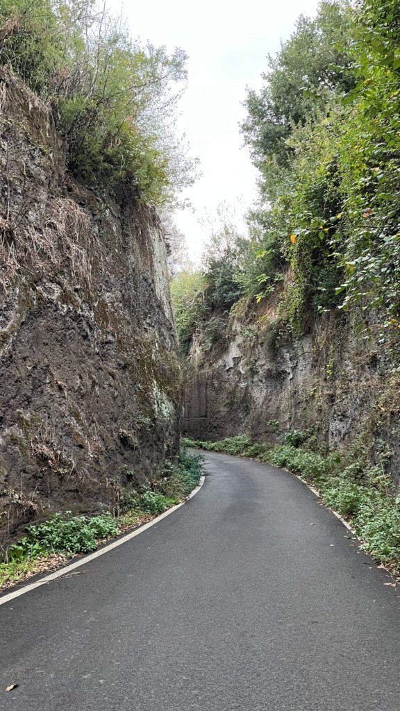
Leaving Viterbo – Palazzo del Papi“ The mysterious Etruscan Vie Cave
Apparently, the origin of these excavated roads has a variety of explanations. They are narrow roadways cut into soft,tufa stone over 2 500 years ago. They usually led from Etruscan settlements to nearby necropoli – depth can vary between 12 – 24 metres.
The municipality of Vetralla (province of Viterbo, Lazio) is located along the Via Francigena at 300 metres above sea level. Known for its characteristic medieval village and the woods of the Cimini mountains – the green lung of Tuscia – it is a land of important Etruscan, Roman, and Barbarian settlements and has a rich artistic and archaeological heritage. In this borgo, along Via Francigena stage 42 Vetralla-Sutri, the mural ‘Il Cammino’ (The Way) created by painter Alessandro Ridolfi has just been completed. The artwork was realised on the initiative of a committee of local volunteers to enhance the places crossed by the Via Francigena in Vetralla.Though well preserved, today’s sleepy town is divided between a few businesses scattered along the Via Roma in the upper city and others along the busy Via Cassia highway a few metres below.
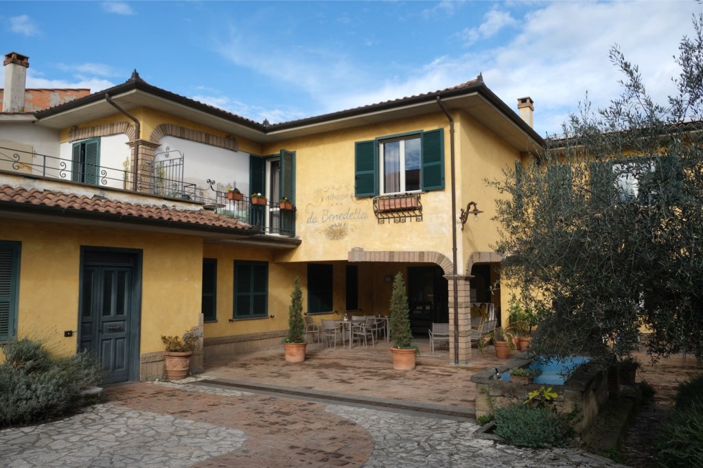
Vetralla’s most important architectural monument The 12th century Church of San FrancescoALBERGO DA BENEDETTA , Via Francesco Petrarca,Vetralla
“Da Benedetta is a hotel in Vetralla, on the ancient Via Francigena, between Viterbo and Rome. It was grandmother Benedetta Rosati who opened, back in 1959, the restaurant from which the hotel developed, at the instigation of the Pasquinelli family (it was the year 2002). In more than sixty years, our family has seen the territory, the pilgrims and its own hotel change, but never the tradition and the identity legacy of grandmother Benedetta. Family-run, recently renovated, pet friendly and with a green soul, the Da Benedetta hotel restores the spirit of this splendid land, Tuscia. A soft land, of passage, in which culture is a legacy of ancestors, of wayfarers.“ FROM THE HOTEL’S WEBSITE
“I stayed at Da Benedetta for one night while walking the Via Francigena. Even though I arrived a little early, the very helpful lady on reception allowed me to check in, and my room was both clean and very comfortable, with a good bathroom. Breakfast next morning set me up for several hours walking. A very pleasant location with welcoming staff. Recommended.” RECENT REVIEW
PS I have not gone into too much detail about the route; I have guidance for both and may be worth waiting for Sloways’ info.
It would be a shame to leave Montefiascone without recounting the amusing story of its most famous (some say undeserved )wine. Legend of Est! Est! Est!: The name originates from a story about a bibulous German prelate who sent his servant ahead to scout for good wines during his travels. The servant would mark promising taverns with “Est” (Latin for “it is”) on the door. If the wine was exceptionally good, he would write “Est! Est! Est!”. The bishop, impressed by the servant’s enthusiastic marking, embraced the wine and gave it the name. However,the priest took such a shine to it that he died from overconsumption; his pickled remains were laid to rest in the church of St Flávio.
Buona Salute!
Cathedral of Santa Margherita, Montefiascone
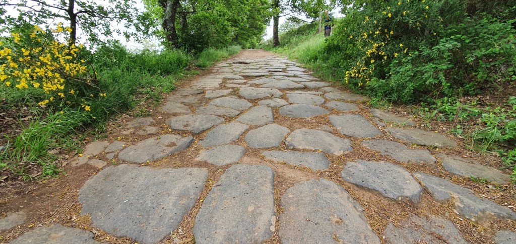
The first section of the route is spectacular, walking along the ancient paving of Via Cassia, still in good condition. Then a stretch across a hill track, overlooking lovely views of Montefiascone and Viterbo.
This way up to the start point of this sectionLooking back to Montefiascone – “ over my shoulder”.
The Roman road – The Via Cassia Antica is still in very good condition despite its 2000 years! Walk through history along these well preserved ancient Roman roads. The paving is still in very good condition thanks to the extraordinary road building skills of the ancient Romans. The ancient flagstones (basoli) are still sitting right where the Romans placed them.Montefiascone in the distance
We fork to the left hereabouts A welcome water fountain . We need to take plenty with us on this section.
We walk upwards for a while before descending through shade passing near a railway .
We fork to the right here and soon should see vistas of Viterbo nestled at the foot of a mountain. We follow signs, sending through flat fields to reach Parco Terme Bagnaccio and its famous hot springs. There should be a kiosk open here for refreshments.Pilgrims have traditionally been welcomed here for centuries
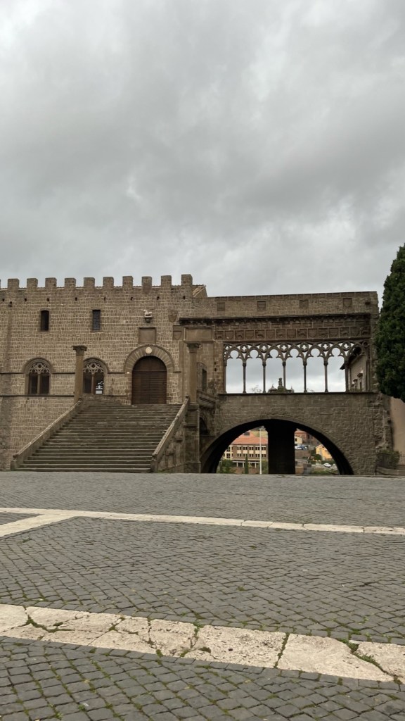
Not far to Viterbo along a gravel road,passing the airport the route becomes a bleak panoply of suburban auto businesses interspersed with tall, concrete retaining walls – the entrails of the city. But not to despair as finally arrive at the Porta Florentina from whence we head straight downhill on cobblestones to the end of Via Matteoti and then the Corso Italia to reach Piazza Plebiscito
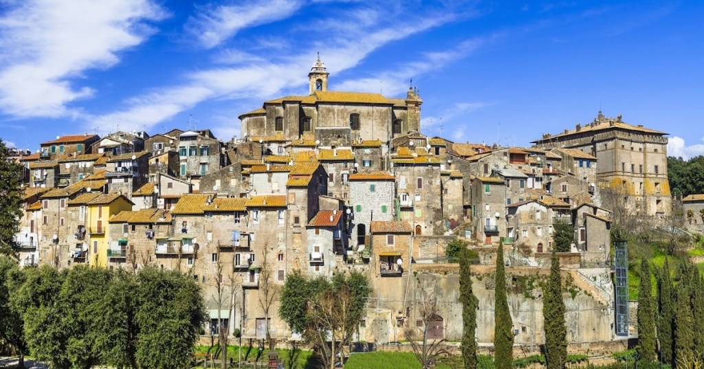
Apparently the “ gritty” entry into Viterbo can give the wrong impression of what is an otherwise charming and historic city,whose existence dates to an era long before Rome. Viterbo is the centre of the Tusca region of Etruscan culture (9th – 4th C b.c ) whose vestiges and influences are still quite visible. The city has an eventful history and a great richness of architecture which we shall have time to explore as we have a full day’s respite here.
Hotel Palazzio Riario, via Della Torre,17 ViterboBreakfast is served.
“Nice hotel. Comfortable, clean, beautiful room in an old house. The owner of the hotel is very nice and friendly, in touch if necessary. Arrived later than the appointed time, checked in very quickly. Location in the very center of the city. Everything is within walking distance. Nearby, a couple of minutes walk, there is even a small supermarket, which is very convenient! Very happy with the choice!” RECENT REVIEW.
Total ascent 638 m.total descent 356 m NB There are no services until MONTEFIASCONE, we shall need to bring snacks and additional water.
Until the last few busy km into Montefiascone the stage is full of serenity and calm. Gravel roads and paths among fields and forests with occasional views of the lake. A couple of limbs of 50-150m.
Rome is 70 miles away. Leaving the Piazza S. Cristina, we pass through the Porta Romana and take the Via IV Novembre. Walk about 200 yards and turn left at the crossroads along the Via Acqua della Croce. It is wiser to buy bottled water than to fill our water bottle at the small fountain or at least it is advisable to inquire about the quality of drinking water in each of the towns through which you pass. Another 100 yards and we turn right into the Via Bartolomeo Bocchini and fork left into the Via Caio Rufo Musonio, named after a philosopher from Bolsena. There is a slightly shorter distance to cover for walkers than cyclists because of the one-way system. There is a uphill stretch at the end of the street. You follow the signpost for the Agriturismo Le Vigne for a short distance. A further hundred yards and the tarmac road gives way to an unpaved track on your right.
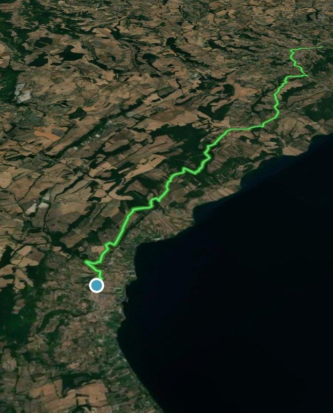
All Trails view.
We shall be walking in the territory of Tuscia, named so because of the Etruscans, who lived in this area (even though Tuscia used to be much wider than this) before the Romans.
There are also many shady stretches.
“Follow the power line and the blackberry bushes for two hundred yards and turn right again close to an electricity box where you can see the red and white “F” and a multitude of other signs.
There is a trough of running water at this point where someone has painted a red “X” as an additional warning not to drink the water. You have to leap or ride across a stream on your right.
Walk uphill for four hundred yards and go down the cement road on your right; a beautiful view of the Lake.
Straight afterwards, at the fork in the road, take the road on your left. A tarmac road leads you to the house with the animals.
Three hundred yards ahead, opposite a private property, continue along a narrow path running alongside it on your left, (take care not to fall into the ditch on your left, half-hidden by the vegetation). Poultry and black pigs.
The house at the end of the narrow path is more elegant.
Walk down as far as the fountain. Four hundred yards and you arrive at a junction where four roads intersect, take the asphalt road in front of you, bearing left.
If you continue straight ahead and downhill, a cross on a post quickly tells you that, on leaving the gravel track, you should have turned left along the tarmac road.
There are enough signs inviting you to bear left.
Follow the power lines for a lot of the way.
Continue walking past a large number of houses, not taking any minor road or track on either side, until you reach a wide green barrier.
There are plenty of signs along the way.
The path after the wide green barrier winds fairly smoothly until you reach a fairly steep uphill stretch.
Leaving the asphalt behind you, you go up to a beautiful low plateau. There are caves (or tombs?) used as garages for farm vehicles.
The walk between Bolseno and the Parco di Turano is indeed very beautiful, only interrupted by small groups of houses. You are on the Monti Volsinii. Excavations are taking place on the nearby Monte Landro where an Etruscan temple has been discovered.
Another cave where building work has been done at different periods to support the entrance arch.
Other caves.
In the past, water trickling through the mountain used to be collected in stone basins or open pools and used for irrigation purposes. A project was funded some years ago in Bolsena and Montefiascone to restore some of them.
Your uphill walk comes to an end and a sign invites you to turn right across the grassland.
That’s right, turn right.
Walk in the hot sun.
It is a beautiful walk between Bolsena and Montefiascone, but it is worth checking the temperature before setting out and being prepared.
The route is well signposted.
At various stages, you catch glimpses of the town of Montefiascone or Bisentina Island.
You cross a dry ford depending on the time of the year.
There is only one isolated house along this stretch of the Via Francigena.
You will soon arrive at another low green barrier.
Cyclists should take care. There is a very inviting downhill ride.
Another mile or so of an enjoyable downhill walk with a splendid view of the Lake, your feet touch the asphalt again and you turn left uphill.
The route is signposted often …
… and in many different ways.
You follow the Via Francigena signpost.
The path leads you between olive groves and vines and rows of vines between olive groves.
The next Via Francigena signpost and the directions for the Bosco di Turona.
The Bosco di Turona is an area of picnics and springs. There is a picnic area with tables before you reach the glade with the chapel and there are tables near the chapel. Turn right at the fork in the road indicated by a Via Francigena signpost.
Signs also indicate the spring, Sorgente di Turona, (1908). Local hunters drink at the spring and so do we.
Just before you reach a small chapel dedicated to the Virgin (and seemingly vandalised), you leave the main track and turn left up an unpaved road.
In September, after the first storms, the torrential rain has cut deep channels in this section of the track and in the approaching downhill path.
Walk another four hundred yards and then take care.
A track goes downhill on your right and is only indicated by arrows and other signs left by pilgrims and walkers.
The channel cut by stormwater makes the descent difficult.
The path goes down to the Fosso d’Arlena (stream).
You ford across the brook and it is sometimes difficult not to get your feet wet. Not everybody is as nimble as we are and it is even more difficult with a bicycle. It is sometimes best to take your shoes and socks off. You enter the wood and turn right uphill. The path is well indicated by white and yellow arrows. For a part of the journey, you can still hear the murmur of the Arlena stream down below.
The path winds steeply up and bears left.
You finally come out into the open countryside with beautiful views of the nearby lake.
The path widens and the slopes are more gentle with the path running alongside vineyards. Milestones reassure you that you are on the right track.
You will notice the first stones of the ancient Cassia.
The route is indicated by familiar Via Francigena signs, increasingly familiar milestones and a myriad of arrows, symbols and stickers.
At a junction where four roads intersect, you can choose to take the unpaved road on your right and ignore the signs for a stretch of asphalt road. The track seems to end near a country house. You may be crossing private property. Continue leftwards alongside a field on your right down an unpaved road. You arrive back on the asphalt and turn right towards the Cassia; you reach the Cassia after 50 yards and turn left towards Montefiascone. If you do decide to follow the “official” route, take the tarmac road on your right and turn left when you reach the Cassia. Another 900 yards or so and you leave the Cassia and turn left.
Keep straight on ignoring the tracks on either side.
This stretch is uphill but not steep and bordered on your left by vineyards and olive groves.
The track starts as a dirt track and then a road which no longer seems to be maintained and another mile or so and you are back on a macadamised road.
You arrive at a busier asphalt road at the entrance to Montefiascone and you turn right. Turn left when you reach the Cassia again. Follow the Via Cardinale Salotti. If you wish to visit the Santuario della Madonna delle Grazie, you can make a detour along the Via S. Maria delle Grazie which joins the main Orvieto-Viterbo road (S.P. UMBRO CASENTINESE). Turn left when you reach the main road and walk a short distance until you reach the Sanctuary. After your visit, follow the main road back into town. Otherwise continue along the Via Cardinale Salotti until you reach the main Orvieto-Viterbo road (S.P. UMBRO CASENTINESE). A little farther along, on your right, you pass in front of the magnificent Church of St Flavian ( S. Flaviano), always open and well worth a visit.
The next stretch of the Via Francigena starts on the Via Cassia again. To enter the town, take a narrow road on your right after the Basilica di San Flaviano. After the Piazzale Roma, take the Corso Cavour as far as the Piazza V. Emanuele. You can visit the Chiesa di Sant’Andrea, the Cattedrale di Santa Margherita and La Rocca dei Papi (Papal Fortress).” The above somewhat lengthy descriptions I found on a Blog called MY FAVOURITE NECROPOLIS
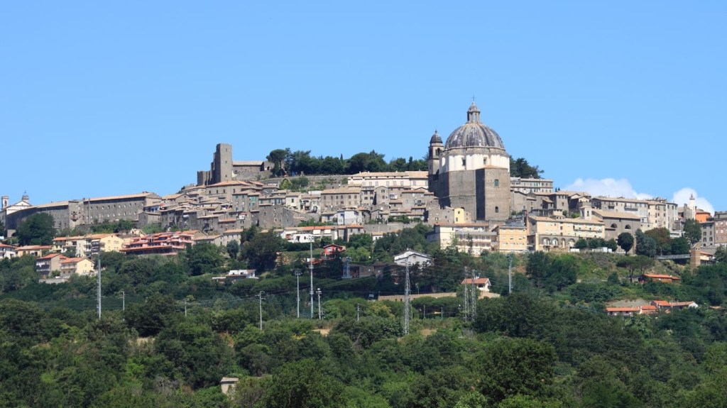
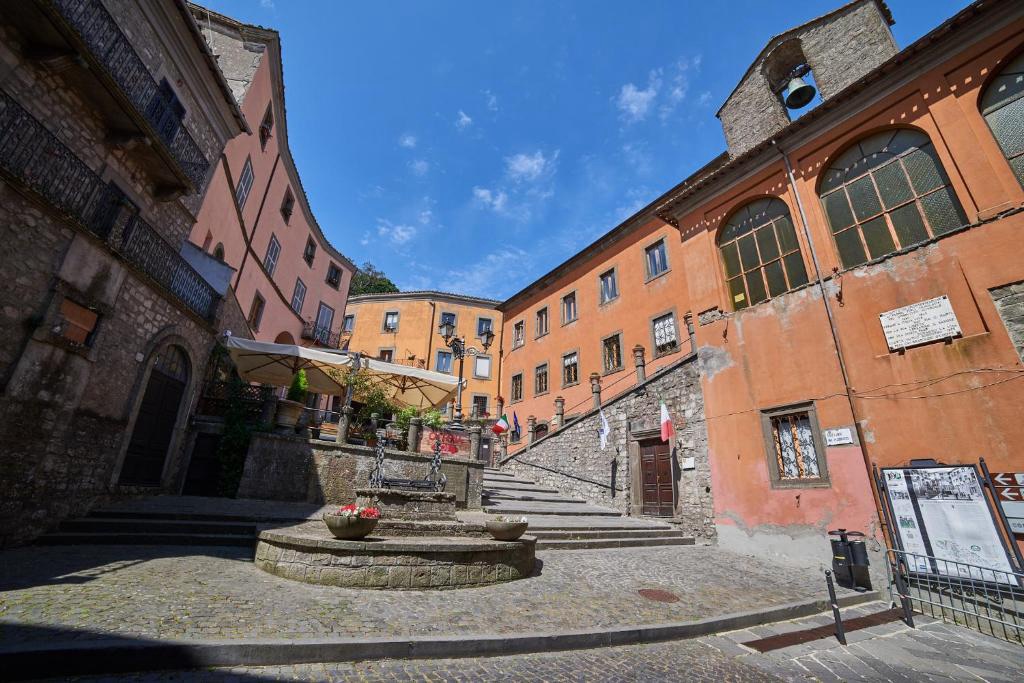
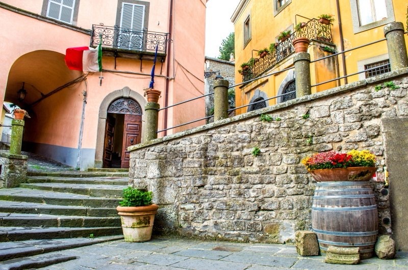
60 miles in old money, to Rome.Montefiascone has a reputation for welcoming Pilgrims.Uphill to the town Centro Storico
Rooftop view. “Stayed one night on the Via Francigena. Room was clean, quiet and staff helpful. Breakfast good and location can’t be beat at the top of the town within easy walking distance of all the sights. Half board arranged at restaurants Dante alegheria. Food was fine and a great people watching experience”. A RECENT REVIEW
Fairly flat terrain- 23% on pavements San Lorenzo is the only stopover on this section.Today, we make our way to Bolsena and its renown volcanic lake. One of our party will be intrigued by the fact the the town’s patron Saint is Santa Cristina,feast day,24 th July.On her feast day,the townspeople act out the lurid scenes depicting the multiple tortures she suffered under the Romans – no one seems particularly worried that the episodes don’t tally with any known historical facts!
There is only one place for re-filling water bottles and refreshments today, so we need to be prepared.
Maybe not quite that much.A shady start
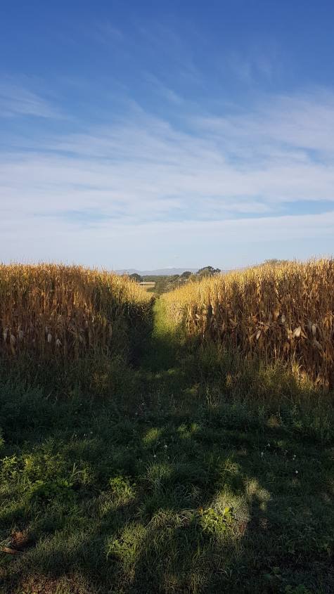
Almost immediately after leaving the city, a part of the route begins along a dirt road that passes through some crops. We are at a low altitude and from here we shall only see the cultivated fields. There are no sunflower or wheat crops to make everything a little more picturesque, but there is no shortage of tall corn plants. They are very tall .
Blue skies though .
The initial stretch is not that remarkable but in less than three hours, precisely halfway along the route, we shall reach the first town of the day and everything begins to have a different aspect . San Lorenzo Nuovo and here to welcome us there is a beautiful octagonal square, called Piazza Europa, which looks pleasantly impressive.
Famous Octagonal Square
San Lorenzo Nuovo is a village located on the northern side of the Volsini mountains just five kilometers from the shores of Lake Bolsena. This country is located in a particular geographical position that places it on the border of three regions: Umbria, Tuscany and Lazio. San Lorenzo Nuovo, as its name suggests, arose in recent times unlike other villages and cities in this area. The town was founded in 1779 by the inhabitants of San Lorenzo alle Grotte,which had to move due to the presence of malaria-carrying swamps which made the air unhealthy. The historic center of the village is of a neoclassical style dating back to 700. The city has a particular urban structure made up of a series of houses that follow the octagonal shape of piazza Europa the city center where the church of San Lorenzo stands. It might come as surprise to learn that the principal crop hereabouts is the humble potato.
Church of San Lorenzo A wooden crucifix (a work from the early 14th century attributed by some to Maitani) and two paintings by Jacopo Zucchi.
Look out onto the road that continues at the end of Piazza Europa to glimpse Lake Bolsena in all its splendor.
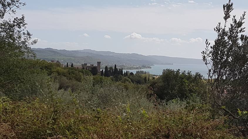
This is Piazza Europa, that blue in the distance is the Lake. Our first encounter with Bolsena! At a 114km2, Lago di Bolsena is Europe’s largest volcanic lake. Between 100,000 and 200,000 years ago successive volcanic eruptions led to the collapse of the earth’s crust in the volcano’s caldera for in the lake and its two islands. Underground springs and storm water runoff fill the lake,which has an outlet to the sea through the Marta River.
Up to Bolsena, the route continues on dirt roads in a pleasant up and down that sees alternating olive groves, meadows and woods. The characteristic that these different landscapes have in common are the fantastic views of the lake that can be glimpsed every now and then. It is a very beautiful section.
And with a body of water on the horizon, any glimpse will be definitely worth a little stop.Onwards through a woodland section Bolsena in the distance. Ancient streetsThe sun kissed lake – anyone for a dip?
WHAT TO SEE IN BOLSENA.
Take a tour of the delightful historic centre. “Among the places of greatest interest we will find the “Collegiata di Santa Cristina”, built in Romanesque style and later restored with the addition of the beautiful Renaissance style façade. The Collegiata is best known for the Miracle of Corpus Domini.I refer you to the very well-kept blog “Itinerari Laziali” to learn in detail the history of the miracles of Santa Cristina. In the upper part of the town the “Church of San Salvatore” and the “Castello Rocca Monaldeschi” (which we have already encountered as soon as we entered the town) dominate the landscape. The entrance ticket to the Castle costs only €5 and allows you to visit the Territorial Museum of Lake Bolsena, the towers with a view of the lake and the Aquarium. If this is not enough for you, there is an immense lake with its shores that are just waiting for your visit.”
Santa Cristina – it was here in 1263,while a priest who doubted the concept of transubstantiation was consecrating the host, the bread he was blessing suddenly began to drip blood onto his hands and the cloth below. In response,the following year Pope Urban IV creathed the feast of Corpus Christi,now celebrated in Catholic Churches throughout the world. The miracle,along with the relics of 3rd c. martyr Santa Cristina made Bolsena a prime pilgrimage destination in its own right.The castle.These posters are ubiquitous and very tempting,too.
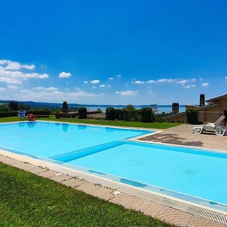
If the lake doesn’t tempt you to swim then possibly the pool at tonight’s Agriturismo will.
A view from Agriturismo Le Vigne,Via dell Vigne,Bolsena. “Nice big room and bathroom ⅊You can use the garden everyone has their place in front of the rooms Good breakfast with lots of choice Very clean Great location you can see on the Bolsena lake Located on Via Francigena” Review from October 2024