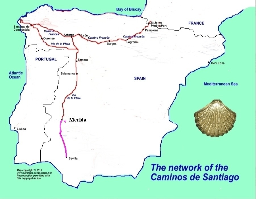
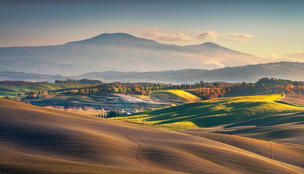
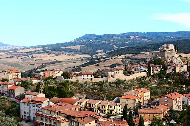
“It is worth preparing yourself for one of the hardest days of the Francigena. It is obviously so because of its length, but also because of its rugged profile and and long,final climb, from 300 to 814 m. The beauty of the landscape, still in the Val d’Orcia, classified as a World Heritage Site by UNESCO, compensates for this.For almost the entire stage, which can cause anxiety, you will see Radicofani, an austere but at the same time charming village, located on the slopes of an ancient volcano.” GRONZE GUIDE
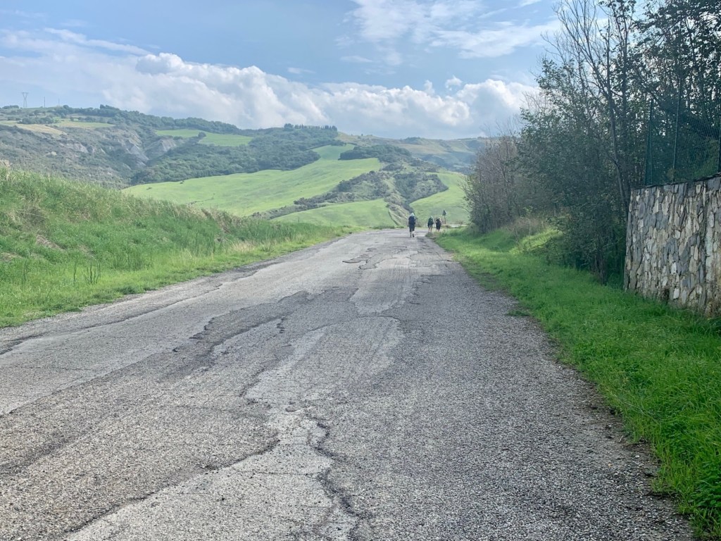
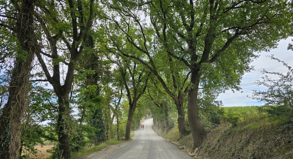
To walk the Via Francigena from Castiglione d’Orcia to Radicofani, follow the marked trail, which involves a descent towards the valley and a crossing of fords. A1 .
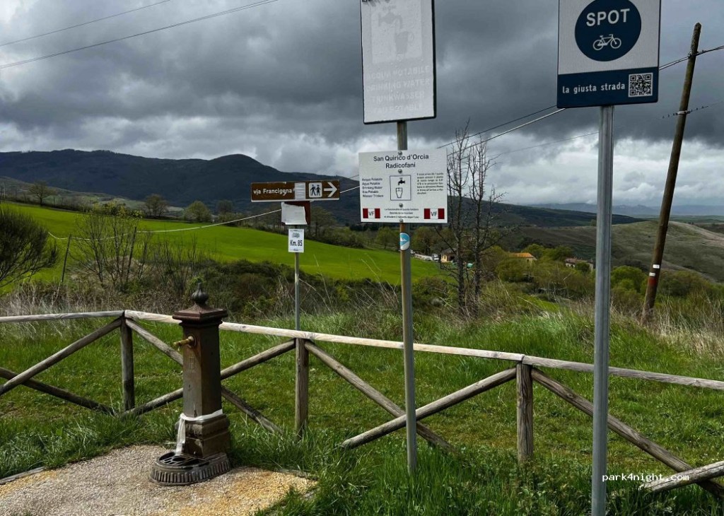
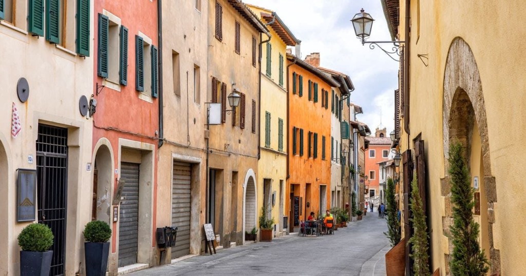
Traditional Francigena signage.Nearing Gallina
We shall need to plan for food and water carefully for this stage, since fountains and food stops are limited, with the only refreshment directly on the route is an agriturismo near Gallina. Otherwise a saunter into Gallina itself,1.1 KM to Ostella La Vecchia Posta.
The way will vary along the d’Orcia valley.
Vineyards and road walking, plus three torrentes to cross.
At this time of year the crossings should be straightforward.
2.6 KM from the Gallina turning brings you to Agriturismo Passalacqua, lunch available to pilgrims – it’s an organic farm directly on the path.
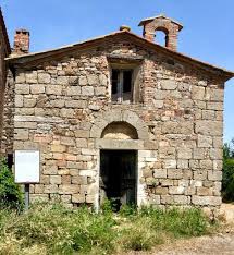
The road continues down towards the SR2 Via Cassia at the bottom of the hill where we turn right to walk up amongst vast field of hay or alfafa in season , heading towards high-tension power lines. The historic Church of San Pellegrino at Briccole is next. It was once a flourishing abbey.
This tiny,unrestored chapel is all that remains today.
The road turns to grass alongside a large pasture,continuing along the grassy road until reaching the Old Via Cassia at, where we turn right ,passing Agriturismo Sant’Alberto, where there is a pilgrim rest area. Going left at a fork we begin a long and sustained climb,ending at new SR2 Via Cassia. Crossing the road carefully we follow a gravel path, between the river Formone and the highway.
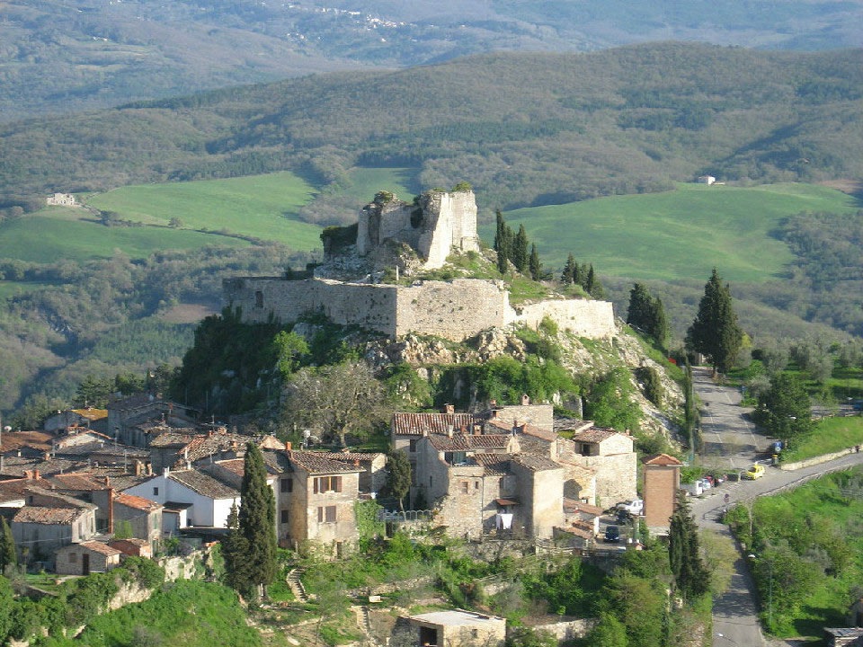
The path crosses under the SP478, then a long and sustained climb,past a sheep farm onwards up a narrow pathway to the left of the road that shields us from cars on the highway , with occasional glimpses of the tall tower of Rocca Radicofani above.
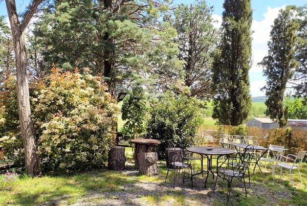
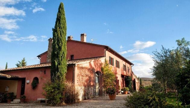
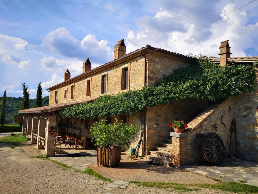
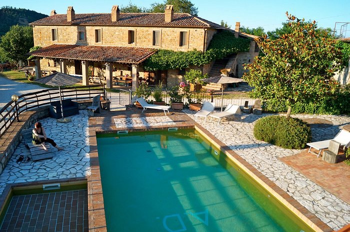
Looking at this night’s accommodation,at some point before Radicofani ,we veer left, off the SP478 to Agriturismo La Selvella. Sloways will doubtless inform us of our route.
Probably very welcome ! A recent review,below. “We stayed here whilst walking the Camino and it was by far the best place we have stayed. Marina, Amber and Janka made us feel extremely welcome. Nothing was too much trouble we were brought Gin & Tonics outside and when we were too tired to walk into the nearest village we were given lifts in and out. The place is ultra relaxing and laid back. Our rooms were lovely and we were lucky enough to stay for two nights. The pool is a great size and the pool area fabulous with great scenic views. We had the feast both nights, on the first night the soup was a tasty tomato soup and on the second it was made with fresh vegetables from the garden. We had gorgeous pastas both nights and on the first night wild boar and on the second lovely pork. The wine list is extensive and very good. The breakfast was very tasty with loads of choice great coffee and honeycomb honey to go with lovely yoghurt. We had a fabulous time and only hope we can come back for longer in the future and would thoroughly recommend as a great place to stay.”The aforementioned tower.
Then through woodlands enjoying views to the right, of a tall mountain.
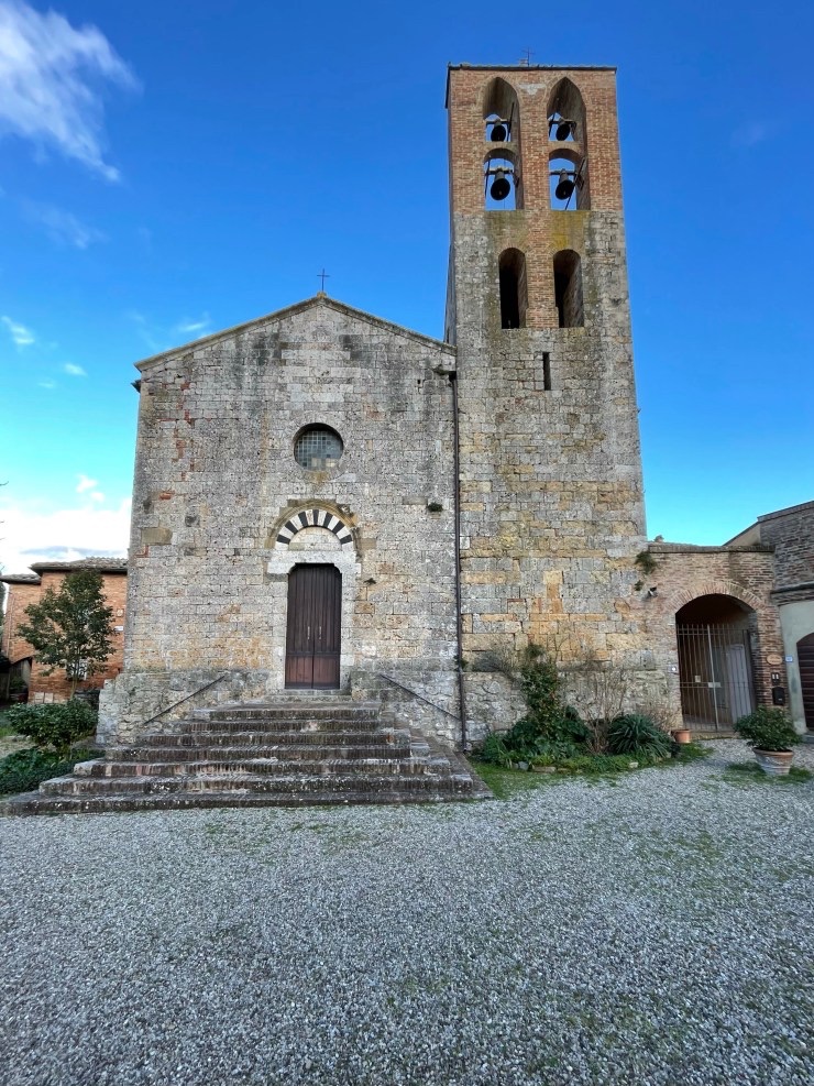
Monte AmiataVia Roma in medieval Radicofani
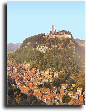
The village stands astride a high ridge between Tuscany and Lazio.
The village is a picturesque cluster of neat,stone homes,shops and restaurants,and its heart is the Romanesque Church of San Pietro reconstructed after WWII bombings.San Pietro
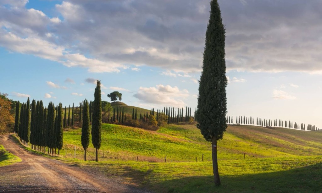
This is Val d’Orcia, included in 2004 in the UNESCOWorld Heritage List. A unique encounter of art and nature, rich in evidence of the past, with a natural landscape redesigned during the Renaissance to reflect the ideals of ‘good government’ in the Italian city-state.
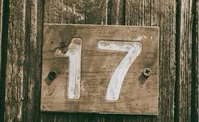
Superstition has often to do with numbers. I know that in some countries 13 is a very bad number. Well, in Italy, 13 is considered a lucky number, whilst fearing the number 17. Better be careful and do not plan anything important on a Friday 17, because it is considered a very bad day. Below is a link to a lighthearted article about superstitions in Italy.
So,we should have nothing to fear whilst walking on a “Friday 13th in Italy!”
It’s a short stage today, but a beautiful one,the reason is to break what would be 29 KM trek to Radocafani, including a long climb at the end of the day.
We shall depart along the Via Dante Alighieri, the pedestrian street,turning right on to the Via Matteoli,then left onto Via Garibaldi,some suburban walking then at a Y junction ( 1.2KM ), the road turns to gravel and climbs,sometimes steeply,leading to a fine view.
A view of Roca d’Orcia with its rectangular castle tower .
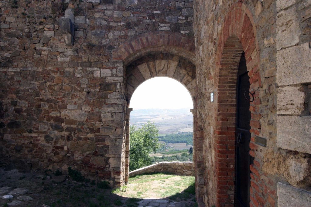
The road returns to concrete on the descent,but we follow arrows to the left, to enter the picturesque hamlet of Vignoni Alto.
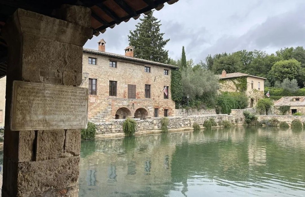
“This village has a unique attraction – in traditional Italian towns and villages there is a main square in the centre. In Bagno Vignoni there is a pool 49 metres long and 29 wide, from the bottom of which bubble up a number of hot springs. The therapeutic qualities of the waters became renowned and attracted numerous pilgrims travelling the Via Francigena on their way to Rome, one of the main destinations for the Christian pilgrimages. It’s not possible to enter the central pool, but it is possible to enjoy a free warm bath in the springs at the adjacent Parco dei Mulini .” The springs have been visited by notable such as St Catherine of Siena,Pope PiusII AND Lorenzo the Magnificent.A great view of the Val d’Orcia from the castle archway. There should be an opportunity for coffee in the village.Agriturismo Le Querciole is the only other possible refreshment stop.
Leaving the village there is a sign to a pedestrian bridge over the River Orcia,however it has been closed for repairs,if not reopened, we continue downhill to the Via Cassia and cross via the auto bridge. Then veering right along a driveway to an Osteria, before which turning left on to the VF. We cross the SP323, passing a small vineyard and orchard on to a gravel road to Castiglione d’Orcia.
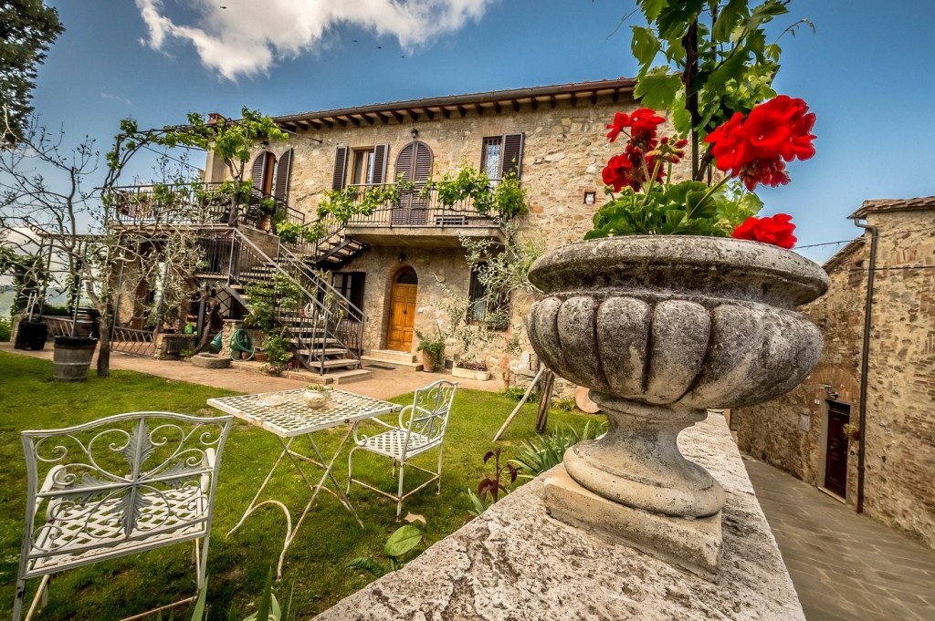
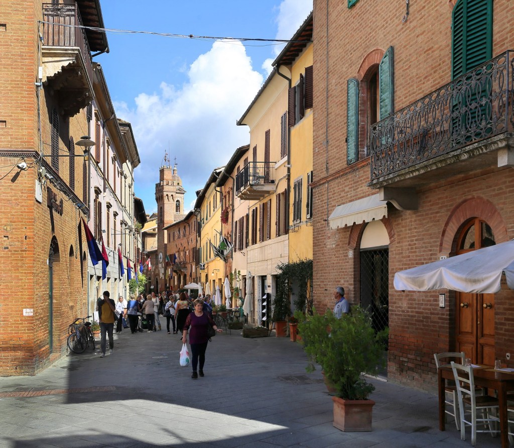
Castiglione our destination for today . A thousand-year-old village in the heart of Tuscany The charming town of Castiglione d’Orcia, in the province of Siena, is perched on one of the verdant hills of the Val d’Orcia, between rows of vineyards and roads lined with cypress trees. It is a typical Tuscan village, with stone and brick houses, offering beautiful views of the surrounding countryside. The charming if tiny central piazza of Castiglione d’Orcia, the Piazza il Vecchietta, is dedicated to the Senesi painter, sculptor and architect, Lorenzo di Pietro (1412-1480), known as Il Vecchietta. In the center of the cobbled and sloping piazza there is a beautiful travertine fountain. The cobblestone piazza and its lovely fountain were built in the 1600s, but the rest of the town consists mostly of beautifully preserved medieval structures and streets. We should have plenty of time to explore them. Link below.
Lodgings for this evening are in B&B II Vecchietta. B&B “The Old Lady”.
Il Vecchietta is a bed and breakfast located in a quiet street in the historic centre of Castiglione d’Orcia , where you can only find typical stone houses from the medieval era, and from which you can see the two main monuments of the place: the ruins of the Rocca Aldobrandesca and the imposing Rocca di Tentennano . Looking further you can admire the splendid hills of the Orcia valley, covered with woods, rows of vineyards and olive groves. The B&B takes its name from the Sienese painter of the 14th century, Lorenzo di Pietro, known precisely as “il Vecchietta”.
A RECENT REVIEW “The owners of Il Vecchietta, Sylvia and Arturo, were such welcoming and kind hosts and I could not have asked for a more wonderful stay, if only it was longer. Their beautiful B&B is on the Via Francigena pilgrim path located in the historic center of Castiglione d’Orcia. My room was spacious, well furnished and with a great view of the Rocca di Tentennano. The bathroom was also excellent. It was great having access to the communal kitchen after a long day of walking . Sylvia was very accommodating of my early start the next day with a delicious homemade breakfast prepared for me and goodies to go! Thank you both for your generous hospitality and I do hope to return.”
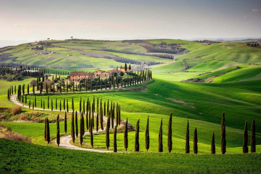
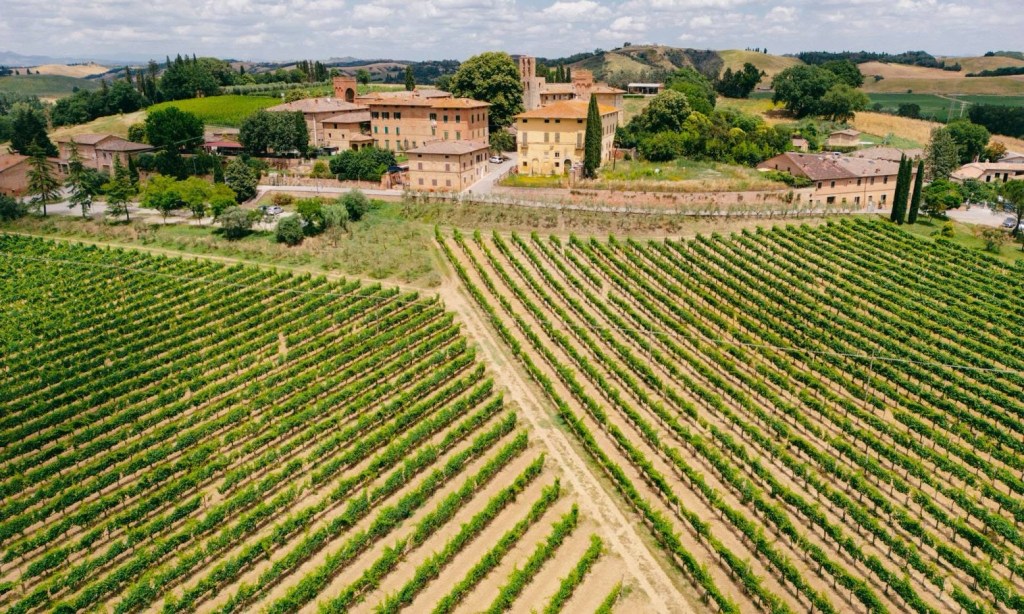
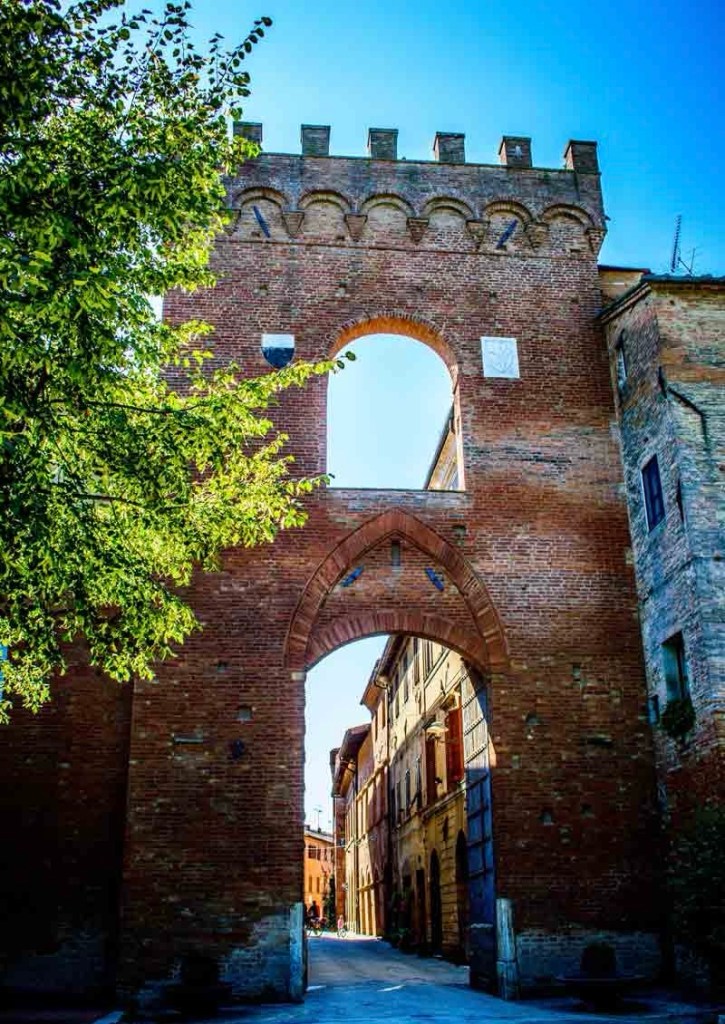
AMENContinuing through the old town and after next city gate we turn left, crossing the highway and railroad tracks , through some suburbia, onto a path. After 2.6 km, we follow the Strada Proviniale del Brunello,leading up hill.Archetypal Tuscan landscape with cypress trees. Anticipating quiet roads.The famous vineyards where Brunello di Montalcino is produced. Considered to be amongst Italy’s finest wines,produced from Sangiovese grapes. ( And one of Italy’s most expensive! )The Altesino winery.The Caparzo Winery.
The road continues along ridges with majestic views of the Tuscan countryside until we reach Torrenieri, with facilities.
“Torrenieri takes its name from a fortified outpost with a black (‘nero’) tower (‘torre’), either by virtue of having been built of dark stone or because the stone was blackened by fire. In 1452 Eleanor, Princess of Portugal, stayed here on her way to marry the emperor Federico III. Being on the Via Francigena, it is constantly traversed by pilgrims on their way to Rome. The diary of the travels of the Archbishop Sigeric from Canterbury describes the tower as having been a hostel from around the year 1,000 AD, but from the 12th-century became a private dwelling and later a castle. Dante may have stopped here during a trip to Rome. In the 14th-century several events in the town are recounted in the novel of the ninth day of the Decameron, by Giovanni Boccaccio. In the 18th-century census Torrenieri was described as “on the road from Siena to Rome, upon an easily accessible hill, entirely cultivated in vines and olives, the small castle of Torrenieri.”
Coffee, lunch, wine tasting…?Main route through the town. A bus can be taken to San Quiricio to avoid the climb if needed.A bronze sculpture of pilgrims’ feet next to the Church of Santa Maria Maddalena. From here one enters into the panoramic Val d’Orcia, following the ascent until reaching the stopping point at the church of San Quirico d’Orcia.For the next hour or so we follow the Strada Provinciale Celamonti ( SP137). This is a long, but gradual climb to a summit. Descending we should see the outline of San Quiricio on a ridge between two hills ahead.Not a lot of shade so we must be sure to have plenty of water aboard and a big hat!San Quirico was declared a UNESCO World Heritage Site in 2004.
The accommodation for this evening is Hotel Palazzuolo, Via Santa Caterina, on the outskirts of the town. An 11 minute walk to Via Dante Alighieri, the way out of San Quirico.
Don’t worry, we’ll be taking our time on what should be a short,relaxing stroll. In fact,time could be spent exploring the town before departure,if wanted and also stocking up on snacks / water.
Lucignano d’Arbia is a beautiful fortified village, which has carefully kept much of its original medieval architecture. We were greeted at the Porta Senese, the gateway into town, by the old brick,water well, where residents drew their daily water for centuries.
The tall solid brick tower, the Torre del Cassero, dates to the 13th century, as does the beautiful church of San Francesco; the church has a Gothic portal and frescoes by Bartolo di Fredi. The Pieve di San Giovanni Battista is Romanesque, with stone vaults and paintings.
San Francesco
Lucignano d’Arbia is compact and a pretty village to wander. Surrounding it are the postcard-like images of the Tuscan countryside with grape vines, rolling hills and cypress trees.
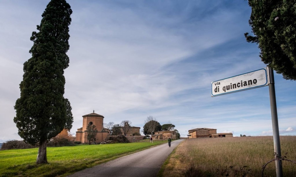
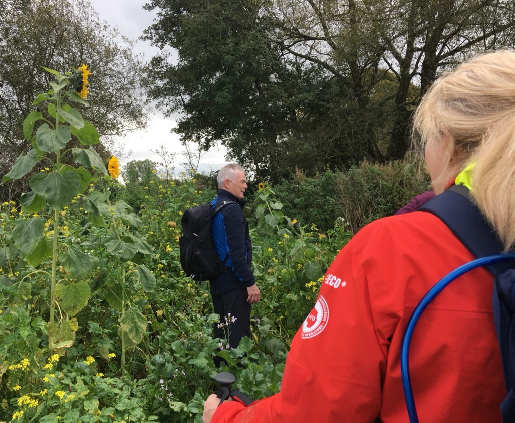
It’s a 2 km flat stroll to Quinciano to rejoin the main route .Quinciano has a large palazzo and the 19 th century octagonal Chapel of Pieri Nerli.Not much else by way of facilities . We walk parallel to a railway on a gravel track among fields of sunflowers for 3.6 KM, then arriving at the outskirts of Ponte d’ Arbia – it’s a 150 M walk into the town for refreshments.
This is an informative link to the history of Ponte d’Arbia.
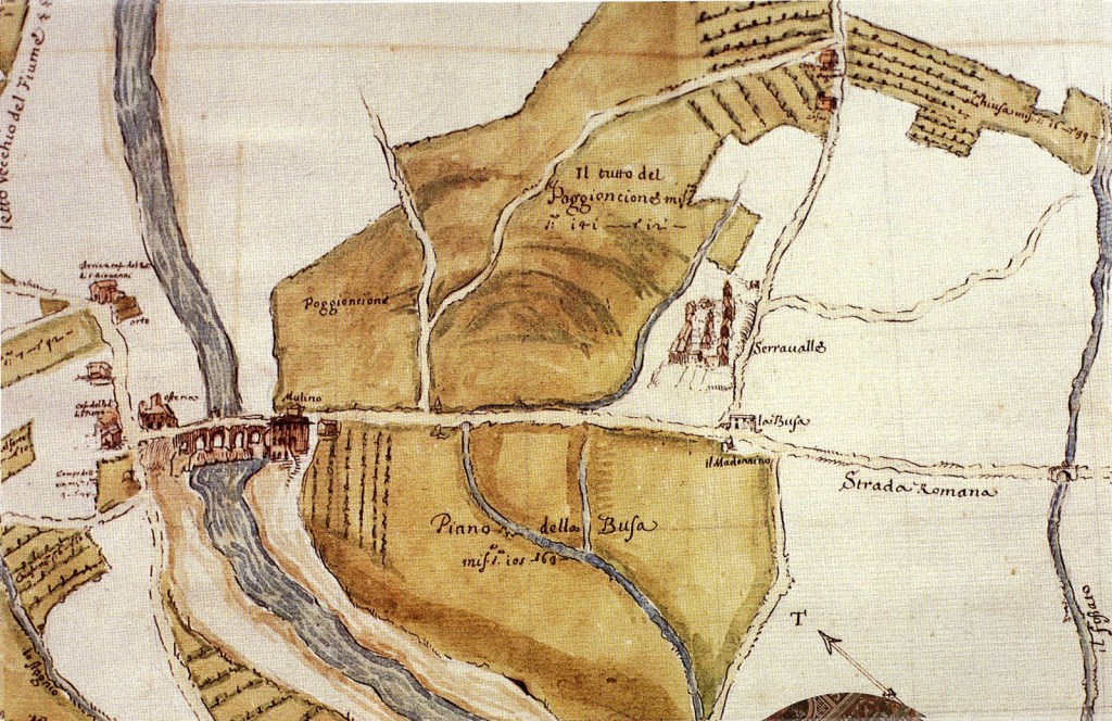
17 th century cartography As historian Emanuele Repetti writes: “The Bridge of Arbia was built by the Commune of Siena in 1388, and rebuilt in 1656 under Prince Mattias de’ Medici, governor of that city, who ordinarily ordered the construction of the bridge over the Asso and that one on the Ombrone in front of Buonconvento, as it appears from the inscriptions still existing in their parapets.” (Repetti, 1835, IV, pp.535-526)
We walk uphill en route to Buonconvento, along a series of paths that keep us among fields and off the SR2. The climb is a little steeper towards the top – good views – and eventually pick up the SR2 Via Cassia just before the town, crossing the River Ombrone to enter Buonconvento via the Porto Sienes. About an hour’s walk from Ponte d’Arbia.
An excellent and beautifully illustrated guide to the town.
Unusually for this part of Tuscany. It’s a medieval walled town (with post-war expansions) which is situated on a plain (and not a hill) at the intersection of the Arbia and Ombrone rivers, surrounded by the grey clay-scarred hills of the Crete Senesi. Located approximately 16 miles to the south-east of Siena ,the town became an important trading centre in the thirteenth century and later a military town for the City State of Siena, which presumably triggered the need for the high town walls and gates which were constructed between 1371 and 1383.
The Via Soccini in what is regarded as one of the most beautiful villages in Italy . The name “ Buonconvento “ comes from the Latin “bonus conventus “meaning “ happy place”.Medievale Cinto da Mura. This is our accommodation- Hotel II Ghibellino Via Alighieri Dante, 1 – IT 53022 8 “One of the best breakfasts along the Francigena that we walked. Centrally located, with restaurants and bars nearby. Great staff”,from a recent review.
On a practical note, supermarket Il Frutteto Di Tatania and Charlie’s Pub pizzeria are very close by and recommended.
It’s a 1.7 km walk to the Porto Romano (22 mins), the traditional exit point from the city. We shall have the first of many encounters with the historic Via Cassia,built by the Romans to connect Rome and Florence.
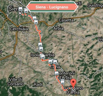
Expect vast farmlands, small hamlets and farmhouses. Red Sienese farmland is replaced by Crete Senesi – gray claylike soil – which gives its name to this region.After passing through an industrial zone,we walk into Isola d’Arbia. Fork right off the highway to a bar, if needed.
A little further on we encounter Ponte a Tressa,located at the confluence of the Tressa and Arabia rivers – pilgrim links date back to its 12 th century pilgrim hospital. 15th century Church of San Michele Arcangelo. Refreshments and bus stop available here,too.
Continuing among fields of Alfafa and grain until Grancia di Cuna ( water ). This one of Tuscany’s best-preserved fortified farms
After Cuna the road circles down, through duplex style homes and the on to a narrow path that climbs to a cell phone tower – expect wide vistas over the countryside. Very soon we come to Monteroni d’Arbia, the largest town in the area – all amenities.
After here there are no more facilities until Lucignano but it’s not too far to,our destination.
We leave Digbeth coach station at 07.05 ,arriving at Luton airport at 10.05.
Flight to Pisa, departing at 12.50, arriving in Pisa at 16.10 ( hour’s time difference ). Then to Siena by Sloways minibus. Expected arrival time after a journey of 125 KM – 19.00 at best – 12 hours…
This leaves little time for exploring Siena. I attach a link for your interest.
I have been to Siena and it is a gem,but given time limits and a long day, I’ll settle for a stroll in the old streets, a drink in the square and dinner.” Chianti and Pizza” has been recommended.
Siena -Hotel Chiusarelli – where we are staying – Restaurant recommended,too.
LYME REGIS – Situated on the world-famous Jurassic Coast.
The town is regarded as the ‘Pearl of Dorset’ and is renowned for its natural beauty, fossils, literary connections and extraordinarily rich heritage, it is also famous for being the birthplace of Mary Anning, one of history’s most important fossil collectors and palaeontologists.A memorial to Mary Anning up on the Coastal Path.09.30 walking down towards The Cobb, in Lyme Regis after a pleasant, meandering drive of 20 miles or so from The Shrubbery.Open for business A very quiet scene….by midday the town was very busy.Beach hutsThe sun barely breaking through on a breeze free coastal scene.The harbourA walk along the sea wall .An extension of huge rocks from the end of the wall.Low key rollers – there were paddle boarders and swimmers on the more protected beach.A pleasant stroll along the prom with its mixture of cafes and houses brought us to this signpost – much “Literary” history is associated with Lyme Regis.
Making our way towards the Coastal path we came across another local hero with a sea faring pedigree.
Not many I’m afraid!Well designed board walk.Gaining some height above Lyme RegisOn the Coastal path.Quite wide to start but it soon narrowed down.We turned around at this point as we had no intention to walk too far – just to get a “ feel” for the path – and anyway it was coffee time.Some pleasant seawards views .
It was a most enjoyable morning in what is a charming resort – no high rise buildings or “ tat” – Lyme Regis retains a traditional English seaside atmosphere and seems to be doing very well with it remaining so.
Sunday afternoon in Ilminster
Ilminster takes its name from the River Ile and the Minster church dating from 1450. The town grew up around the church and some of the oldest buildings are close to the churchyard including the former grammar school founded in 1549. Sundial on the school wall
In Victorian times the town was an important staging post for travellers with east-west and north-south routes converging there. The town is now by – passed by the A 358 & A 303.
This abandoned church was the Arts Centre. Such a beautiful building too.I turned right here and came down to the market square.I then walked uphill passing some independent shops en route.A great bit of signage.Looking upwards at the “ hanging gardens” of Ilminster!Romantically named “ Love Lane”An unusual placement for this water pump.At the top of the hill, I turned left again and facing me were two gatehouses, either side of an imposing if somewhat mysterious driveway . This one was up for sale.It must have led to some sort of grand house I would surmise.
The other one looks as though it’s receiving some much needed TLC !
Moving on,a first glimpse of Ilminster’s pride & joy.The Minster.A brief resume of its history.This stained glass window is of interest because it was created as a memorial to the owner of the Shrubbery – our hotel – formerly a private house.The Shrubbery Hotel – we enjoyed our stay here – good,home cooked food and a very hardworking,friendly staff.Ilminster is a sleepy, friendly place – I wish I had the time to follow its Treasure Trail
We enjoyed a good evening meal on Friday in the Shrubberies and it was good to have our very own “Beverley Sisters“ back with us.
After breakfast,on Saturday morning, we drove six miles or so to South Petherton, to begin our circular walk through small unspoilt villages, arable fields and orchards.
One of many Market towns hereabouts.
Its 15th century church dominates the skyline.Mike was leading the walk which he found on the Ramblers’ website – there were ten of us altogether.A thatched cottage, typical,of the area in Over Station.A damp somewhat overgrown mixture of Sunflowers and other vegetation seemed to bar the route, but we made it through. Pat, pictured right, spotted Newts in some of the lightly flooded areas.Approaching the village of Merriot.Sunflowers abounded.A fallen tree near Stoke- Sub – Hamdon was a good place for a break.A typical view on our walk.Higher Street! That’s a first.An eye catching des-res.
Time to move on from Merriot’s parish church after a lunch stop.
Apple orchards a-plenty and time for some “ foraging”.Not on a church but carved on a garden wall, re-entering South Petherton.The Old Chapel built with the local “ Ham” stone. It was a very enjoyable saunter.
After another welcome dinner at The Shrubbery, I put on a bit of a “ Folderol” for the group and after a long day the “ audience “ did well to keep up the pace!
Some aspect of social history to begin proceedings.something about the origins of the expression “ Not having a pot to p… in”. I watered it down somewhat though.
I have driven past the motorway exit to Taunton many times but never felt tempted to visit Somerset’s county town. However, we decided to break our journey to The Shrubbery Hotel Ilminster, at Taunton. Choosing the Gateway Park and Ride proved to be a good option and avoided the hassle of driving into the town and finding somewhere to park.
A pound each way to and from the town centre.
First port of call was a coffee stop, almost opposite the bus stop – The Bakery, housed in a former Royal Bank of Scotland.
A much needed break after the drive down the M5 which was smooth and uneventful – good coffee,too.
Much of the centre is semi pedestrianised and we were soon struck by a number of interesting buildings.
Taunton was the first place in the UK to be permanently lit by electric street lighting.Culture on offer, too.
We were only planning on a couple of hours, to include a picnic, ideally in a green spot and by pure chance we happened upon part of the town’s Heritage Trail, by taking a random turn down an alley into Bath Place – a row of original 19th century shop frontages and small mansions.
This opened out on to a main road and Mitre House.We soon found ourselves following the River Tone after which the town is named.Our next stop on this section of the Trail was the Castle, which now housed the Somerset County Museum. “Housed in Taunton’s historic castle, the Museum of Somerset tells the county’s fascinating story from prehistoric times to the present day. Within the 12th century castle walls you’ll find contemporary gallery spaces and great family visitor facilities, all situated within the town centre. With an amazing nine themed galleries, each with its own distinctive character, there’s something for everyone to discover. Our ‘must see’ exhibits include a 200 million year old Plesiosaur fossil (a type of marine reptile); the impressive Low Ham Roman mosaic; the Frome Hoard and a stunning Bronze Age Gold Torc. The museum also houses The Somerset Military Museum.” Maybe next time!
We then came to the Weir which was perfect for an alfresco lunch on a nearby bench.
Some very well,placed riverside retirement flats opposite.We crossed this lovely bridge and made our way back towards the bus stop.A proper Cobblers’.With St James’ church in the background which was not open so I wasn’t able to discover any possible Camino links.
Closer to the town centre – the Taunton Minster’ striking tower.
The foundations of Taunton Minster, St Mary Magdalene church, were probably laid in the early eighth century when Ina, king of the West Saxons established Christianity in Taunton. The church was first built in stone as part of the reorganisation of Taunton by Henry of Blois, Bishop of Winchester, by 1180. St Mary’s became the town church in 1308 when Bishop Hazelshaw of Winchester changed its legal standing from a chapel of Taunton Priory to a church with its own ‘living’; the Revd Simon de Lyme became its first incumbent. This was achieved through a legal process known as the ‘Ordination of the vicarage’. The church is mainly built of sandstone and has a painted interior, except for the ‘forest’ of pillars which line the four aisles – a rare feature in a parish church. Most of the statues and stained glass date from the Victorian restoration.
Then it was a short wait for the bus back to the ParknRide. What struck me about Taunton during this short saunter, was what an interesting and well kept town it was, with the added attractions of tempting shops, restaurants and pubs.
Not to omit, for me, another of its great attractions – the cricket ground ! Must make an effort to come back next summer when Warwickshire are playing there.
It was a ten mile drive to Ilminster from Taunton and the hotel was easy to locate
A warm welcome with afternoon tea and cakes awaited us and first impressions were most favourable .
A well stocked bar with a good choice of drinks by the look.The view from our bedroom window – restful as the room.Feet up time – Sharpeners at 18.00 with dinner to follow. Tomorrow there is a choice of three, local walks and the weather forecast looks fair.
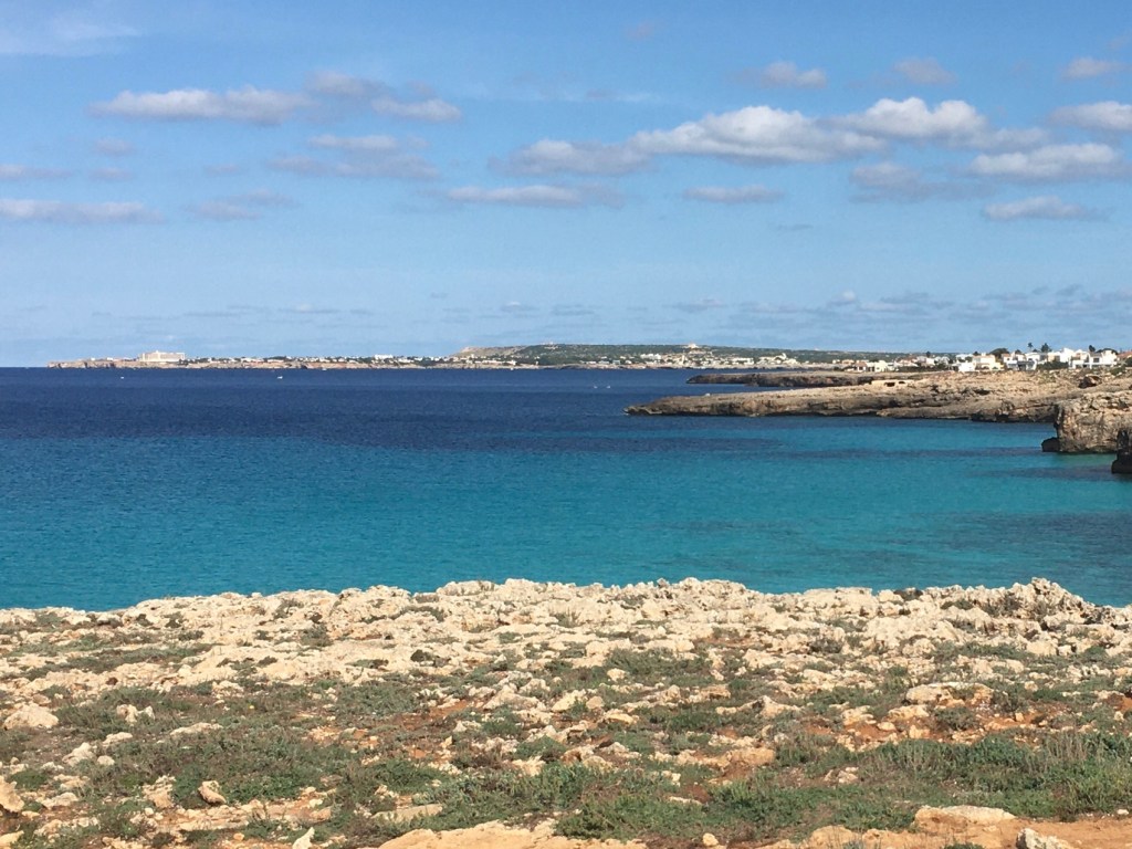
There are plenty of “pathless woods” to be seen from the coach window along the Me 1 road to Mahón and although Byron’s poem is not specifically about Menorca, it evokes the island for me.“ …the deep sea…” and “ the lonely shore”
Mahón, the capital of Menorca has an astonishing history and reading about it gives the visitor an improved understanding of its place in the island’s history and how it became the Capital city,displacing Ciutadella in the process.
MAHÓN’s TOUGH HISTORY
The Mola Fortress
While nowadays, this city is a bustling centre for tourism and trade, this wasn’t always the case. In fact, this city was once riddled with destruction and suffering and was once one of the most important military ports in the entire Mediterranean. Many historians believe the name Menorca,Mahon comes from the Carthaginian general Mago Barca, who was the brother to Hannibal and who is thought to have taken refuge in the city during the year 205 BC.
Born 243bc, died 203 bc
After the fall of the Western Roman Empire, this city became part of the Eastern Roman Empire and an incredibly important port. Port cities were considered highly valuable at the time and they were being used as the main source of trade and transportation. Unfortunately, as a result, it suffered a tremendous number of raids from both Viking and Arab expeditions. This continued for centuries until the city was finally conquered by the Islamic Caliphate of Cordoba in the year 903.
Islamic Moorish rule lasted in Mahon until the year 1287 when it was eventually reconquered by Alfonso III, the King of Aragon. He made the city a part of the Kingdom of Majorca and also part of the Crown of Aragon.
The Crown of Aragon was a composite monarchy, which is to say a group of separate kingdoms all ruled under one king.
This was a win-win situation for everyone involved as joining this composite monarchy provided the city with enormous protection while the city itself offered a brand new trade port for these kingdoms to take advantage of.
In fact, Mahon Harbour was considered one of the most strategically important in all of the western Mediterranean. Because of this, the Crown of Aragon decided that its refortification was necessary and provided the city with the extra protection it needed to stay safe for centuries more. However, in the year 1535, Hayreddin Barbarossa led the Ottomans to attack Mahon in what would become known as the Sack of Mahon. The attack was a tremendous loss for Aragon as the Ottomans took over 6,000 captives back to the Algiers as slaves. Under British Control. The War of Spanish Succession lasted between the years 1701 and 1714 as a result of King Charles II dying without leaving behind a male heir. This led to a tremendous amount of unrest throughout Europe, with both the French Royal Family and the Austrian Hapsburgs having a claim to the Spanish throne.
However, England wanted to make sure that neither of these kingdoms had access to the riches and power of Spain and made a Union with the Dutch to conquer the important city of Mahon. Of course, England quickly took note of the potential and profit that this city and the Island as a whole could offer and sought to gain full control which was granted in the year 1713 as a result of the Treaty of Utrecht.a-painting-by-semiramis-oner-
It was during this time that the city of Mahon has named as the capital which conveniently served as the residence for the Governor of Menorca.
Contemporary photo of his residence
During the year 1756, the island was lost to French control after what would later be known as the Naval Battle of Menorca.However, after the French lost the 7 Years War, the island was returned to the British in the year 1763, but this ownership wouldn’t last long. In the year 1782, the French and Spanish started a combined five-month invasion which took a massive toll on the island and the British eventually surrendered it.In 1783, control of the island was transferred back to Spain according to the Peace of Paris.
However, the British would eventually recapture the important port island in 1798 during the French Revolutionary Wars.
Luckily, when the French and British decided it was finally time to end all the hostilities between them, they agreed to withdraw their militaries and claims from certain territories including the island of Menorca, which was finally passed back to Spain, where it has stayed ever since.
RECENT HISTORY OF MENORCA
During the 20th century, Spain itself suffered through a terrible civil war. At this time, the entire island remained loyal to the Republic. However, it was captured by the Nationalists in the year 1939.
Unfortunately, during the battle to capture the Island, Italian and Spanish Nationalist bomber planes bombed the city of Mahon Menorca Spain and destroyed many important historical sites. Luckily, a number of structures remained undamaged or easily repairable making it possible for tourists to still enjoy the wonders of this incredible city to this day.
Original city walls
The history of Mahon has been riddled with conquests, sieges, and battles. However, throughout all that terror this stunning city has also bloomed under the constant cultural influences and changing powers.
Nearing the Fish MarketSeafood tapas Not just Delicacies !
The city now serves as the seat of the Island Council of Menorca and quite a bit of effort has been made to promote tourism as a primary source of income for the island’s residents helping it to remain one of the richest port cities in all of Spain.
The Capital City of Mahon where people love walking through the historic areas whilst taking in the stunning Mahon Harbour which happens to be one of the deepest natural harbours in the world.
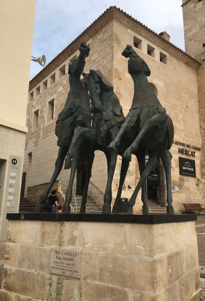
Mahón’s harbourLooking up from the harbour Shopping mall with a difference Mercat del Claustre is as impressive from the exterior as it is inside. Adjoined to a church, it dates back to the 18th century, with many market stalls on the ground floor tucked away in the old monastic cells. The building has an unusual history with many tales to tell, not least during its time as a court and a prison. Today though, it’s a buzzing, colourful space. Often used for cultural events, and displaying Menorca’s finest fresh vegetables and handicrafts including Avarcas (Menorcan sandals), woven wicker bags and fragrant flowers.
Many delicate facades in Mahón
Window shoppingSo many things catch the eyeThe only train on the island It’s set inside the stunning Sant Francesc de Maó convent, and takes you on a journey through Menorca’s different timelines. With sizeable collections of sculptures, antique maps and even Talayotic jewellery, this place gives you a true insight into the turbulent history and culture of this now tranquil Balearic island.A walk along the harbour is a must and a good place for refreshments.