Archive | February, 2023

MALAGA’s CASTLE,ALCAZABA & ROMAN THEATRE – 2nd February 2023

3 Feb

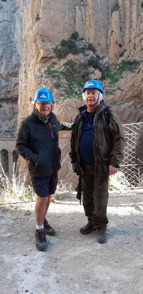
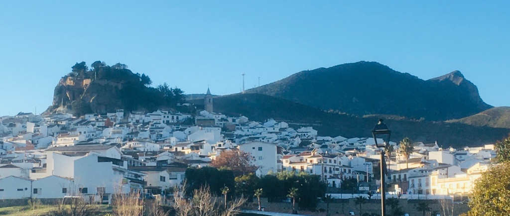
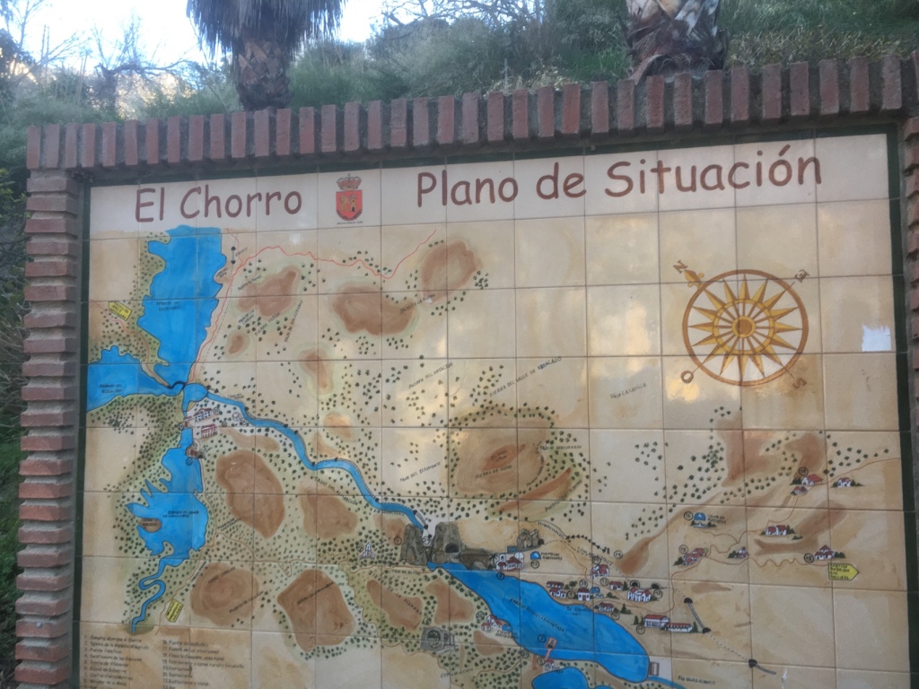
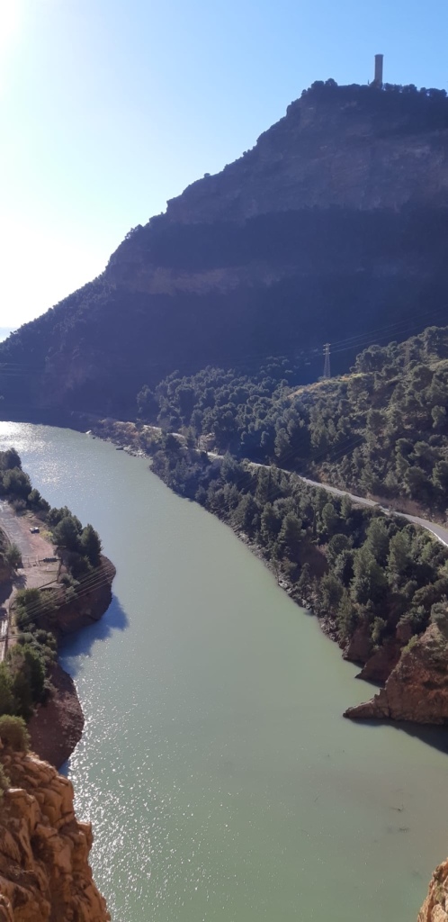
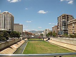
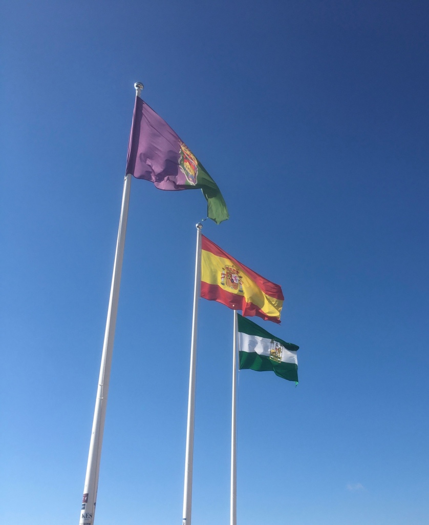
Awoke to another sunny morning . All ready for today’s saunter.

Patio number 3

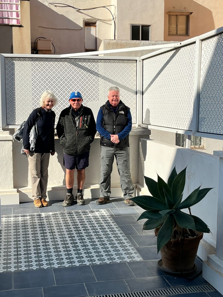
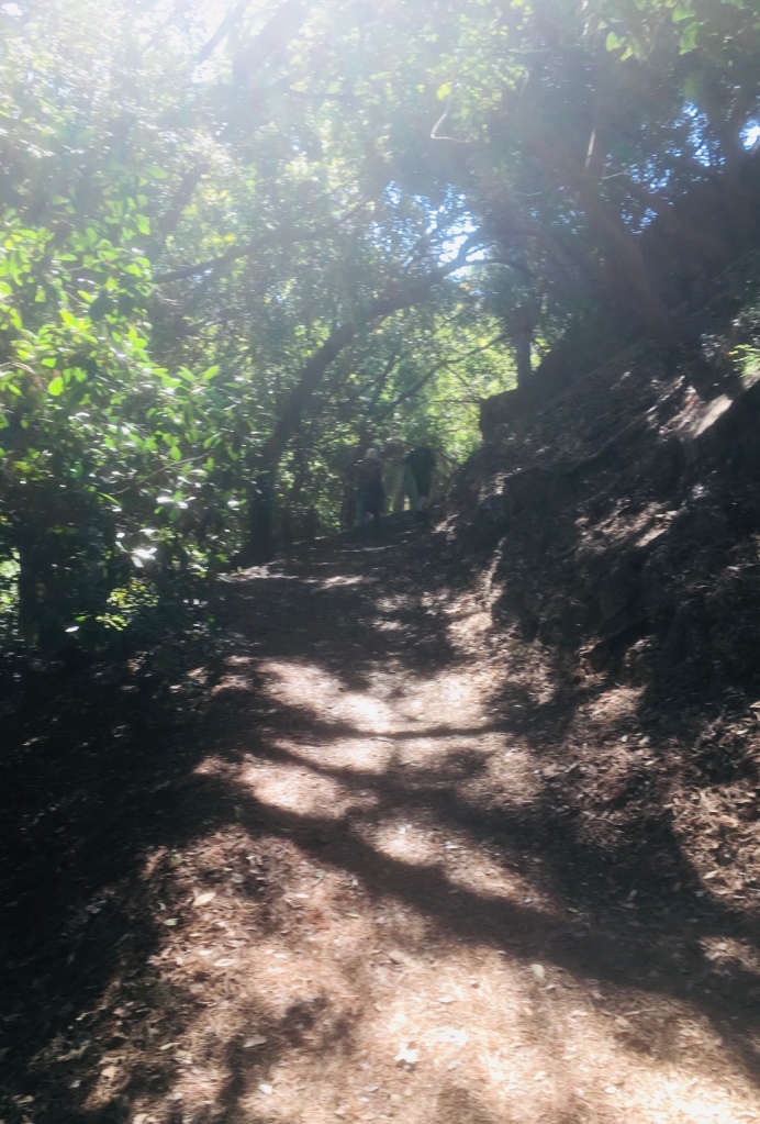
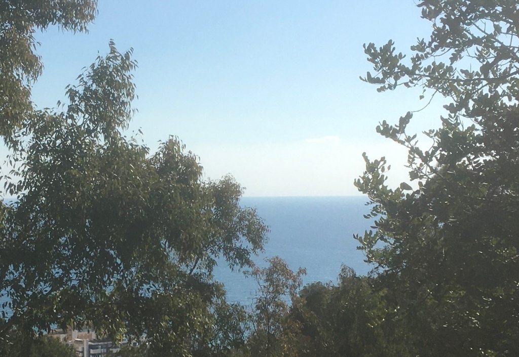
Leaving Plaza de Merced,we began a steady uphill walk.

Traffic free all the way up to the top and along a tree lined boulevard .
Cathedral in the distance

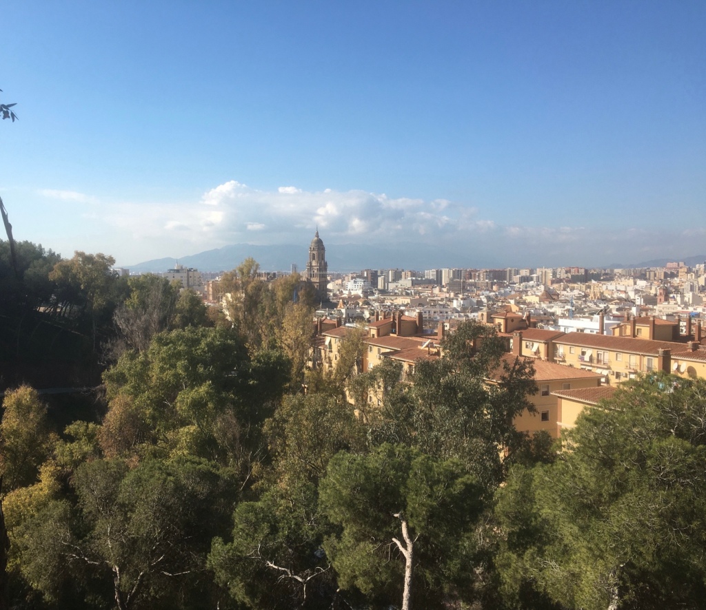
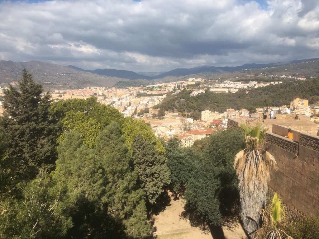
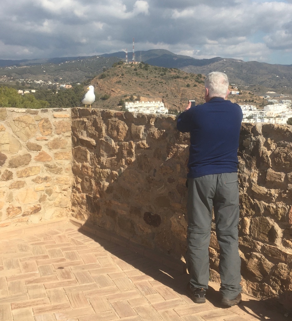
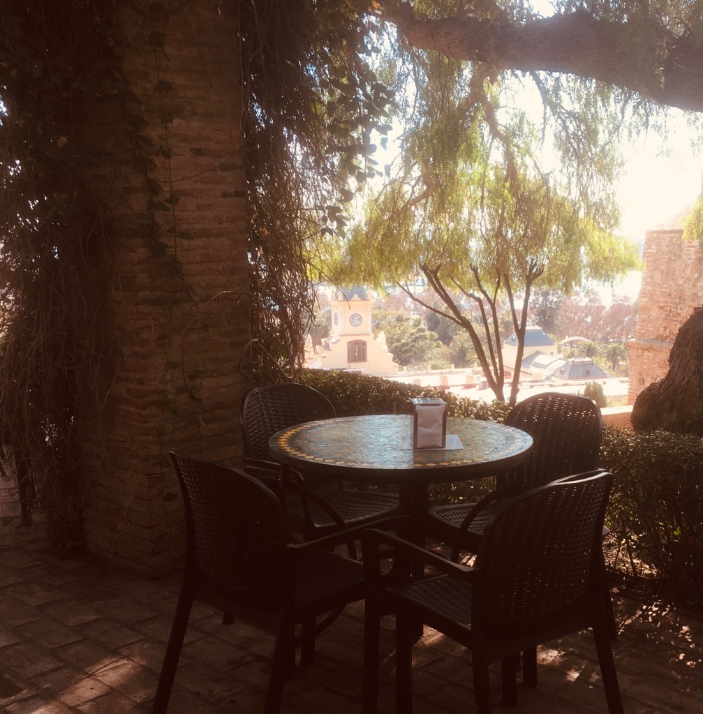
Nearing the top we were looking forward to coffee.

We were on the lookout for red squirrels.
He’ s hiding behind the tree trunk
Oh what big claws you have!
The roots of a rubber tree by the Castle cafe.
We made our way afterwards into the Castillo
The history of the Gibralfaro Castle dates back to the 14th century , when it was built. This served to protect the Alcazaba and the entire city of Malaga , since it extends over more than 21,000 square meters. Likewise, the natural enclave of this place is also impressive.

HISTORY OF GIBRALFARO CASTLE
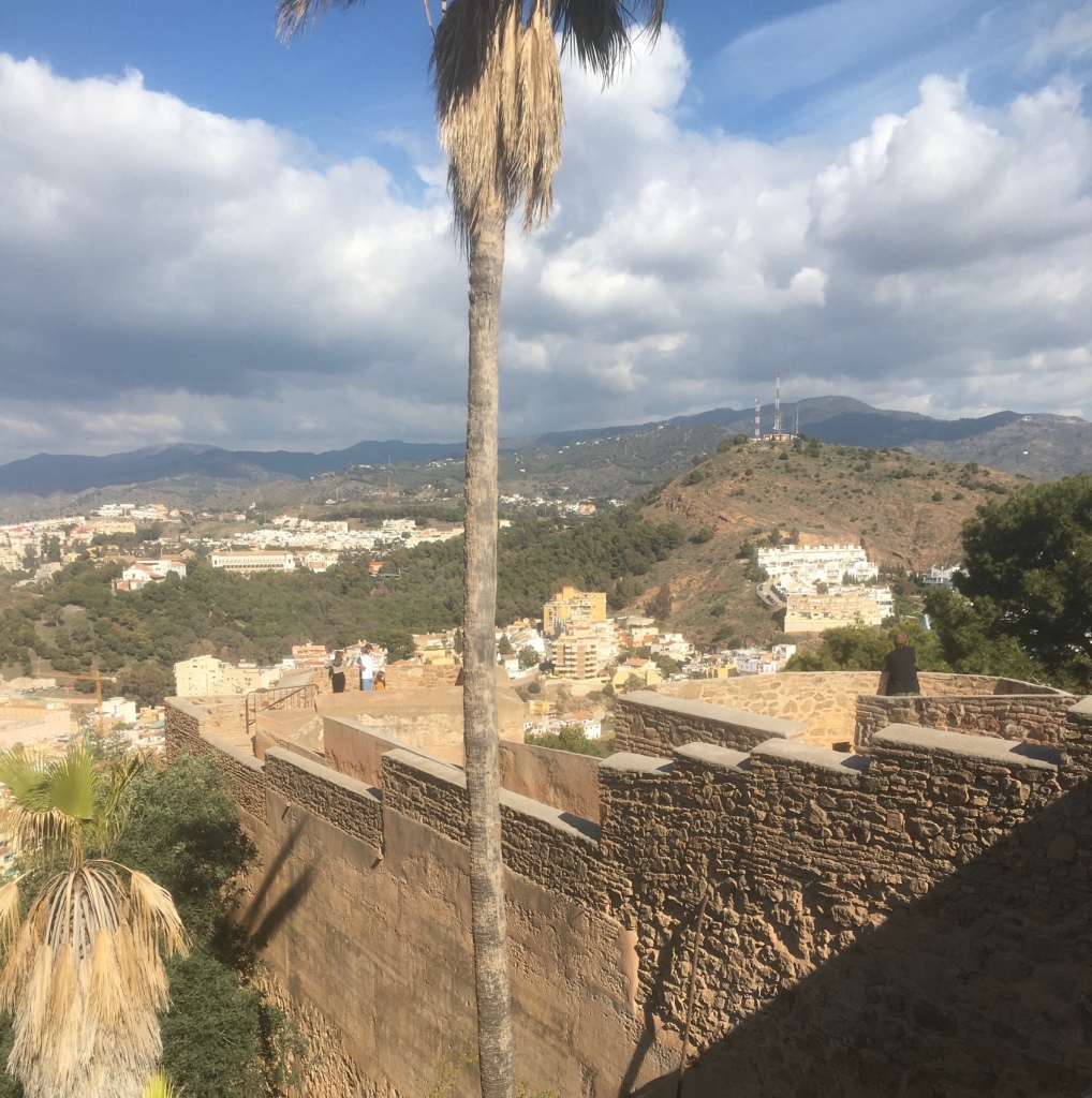
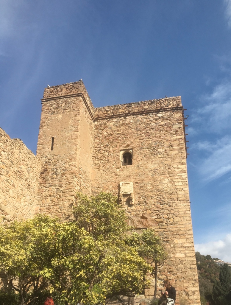
It is a Muslim fortress built in the 14th century AD to house soldiers and to control access to the capital both by land and by sea, so its height, approximately 132m above sea level , was key. for said task.
It arose as a defensive support for the citadel, with which it was once linked through the outer passage of the coracha that today is inaccessible.
Its current nickname, “Gibralfaro” , derives from the Arabic word “Jabal-Faruk” (mount of the lighthouse), and it is that the Phoenicians, the first settlers of Malaga, also took this mountain as a settlement and established the lighthouse on its top. gets name

A fascinating remnant of Malaga’s Islamic past are the sheer walls of Gibralfaro Castle , spectacularly perched high on the hill overlooking the city. Built by Abd al-Rahman I, Cordovan emir from the 8th century and rebuilt later in the 14th century, when Málaga was the main port of the emirate of Granada .
Gibralfaro Castle , also called Castillo de Málaga , is particularly notable for its twin centers: the castle garrison built on top of a rocky hill overlooking the city and the fortified Islamic Palace or Alcazaba, situated at the foot of the hill, both connected by a defensive back.

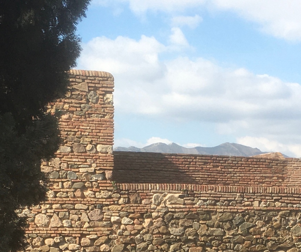
The Gibralfaro fortress dominates the entire city, and is located on the crest of a long hill located 132 m. above sea level, whose steep slopes descend towards the sea and towards the city. Since time immemorial, this fortress was the great watchtower not only to observe the population settled at the foot of its western slope, but also the accesses to it by land and sea.

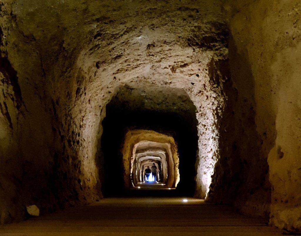
Very few Arab remains are preserved inside the Castle due to its military use, and to the many interventions that occurred in Christian times, such as the disappearance of the mosque and dependencies. Later it was partly blown up by the French, together with the ammunition that they could not transport, when they left the city during the War of Independence. The powder magazine of the Castle is currently occupied by an Interpretation Center.

The castle is famous for the three-month siege in the summer of 1487 by the Catholic monarchs, Ferdinand and Isabella, after which Ferdinand occupied the site, while his queen took up residence in the town.
For a time, it was considered the most impregnable fortress on the Iberian peninsula. It has two lines of walls and eight towers.
Some more great views
Matt getting a close up of a yellow legged Gull
We made our way downwards towards the ALCAZABA
Penny’s favourite spot – the park and a very exclusive hotel
History of the Alcazaba

What’s the meaning of Alcazaba?
The word Alcazaba comes from Arabic ‘AL-qasbah’ and refers to a fortification within a walled town.

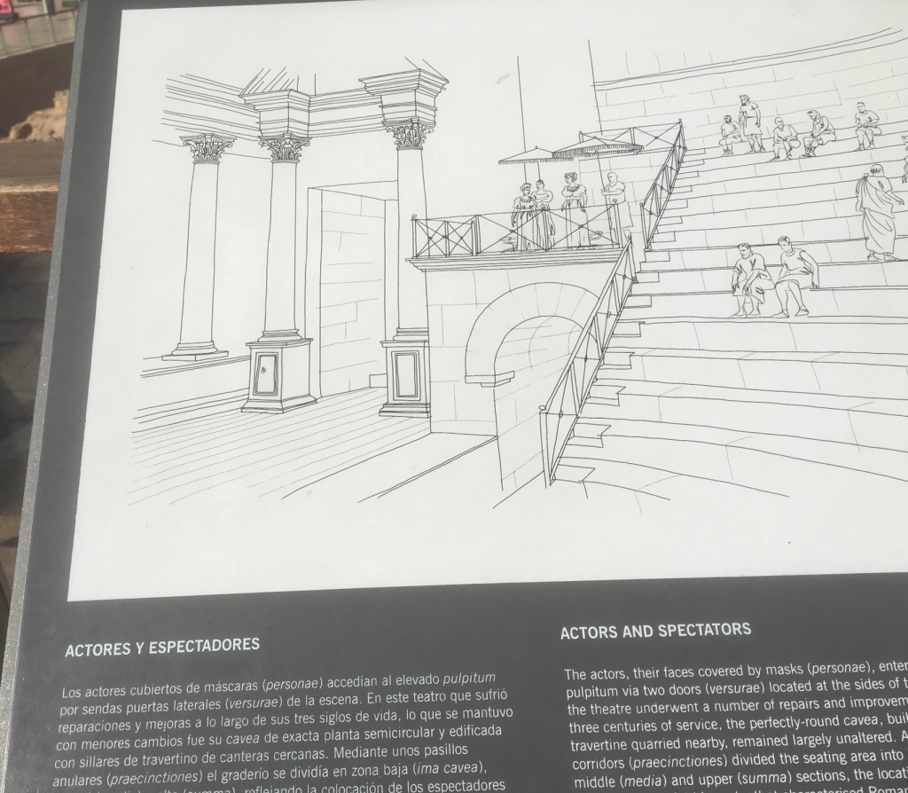
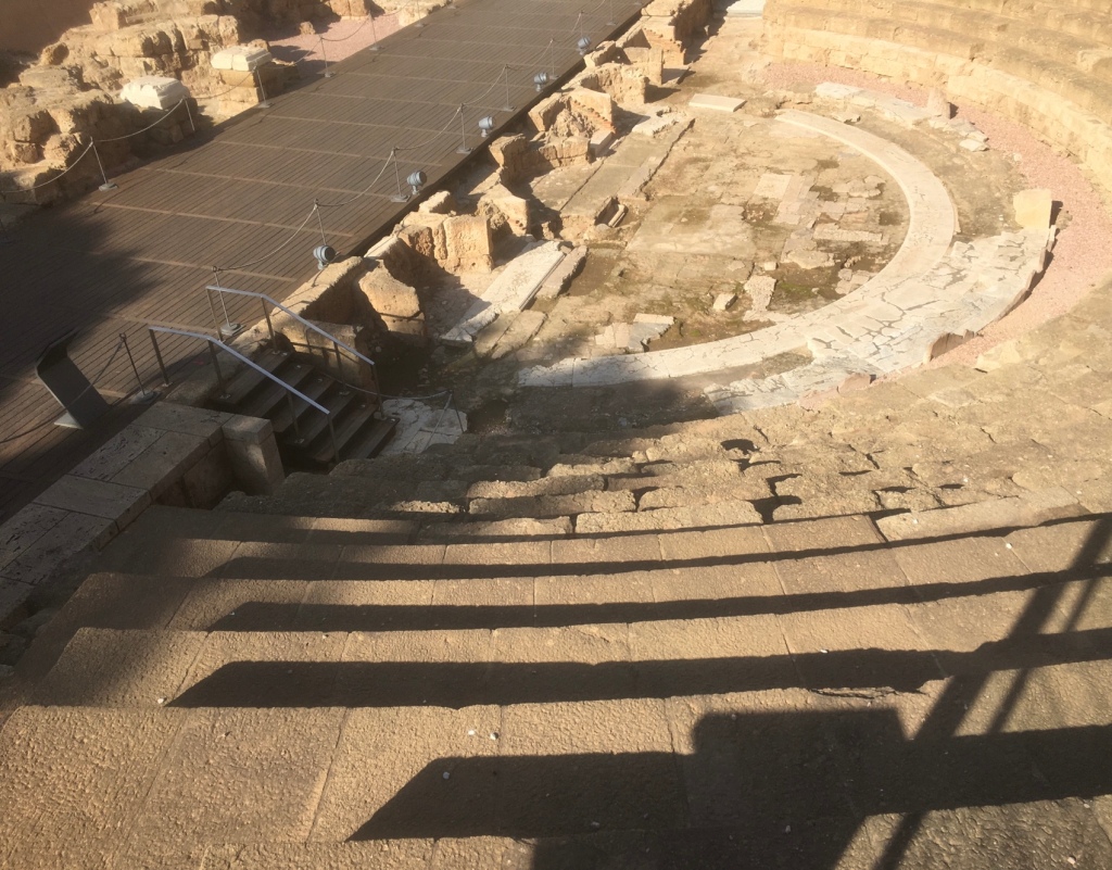
The Alcazaba of Malaga is a fortress palace built between 1057 and 1063 by the Muslims and at the request of the king of Taifas Berber in Granada, which used elements of the ancient Roman theater that sits at the foot of the palace. Due to the Muslim origin of the Alcazaba, its name arises, which in Arabic takes the meaning of ‘citadel’

Built between 1057 and 1063 by the Moors, the Alcazaba of Malaga was, at its height, comparable to Granada’s Alhambra in terms of its splendour and the impressiveness of its fortifications.
The Alcazaba is located at the foot of Mount Gibralfaro and overlooks the city of Malaga. A huge citadel, it spanned 15,000 square meters. Its fortifications, which included double walls and 110 towers, guarded the harbour and the city from attack.
In the 13th century, a 2nd fortress was added. With the increased use of gunpowder in Europe, the Muslims knew that if the Christians conquered the mountain they could use cannons to fire down on the Alcazaba. So Gibralfaro Castle was built at the top of Mount Gibralfaro to protect the Alcazaba and the city (more on Gibralfaro Castle here). The two castles were connected by a ‘coracha’, a walled corridor allowing soldiers to move from one castle to the other.
In addition to the impressiveness of its fortifications, the Alcazaba was also a palace. Within its walls were gardens, ponds, sumptuous halls, a deep well and a mosque.

The Alcazaba was put the to test in 1487 when the Catholic Monarchs tried to take Malaga. For four months the Muslim army, formed of 15,000 men (versus 80,000 Christians), resisted. Finally, having run out of provisions, they surrendered.

The Fortress was used by the Catholics after the takeover and was kept in good condition until the 17th century. At the time two events contributed to its deterioration: a severe earthquake in 1680 and the damage caused by an attack by French ships in 1693 (during the Nine Years’ War). After that, the fortress was used for various purposes including as a prison and a hospital.

In the 1930’s rehabilitation work began and the compound was declared Historical Heritage of Spain (now an Asset of Cultural Interest). The Alcazaba is today one of the most important Muslim works preserved in Spain.

I like the tops of the mountains in the distance.

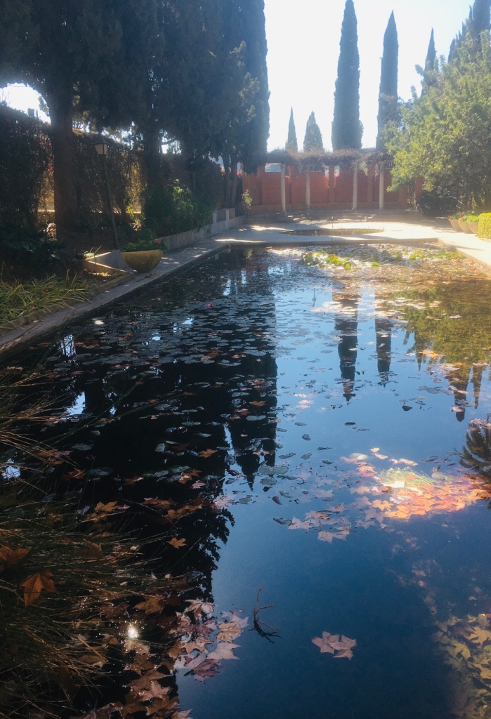
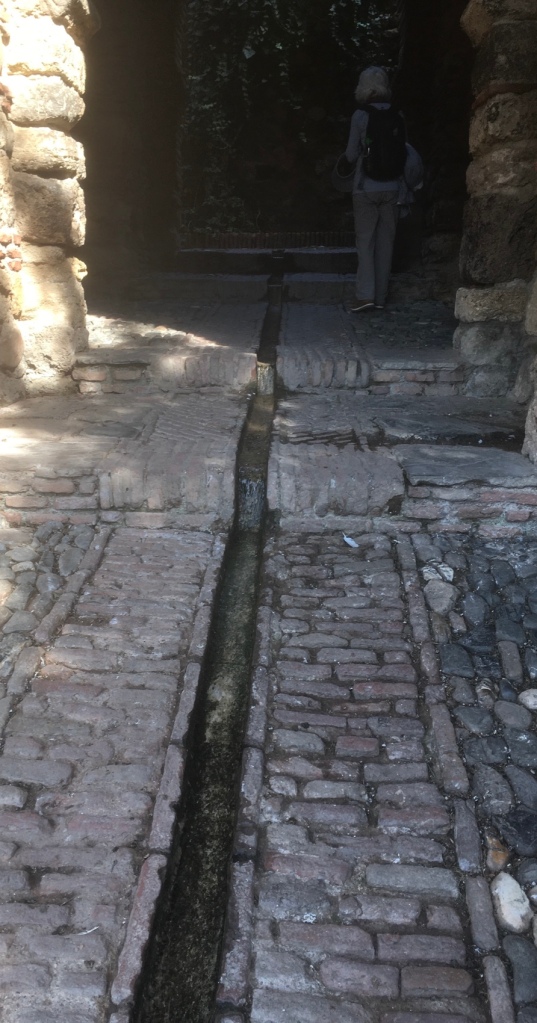
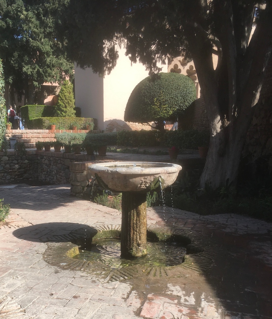
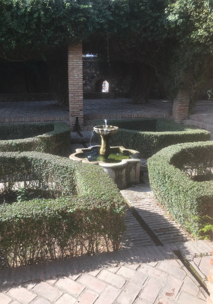
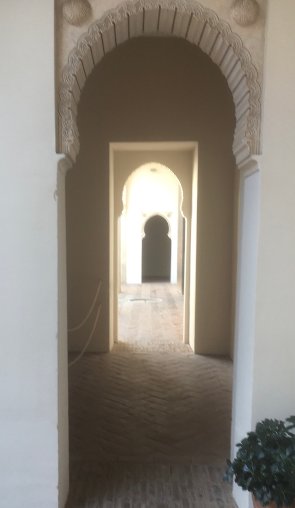
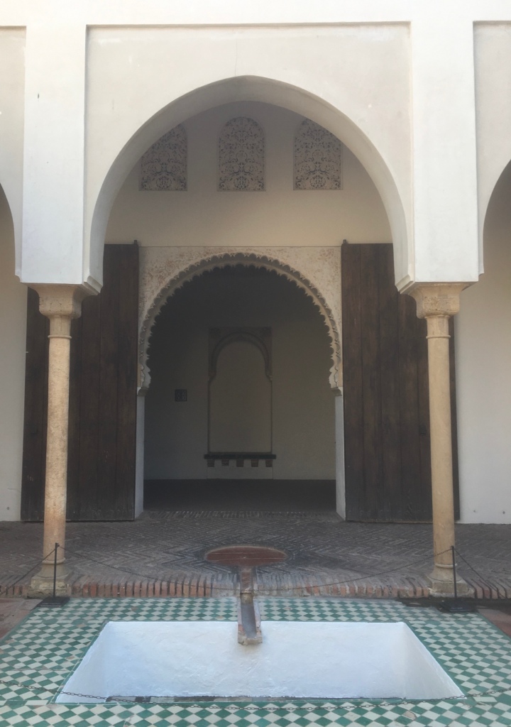
The almost constant features in the Alcazaba are those of water and shade.

The rivulets that ran through and across rooms and corridors reminded me of the Alhambra in Granada. These are distinctly Moorish designs and obviously appropriate to what are for most of the year very hot temperatures.

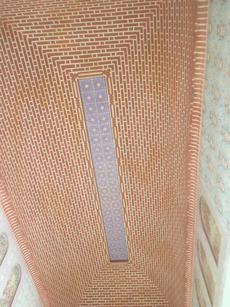
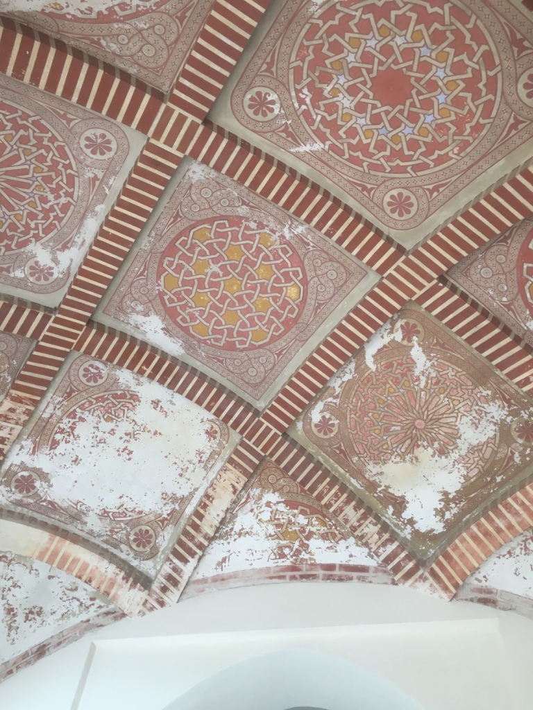
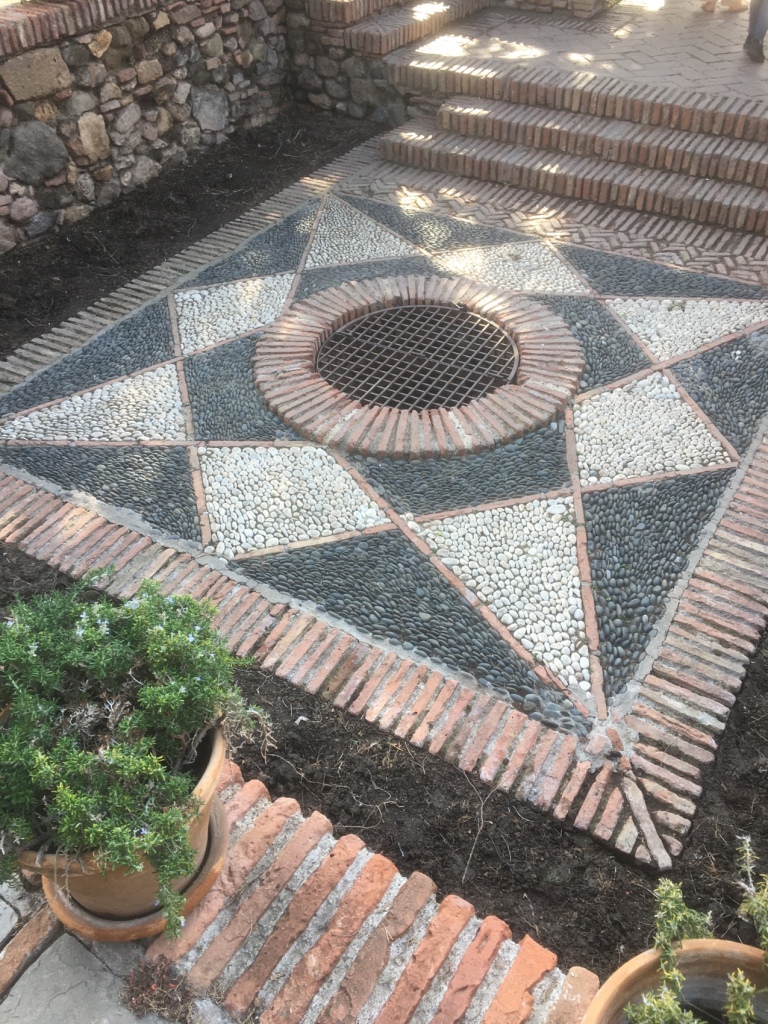
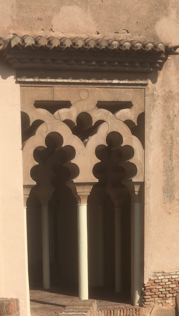
The other classic Moorish feature is that of design and artwork- none of it figurative; no statues nor pictures – but delicately patterned and repetitive.

The ceilings in particular are striking.

Some of the water features…

These feed into different rooms.
This well is over 30 metres in depth.

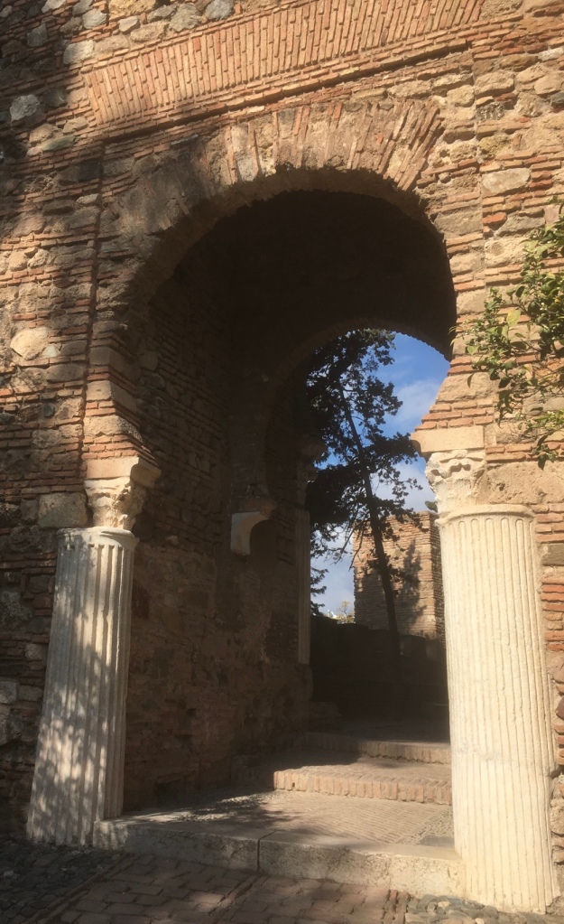
Archways and pattern work.

The Bar has good views and and is typically very shady – we enjoyed some excellent Bocadillos along with the cold drinks.

Home made frozen lemonade was Penny’s choice.

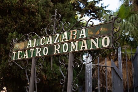
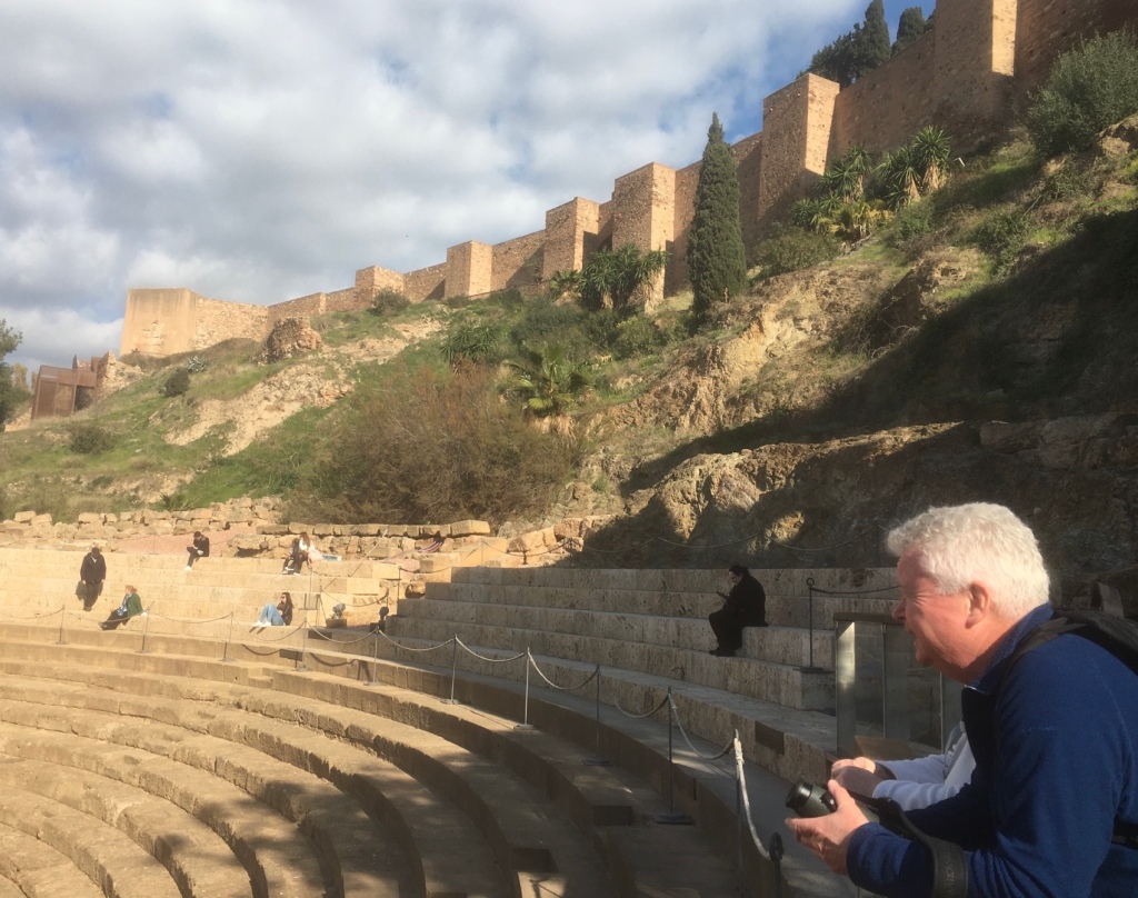
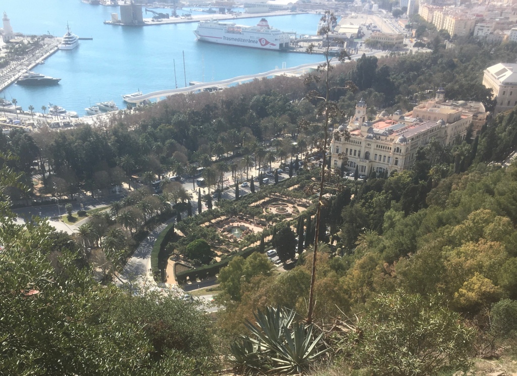
Finally, it was another short walk down to the Roman Theatre.

Then it was a walk back to the apartment and a sunny balcony. This was my last full day in Malaga. We finished the evening in a local Tapas bar, MESÓN EL BUCO. I was spoilt by Penny,Brid and Matt – they helped to make it a memorable stay – it was the first time I had “ wintered “ in Spain, hopefully not the last. MUCHAS GRACIAS

February 1st – Walking the Caminito del Rey

2 Feb
Mandatory wearing of hats in case of rockfalls.

We booked an excursion for the walk,including transport by coach,breakfast en route,admission and the services of a guide – there was a courier on board to advise about the route,times,etc. It’s a forty mile drive up into the mountains, initially through Citrus groves,then becoming more serpentine like as the expertly driven coach made its way along narrow roads upwards – almost as exciting as the walk. By the end of the day we were glad to have done so – not having a guide we would have missed out on lots of background information – you can’t get lost! Unless you fall off….

A frosty view of the village, Ardales,where we had a traditional Andalusian breakfast .

The numbers allowed on the Caminito are restricted,although some individual tickets are permitted

We walked above the dam to approach the starting point. It’s worth pointing out that “ Caminito” means little walk and is not related to the Caminos. Also,the walkway was not constructed with tourism in mind it was to facilitate movement of workers along and between strategic points of the dam.It was built between 1901 and 1905, to join together two waterfalls belonging to the company Sociedad Hidroeléctrica de El Chorro, the Salto de El Chorro and the Salto del Gaitanejo. The Camino began at the El Chorro Station, next to the train tracks, and allowed workers and materials to pass from one Salto to the other, facilitating the surveillance of the facilities.
At the beginning of the walk you get your first glimpse of the Malaga – Cordoba railway- most of the original iron bridges were replaced by brickwork.
Desfiladero de Los Gaitanes
An original crossing the river and first sight of the Caminito.

The history of the Caminito’s construction is fascinating and frightening in equal measure.

Construction of the Caminito del Rey

The difficulties to build the road had to be many, and more at that time. The workers had to work suspended above the void, tied to ropes attached to the top of the cliff. In the popular imagination, such work had to be carried out by prisoners, even those sentenced to death, the only ones capable of risking their lives, according to what they say, in exchange for redemption in the sentences they were serving.

However, the only thing we know for sure is that sailors from Malaga worked on this and other works in the reservoir, skilled at hanging from the ropes of their boats.

Like all places capable of captivating the imagination,the Balconcillo also has its legend. Any local will be able to inform the stranger about the tragic death of a young English woman, with flowing blond hair, who fell from there mounted on a white horse when life for her became unbearable. The truth is that, although everyone knows the story, no one has witnessed it or can date it.
It is one more legend to decorate a place that certainly does not need decorations. Our guide did relate a tragically true story that earlier this century before the walkway was rebuilt,a16 year old girl and her father were washed away and drowned when a flash flood swept away their tent in the middle of the night.

The original structure still exists in many sections of the walk and the decaying remains in places made the hairs on my neck rise.

Having said that, the Caminito is perfectly safe now.

The Walkway was not originally called Caminito del Rey – The little walk of the king – it came about unintentionally. King Alfonso XIII covered this entire service path on May 21, 1921, on the occasion of his inaugural visit to the recently completed El Chorro reservoir dam, which would later be called the Conde de Guadalhorce dam. Since then, the road has taken its current name: the Caminito del Rey.

The description of the occasion is as follows : –

In the book “ El Chorro, one hundred years of history ”, by Sebastián Lara Centella, the royal visit to the Caminito del Rey is described as follows:

“The day dawned cloudy, and a series of intermittent downpours marred the inauguration festivities and made the visit more painful, which already required a journey with stages by train and road. However, the king was cordial and in good humor and was pleased to listen to all the explanations that Benjumea gave him about the facilities, which he wanted to know in detail. A lunch was served for more than two hundred diners, to which personalities, authorities, engineers and journalists were invited. After dessert, the Minister of Public Works gave a speech in which he highlighted the importance of public works and the example that the El Chorro Reservoir represented for the nation, due to its success in harmonizing industrial and agricultural use. After lunch, in torrential rain, the King went to lay the last stone. For the King to sign the inauguration act, a table and an armchair carved in the same stone used in the construction of the reservoir had been provided. The act signed by Alfonso XIII reads as follows: During the reign of the Catholic Majesty of Alfonso XIII, on May 21, 1921, the works of the El Chorro Reservoir were completed, and the last stone was laid by the august hand of the Spanish monarch, by whose important life was vowed by all those who are honored by stamping their signature after that of His Majesty. After the ceremony, the King and his companions visited the Gaitanejo dam, and crossed the Balcón de los Gaitanes, which had been adorned with a garland held by four stuffed eagles, in which you could read: “To the King”.

The Caminito is a breathtaking walk.

The passing of the years and the lack of maintenance meant that, in recent years, the Caminito del Rey was not passable . In several areas the floor had disappeared, leaving only the beam that supported it. The holes in the pavement, the collapsed railings and, in general, the lack of security of the entire path, attracted many hikers who saw in danger one more incentive to walk the path.
Several fatal accidents that occurred in the years 1999 and 2000 caused the Junta de Andalucía to close the accesses and demolish the initial section to prevent hikers from passing through the Caminito del Rey.. The picture is of the newly rebuilt walkway.

Hopefully the following snaps will evoke the atmosphere and the views to be enjoyed as you walk along this marvellous balcony.

Matt and I.
Train emerging from one of many tunnels.
There are occasional small stairways.
The way is wide enough for walkers to pass in both directions now.
There is an official on duty at the bridge to ensure no more than ten walkers cross at a time.
On the right is an original water pipe . We walked along a section which is now a tunnel.
Footlights help…
A small balcony many metres above the water affording another viewpoint.
Matt and Brid were able to pick out the tracks of Otters with help of their binoculars.
This Ammonite is preserved from millions of years ago when all of this area was part of an ocean.
Almond Blossom
Carlo,our guide.
What a Walk it Was.
More information can be obtained on the link above. If you are ever in the area go for it!

https://www.google.com/maps/@36.9162325,-4.7706384,0a,82.2y,233.17h,72.25t/data=!3m4!1e1!3m2!1sbsRvitme3IAsd_prHjLUDA!2e0?source=apiv3 Another way of enjoying the Caminito del Rey.

La Concepción Jardín Botánico Malaga 31/01/2023 by local bus.

1 Feb

We had a longish walk to our bus stop on the banks of the Guadelmina, the river that used to flow through the city – very little flow now, the reasons for which we were to discover later.

En route we needed a little local assistance.

An interesting building en route.

Then it was a KM walk to the gardens which took you above the Autovia.

The origins of La Concepcion Estate can be traced back to the joining together of several smaller estates along the banks of the River Guadalmedina to the north of the city of Malaga. Used for agricultural purposes, they were home to cereal crops, olive and almond trees, vines, and, most notably, citrus trees. The garden was created by the Marquis and Marchioness of the House of Loring, Jorge Loring Oyarzabal and Amalia Heredia Livermore, both of whom were born to well-known businessmen who came to the city to make their fortunes. According to the jurist Rodriguez de Berlanga, the idea for the garden originally came to them after they had visited a series of palaces, villas, parks, estates, and botanical gardens during their honeymoon in Europe seven years earlier. To bring it to life, they enlisted the services of a French gardener, Jacinto Chamoussent, whose skilled selection and acclimatisation of exotic plants was subsequently rewarded with numerous prizes.

La Concepcion quickly became known throughout Europe.

In 1911, La Concepcion was sold to a husband and wife from Bilbao, Rafael Echevarria and Amalia Echevarrieta, who expanded the garden, adding new features such as the Nymph’s Stream, the Palm Tree Avenue and the Viewpoint which overlooks the city.

The Mediterranean in the far distance.In 1943, La Concepcion was officially declared a Garden of Historical and Artistic Interest, and today it is also recognised as a Place of Cultural Interest.
It is a tranquil place despite the ever present hum of traffic from the Autovia.After the death of the Basque couple, La Concepcion was taken over by Amalia’s brother, Horacio Echevarrieta, who kept the estate in perfect condition until he died in 1963. This signalled the start of a period of decline for the estate, whose buildings and gardens were abandoned by the new heirs.
In 1990, the estate was purchased by Malaga City Council for 600 million pesetas (€3,606,073). Once the necessary infrastructure and adaptation work had been carried out, it was opened to the public in 1994 with two main aims: to conserve and embellish the Historical Garden itself and to turn the rest of the botanical garden into a space whose collections of plants could be used for scientific and educational purposes.
We made our way along the forest route.
Then we came upon this enormous dam wall.
The Embalse del Limonera

View of the reservoir.
Geographic location
River
Guadalmedina
Basin
Andalusian Mediterranean
coordinates
36°45′34″N 4°25′56″W / 36.759386 , -4.43213
administrative location
Country
Spanish flag Spain
Community
Andalusia
Province
Malaga
General data
Condition
Exploitation
Owner
Junta de Andalucía
Designer
L. de Cossio / INYPSA
Use
Supply and regulation
Opening
December 31, 1983
Prey
Kind
Loose materials,

clay core
Height
95m
Long.
coronation
414m
coronation height
121m
foundation height
26m
riverbed height
52m
prey volume
3,390,000

Water body
Surface
105
ha
annual contribution
15
hm³
Total capacity
25hm³
Location map
Lemon Reservoir
Lemon Reservoir

Location in the province of Malaga
[
edit data in Wikidata ]
El Limonero has a capacity of 25
hm³ and an area of 105
ha .
It affects a length of 5 km of the
Guadalmedina river , on which it is located.
The reservoir regulates the avenues of the Guadalmedina river and serves as a source of supply for the city of Malaga.
It was finished and inaugurated in October 1983. It should be noted that its retaining wall is not made of concrete, but of rock. WIKIPEDIA

The garden has a great number of species and features, too many to do justice to,but here are some examples.

The lily pond

The administrator’s building housed many paintings of interest .

Here are some that caught our attention.
We enjoyed warm weather for the end of January,I should imagine that in the summer months it would be welcome oasis of greenery. On a practical note,take refreshments as there was no cafeteria in operation .
Another great Malaga excursion.

In the evening we met up with Camino aficionado and guidebook writer,Johnnie Walker for an often hilarious chat – I gather he over winters from Santiago’s rainy season here and plays the organ at a local,Jesuit Church-Salud John,it was great to meet up again .

A particularly interesting book,especially if you are considering a Camino.

We ended our day with a memorable meal at this restaurant.

With wine from the mountains of Malaga.