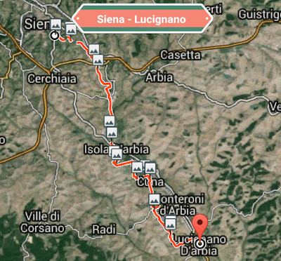
It’s a 1.7 km walk to the Porto Romano (22 mins), the traditional exit point from the city. We shall have the first of many encounters with the historic Via Cassia,built by the Romans to connect Rome and Florence.
Expect vast farmlands, small hamlets and farmhouses. Red Sienese farmland is replaced by Crete Senesi – gray claylike soil – which gives its name to this region.After passing through an industrial zone,we walk into Isola d’Arbia. Fork right off the highway to a bar, if needed.
A little further on we encounter Ponte a Tressa,located at the confluence of the Tressa and Arabia rivers – pilgrim links date back to its 12 th century pilgrim hospital. 15th century Church of San Michele Arcangelo. Refreshments and bus stop available here,too.
Continuing among fields of Alfafa and grain until Grancia di Cuna ( water ). This one of Tuscany’s best-preserved fortified farms
After Cuna the road circles down, through duplex style homes and the on to a narrow path that climbs to a cell phone tower – expect wide vistas over the countryside. Very soon we come to Monteroni d’Arbia, the largest town in the area – all amenities.
After here there are no more facilities until Lucignano but it’s not too far to,our destination.


Well done John! Great description. Derm 👍🏼👏🏼💪🏼🙏🏼